Spider Lake Topo Map Minnesota
To zoom in, hover over the map of Spider Lake
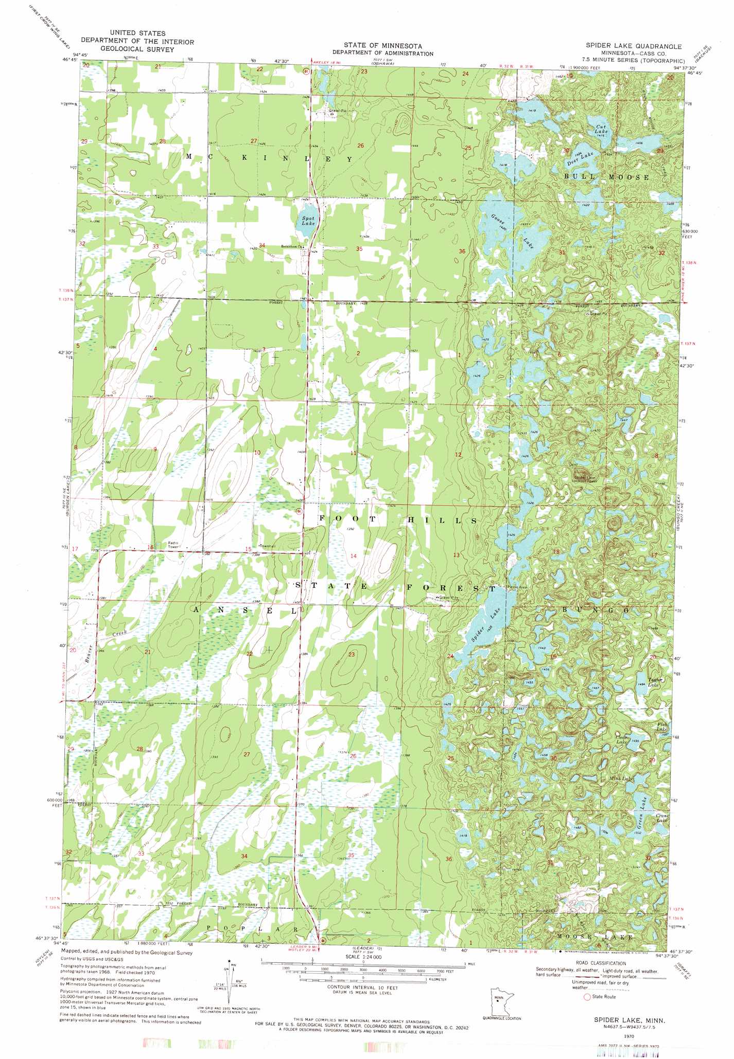
USGS Topo Quad 46094f6 - 1:24,000 scale
| Topo Map Name: | Spider Lake |
| USGS Topo Quad ID: | 46094f6 |
| Print Size: | ca. 21 1/4" wide x 27" high |
| Southeast Coordinates: | 46.625° N latitude / 94.625° W longitude |
| Map Center Coordinates: | 46.6875° N latitude / 94.6875° W longitude |
| U.S. State: | MN |
| Filename: | o46094f6.jpg |
| Download Map JPG Image: | Spider Lake topo map 1:24,000 scale |
| Map Type: | Topographic |
| Topo Series: | 7.5´ |
| Map Scale: | 1:24,000 |
| Source of Map Images: | United States Geological Survey (USGS) |
| Alternate Map Versions: |
Spider Lake MN 1970, updated 1972 Download PDF Buy paper map Spider Lake MN 2010 Download PDF Buy paper map Spider Lake MN 2013 Download PDF Buy paper map Spider Lake MN 2016 Download PDF Buy paper map |
1:24,000 Topo Quads surrounding Spider Lake
Dorset |
Nevis |
Crystal Lake |
Hackensack |
Webb Lake |
Huntersville |
First Crow Wing Lake |
Oshawa |
Backus |
Mildred |
Nimrod |
Burgen Lake |
Spider Lake |
Bungo Creek |
Pine River |
Nimrod Sw |
Oylen |
Leader |
Graff |
Pine River Sw |
Aldrich North |
Staples Ne |
Motley Nw |
Casino |
Wilson Bay |
> Back to 46094e1 at 1:100,000 scale
> Back to 46094a1 at 1:250,000 scale
> Back to U.S. Topo Maps home
Spider Lake topo map: Gazetteer
Spider Lake: Forests
Foot Hills State Forest elevation 442m 1450′Spider Lake: Lakes
Clear Lake elevation 457m 1499′Crane Lake elevation 458m 1502′
Cut Lake elevation 432m 1417′
Deer Lake elevation 434m 1423′
Goose Lake elevation 433m 1420′
Green Lake elevation 458m 1502′
Mink Lake elevation 455m 1492′
Spider Lake elevation 435m 1427′
Spot Lake elevation 431m 1414′
Taylor Lake elevation 457m 1499′
Spider Lake digital topo map on disk
Buy this Spider Lake topo map showing relief, roads, GPS coordinates and other geographical features, as a high-resolution digital map file on DVD: