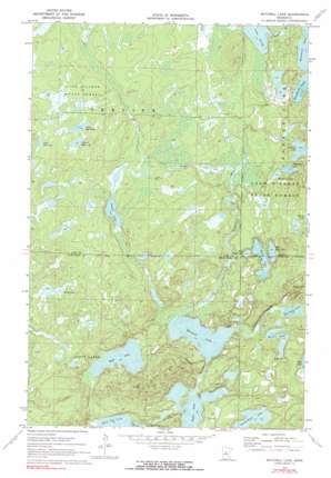
Mitchell Lake Topo Map Minnesota
To zoom in, hover over the map of Mitchell Lake
USGS Topo Quad 46094g1 - 1:24,000 scale
| Topo Map Name: | Mitchell Lake |
| USGS Topo Quad ID: | 46094g1 |
| Print Size: | ca. 21 1/4" wide x 27" high |
| Southeast Coordinates: | 46.75° N latitude / 94° W longitude |
| Map Center Coordinates: | 46.8125° N latitude / 94.0625° W longitude |
| U.S. State: | MN |
| Filename: | o46094g1.jpg |
| Download Map JPG Image: | Mitchell Lake topo map 1:24,000 scale |
| Map Type: | Topographic |
| Topo Series: | 7.5´ |
| Map Scale: | 1:24,000 |
| Source of Map Images: | United States Geological Survey (USGS) |
| Alternate Map Versions: |
Mitchell Lake MN 1970, updated 1972 Download PDF Buy paper map Mitchell Lake MN 1970, updated 1980 Download PDF Buy paper map Mitchell Lake MN 2010 Download PDF Buy paper map Mitchell Lake MN 2013 Download PDF Buy paper map Mitchell Lake MN 2016 Download PDF Buy paper map |
1:24,000 Topo Quads surrounding Mitchell Lake
> Back to 46094e1 at 1:100,000 scale
> Back to 46094a1 at 1:250,000 scale
> Back to U.S. Topo Maps home
Mitchell Lake topo map: Gazetteer
Mitchell Lake: Dams
George Lake Dam elevation 403m 1322′Mitchell Lake: Lakes
Andrus Lake elevation 400m 1312′Butterfield Lake elevation 385m 1263′
East Wood Lake elevation 391m 1282′
First Dog Lake elevation 435m 1427′
Kego Lake elevation 391m 1282′
Minnie Lake elevation 388m 1272′
Mitchell Lake elevation 382m 1253′
Pavelgrit Lake elevation 397m 1302′
Pistol Lake elevation 407m 1335′
Pug Hole Lake elevation 385m 1263′
Second Dog Lake elevation 434m 1423′
Snowshoe Lake elevation 397m 1302′
West Dog Lake elevation 441m 1446′
West Wood Lake elevation 391m 1282′
Wolf Lake elevation 435m 1427′
Wood Lake elevation 391m 1282′
Mitchell Lake: Reservoirs
George Lake elevation 403m 1322′Mitchell Lake: Streams
Crooked Creek elevation 382m 1253′Daggett Brook elevation 382m 1253′
Hay Creek elevation 390m 1279′
Mitchell Lake digital topo map on disk
Buy this Mitchell Lake topo map showing relief, roads, GPS coordinates and other geographical features, as a high-resolution digital map file on DVD:


