First Crow Wing Lake Topo Map Minnesota
To zoom in, hover over the map of First Crow Wing Lake
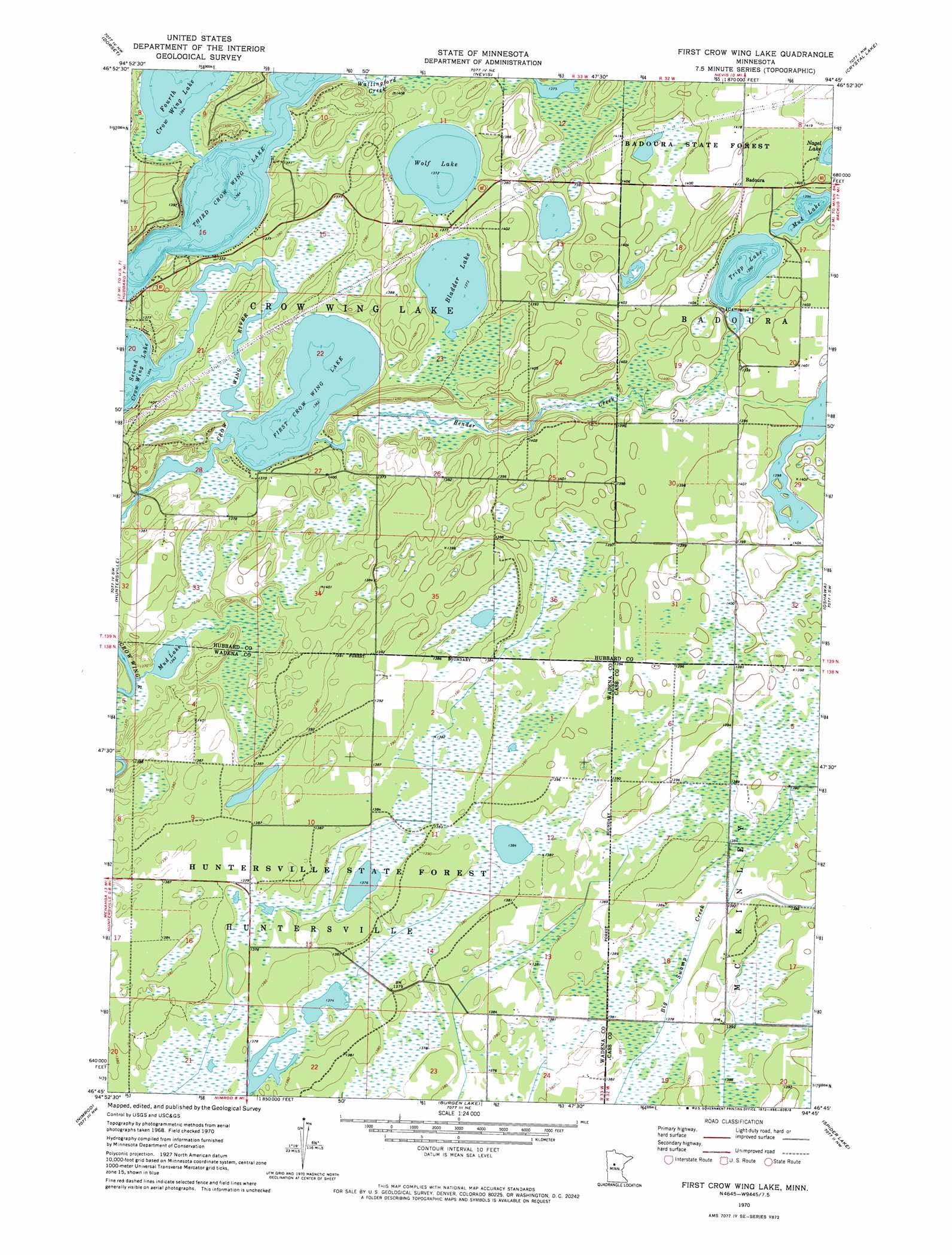
USGS Topo Quad 46094g7 - 1:24,000 scale
| Topo Map Name: | First Crow Wing Lake |
| USGS Topo Quad ID: | 46094g7 |
| Print Size: | ca. 21 1/4" wide x 27" high |
| Southeast Coordinates: | 46.75° N latitude / 94.75° W longitude |
| Map Center Coordinates: | 46.8125° N latitude / 94.8125° W longitude |
| U.S. State: | MN |
| Filename: | o46094g7.jpg |
| Download Map JPG Image: | First Crow Wing Lake topo map 1:24,000 scale |
| Map Type: | Topographic |
| Topo Series: | 7.5´ |
| Map Scale: | 1:24,000 |
| Source of Map Images: | United States Geological Survey (USGS) |
| Alternate Map Versions: |
First Crow Wing Lake MN 1970, updated 1972 Download PDF Buy paper map First Crow Wing Lake MN 2010 Download PDF Buy paper map First Crow Wing Lake MN 2013 Download PDF Buy paper map First Crow Wing Lake MN 2016 Download PDF Buy paper map |
1:24,000 Topo Quads surrounding First Crow Wing Lake
Skunk Lake |
Mantrap Lake |
East Crooked Lake |
Akeley |
Walker |
Park Rapids |
Dorset |
Nevis |
Crystal Lake |
Hackensack |
Menahga |
Huntersville |
First Crow Wing Lake |
Oshawa |
Backus |
Sebeka |
Nimrod |
Burgen Lake |
Spider Lake |
Bungo Creek |
Blue Grass |
Nimrod Sw |
Oylen |
Leader |
Graff |
> Back to 46094e1 at 1:100,000 scale
> Back to 46094a1 at 1:250,000 scale
> Back to U.S. Topo Maps home
First Crow Wing Lake topo map: Gazetteer
First Crow Wing Lake: Dams
Huntersville Impoundment Munber 3 Dam elevation 421m 1381′Huntersville Impoundment Number 4 Dam elevation 421m 1381′
Washburn Lake Dam elevation 419m 1374′
First Crow Wing Lake: Lakes
Bladder Lake elevation 419m 1374′First Crow Wing Lake elevation 419m 1374′
Mud Lake elevation 425m 1394′
Mud Lake elevation 419m 1374′
Third Crow Wing Lake elevation 419m 1374′
Tripp Lake elevation 424m 1391′
Wolf Lake elevation 419m 1374′
First Crow Wing Lake: Populated Places
Badoura elevation 432m 1417′First Crow Wing Lake: Post Offices
Badoura Post Office (historical) elevation 431m 1414′Bigswamp Post Office (historical) elevation 424m 1391′
First Crow Wing Lake: Reservoirs
Washburn Lake elevation 419m 1374′First Crow Wing Lake: Streams
Bender Creek elevation 419m 1374′First Crow Wing Lake digital topo map on disk
Buy this First Crow Wing Lake topo map showing relief, roads, GPS coordinates and other geographical features, as a high-resolution digital map file on DVD: