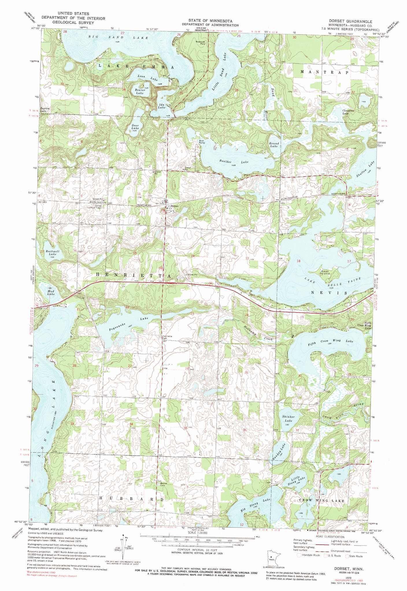
Dorset Topo Map Minnesota
To zoom in, hover over the map of Dorset
USGS Topo Quad 46094h8 - 1:24,000 scale
| Topo Map Name: | Dorset |
| USGS Topo Quad ID: | 46094h8 |
| Print Size: | ca. 21 1/4" wide x 27" high |
| Southeast Coordinates: | 46.875° N latitude / 94.875° W longitude |
| Map Center Coordinates: | 46.9375° N latitude / 94.9375° W longitude |
| U.S. State: | MN |
| Filename: | o46094h8.jpg |
| Download Map JPG Image: | Dorset topo map 1:24,000 scale |
| Map Type: | Topographic |
| Topo Series: | 7.5´ |
| Map Scale: | 1:24,000 |
| Source of Map Images: | United States Geological Survey (USGS) |
| Alternate Map Versions: |
Dorset MN 1970, updated 1972 Download PDF Buy paper map Dorset MN 1970, updated 1988 Download PDF Buy paper map Dorset MN 2010 Download PDF Buy paper map Dorset MN 2013 Download PDF Buy paper map Dorset MN 2016 Download PDF Buy paper map |
1:24,000 Topo Quads surrounding Dorset
Lake Itasca |
Schoolcraft Lake |
Lake George |
Laporte |
Benedict |
Two Inlets |
Skunk Lake |
Mantrap Lake |
East Crooked Lake |
Akeley |
Park Rapids Nw |
Park Rapids |
Dorset |
Nevis |
Crystal Lake |
Park Rapids Sw |
Menahga |
Huntersville |
First Crow Wing Lake |
Oshawa |
Sebeka Nw |
Sebeka |
Nimrod |
Burgen Lake |
Spider Lake |
> Back to 46094e1 at 1:100,000 scale
> Back to 46094a1 at 1:250,000 scale
> Back to U.S. Topo Maps home
Dorset topo map: Gazetteer
Dorset: Dams
Crow Wing Number 5 Lake Dam elevation 423m 1387′Dorset: Guts
Sand River elevation 436m 1430′Dorset: Islands
Goat Island elevation 438m 1437′Dorset: Lakes
Beaver Lake elevation 436m 1430′Big Stony Lake elevation 424m 1391′
Boulder Lake elevation 436m 1430′
Clausens Lake elevation 436m 1430′
Deer Lake elevation 436m 1430′
Fifth Crow Wing Lake elevation 421m 1381′
Ida Lake elevation 436m 1430′
Lake Belle Taine elevation 436m 1430′
Little Sand Lake elevation 436m 1430′
Little Stony Lake elevation 423m 1387′
Long Lake elevation 421m 1381′
Loon Lake elevation 436m 1430′
Mud Lake elevation 421m 1381′
Peysenske Lake elevation 429m 1407′
Rockwell Lake elevation 429m 1407′
Round Lake elevation 436m 1430′
Shallow Lake elevation 436m 1430′
Shinker Lake elevation 424m 1391′
Sunday Lake elevation 424m 1391′
Dorset: Populated Places
Dorset elevation 448m 1469′Dorset: Post Offices
Dorset Post Office (historical) elevation 448m 1469′Dorset: Streams
Hellkamp Creek elevation 421m 1381′Dorset digital topo map on disk
Buy this Dorset topo map showing relief, roads, GPS coordinates and other geographical features, as a high-resolution digital map file on DVD: