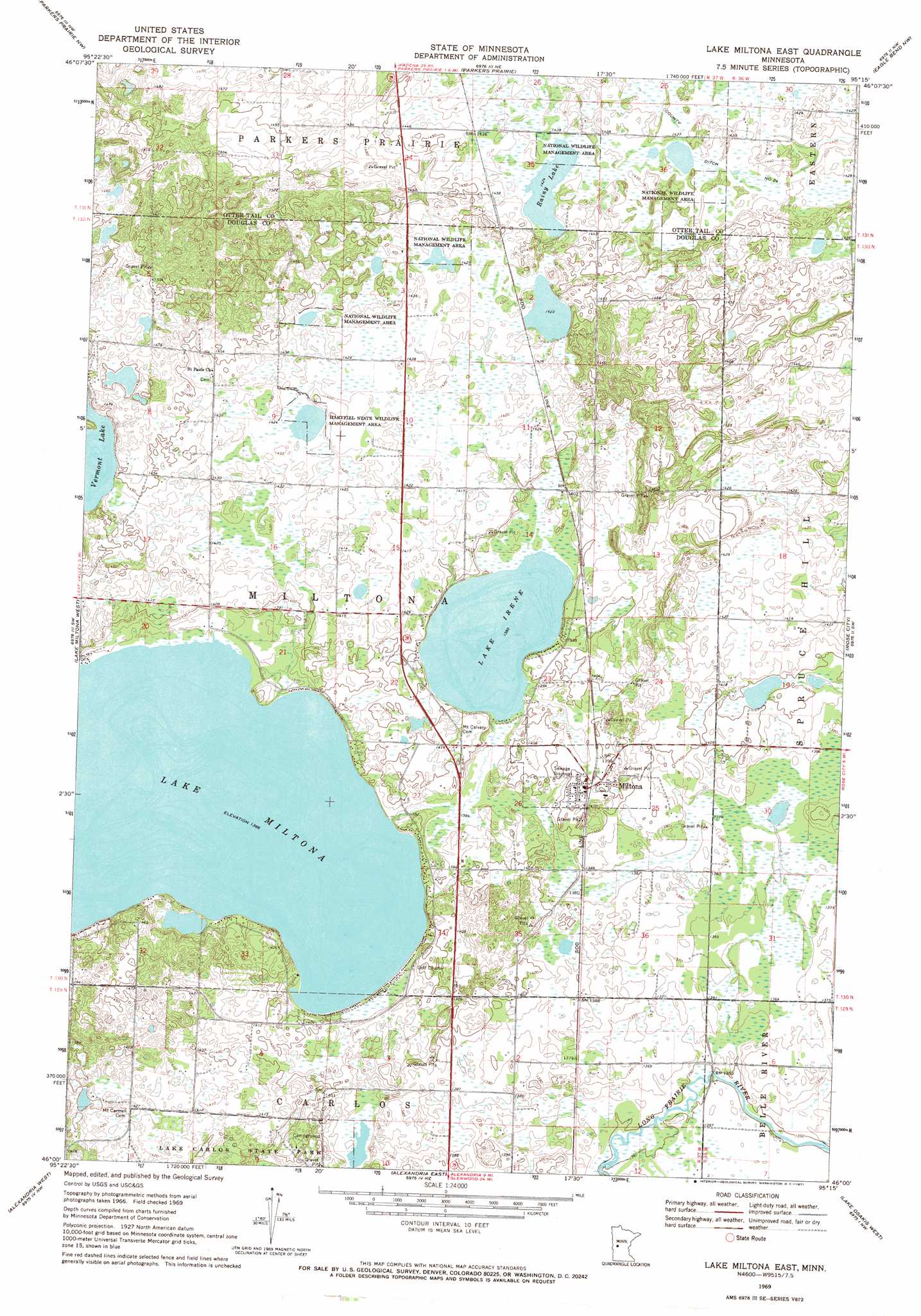
Lake Miltona East Topo Map Minnesota
To zoom in, hover over the map of Lake Miltona East
USGS Topo Quad 46095a3 - 1:24,000 scale
| Topo Map Name: | Lake Miltona East |
| USGS Topo Quad ID: | 46095a3 |
| Print Size: | ca. 21 1/4" wide x 27" high |
| Southeast Coordinates: | 46° N latitude / 95.25° W longitude |
| Map Center Coordinates: | 46.0625° N latitude / 95.3125° W longitude |
| U.S. State: | MN |
| Filename: | o46095a3.jpg |
| Download Map JPG Image: | Lake Miltona East topo map 1:24,000 scale |
| Map Type: | Topographic |
| Topo Series: | 7.5´ |
| Map Scale: | 1:24,000 |
| Source of Map Images: | United States Geological Survey (USGS) |
| Alternate Map Versions: |
Lake Miltona East MN 1969, updated 1971 Download PDF Buy paper map Lake Miltona East MN 2010 Download PDF Buy paper map Lake Miltona East MN 2013 Download PDF Buy paper map Lake Miltona East MN 2016 Download PDF Buy paper map |
1:24,000 Topo Quads surrounding Lake Miltona East
Vining |
Henning |
Henning Se |
Wrightstown |
Bertha |
Inspiration Peak |
Parkers Prairie Nw |
Parkers Prairie |
Eagle Bend Nw |
Eagle Bend |
Millerville |
Lake Miltona West |
Lake Miltona East |
Rose City |
Clotho |
Brandon |
Alexandria West |
Alexandria East |
Lake Osakis West |
Lake Osakis East |
Farwell |
Lake Mary |
Forada |
Osakis |
West Union |
> Back to 46095a1 at 1:100,000 scale
> Back to 46094a1 at 1:250,000 scale
> Back to U.S. Topo Maps home
Lake Miltona East topo map: Gazetteer
Lake Miltona East: Canals
County Ditch Number Twentyfour elevation 435m 1427′Lake Miltona East: Lakes
Lake Irene elevation 421m 1381′Lake Miltona elevation 415m 1361′
Rainy Lake elevation 434m 1423′
Vermont Lake elevation 434m 1423′
Lake Miltona East: Parks
Hartfiel State Wildlife Management Area elevation 434m 1423′Lake Miltona East: Populated Places
Miltona elevation 429m 1407′Lake Miltona East: Post Offices
Miltona Post Office elevation 427m 1400′Lake Miltona East digital topo map on disk
Buy this Lake Miltona East topo map showing relief, roads, GPS coordinates and other geographical features, as a high-resolution digital map file on DVD: