Dent Topo Map Minnesota
To zoom in, hover over the map of Dent
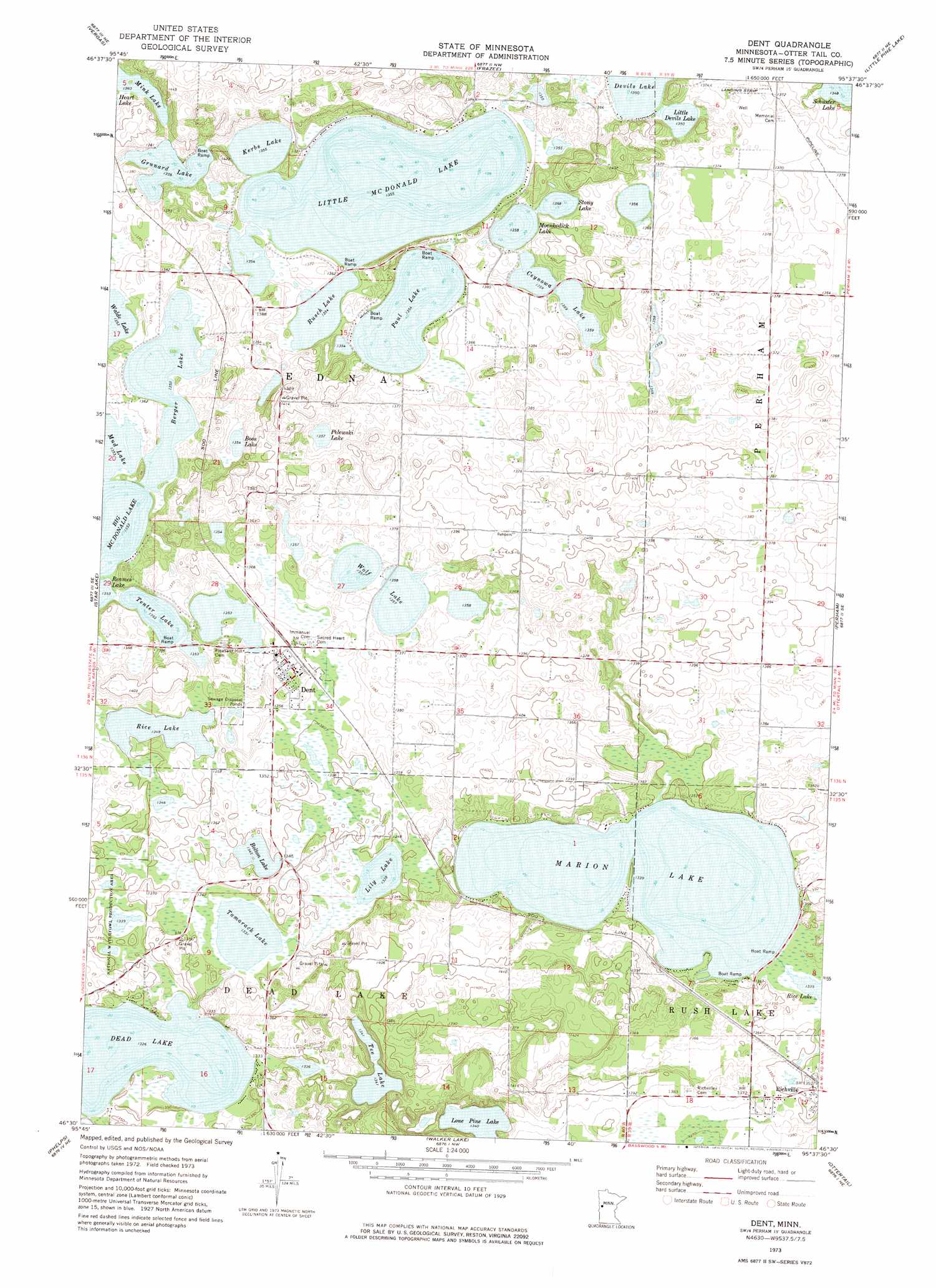
USGS Topo Quad 46095e6 - 1:24,000 scale
| Topo Map Name: | Dent |
| USGS Topo Quad ID: | 46095e6 |
| Print Size: | ca. 21 1/4" wide x 27" high |
| Southeast Coordinates: | 46.5° N latitude / 95.625° W longitude |
| Map Center Coordinates: | 46.5625° N latitude / 95.6875° W longitude |
| U.S. State: | MN |
| Filename: | o46095e6.jpg |
| Download Map JPG Image: | Dent topo map 1:24,000 scale |
| Map Type: | Topographic |
| Topo Series: | 7.5´ |
| Map Scale: | 1:24,000 |
| Source of Map Images: | United States Geological Survey (USGS) |
| Alternate Map Versions: |
Dent MN 1973, updated 1975 Download PDF Buy paper map Dent MN 2010 Download PDF Buy paper map Dent MN 2013 Download PDF Buy paper map Dent MN 2016 Download PDF Buy paper map |
1:24,000 Topo Quads surrounding Dent
Audubon |
Detroit Lakes |
Rochert |
Toad Mountain |
Evergreen |
Lake Franklin |
Vergas |
Frazee |
Little Pine Lake |
New York Mills Nw |
Lake Lida |
Star Lake |
Dent |
Perham |
New York Mills West |
Heilberger Lake |
Phelps |
Walker Lake |
Ottertail |
Heinola |
Wall Lake |
Underwood |
Battle Lake |
Vining |
Henning |
> Back to 46095e1 at 1:100,000 scale
> Back to 46094a1 at 1:250,000 scale
> Back to U.S. Topo Maps home
Dent topo map: Gazetteer
Dent: Airports
Aerovilla Airport elevation 418m 1371′Dent: Lakes
Berger Lake elevation 412m 1351′Bolton Lake elevation 409m 1341′
Boos Lake elevation 412m 1351′
Ceynowa Lake elevation 412m 1351′
Grunard Lake elevation 412m 1351′
Kerbs Lake elevation 412m 1351′
Lily Lake elevation 406m 1332′
Little Devils Lake elevation 412m 1351′
Little McDonald Lake elevation 412m 1351′
Lone Pine Lake elevation 409m 1341′
Marion Lake elevation 406m 1332′
Mink Lake elevation 415m 1361′
Moenkedick Lake elevation 412m 1351′
Mud Lake elevation 412m 1351′
Paul Lake elevation 412m 1351′
Pelewski Lake elevation 412m 1351′
Rice Lake elevation 409m 1341′
Rusch Lake elevation 412m 1351′
Schuster Lake elevation 410m 1345′
Stony Lake elevation 412m 1351′
Tamarack Lake elevation 406m 1332′
Tee Lake elevation 411m 1348′
Tenter Lake elevation 412m 1351′
Walde Lake elevation 412m 1351′
Wolf Lake elevation 412m 1351′
Dent: Populated Places
Dent elevation 419m 1374′Richville elevation 414m 1358′
Richville Trailer Park elevation 414m 1358′
Star Hills Mobile Home Park elevation 419m 1374′
Dent: Post Offices
Dent Post Office (historical) elevation 419m 1374′Richville Post Office (historical) elevation 414m 1358′
Dent digital topo map on disk
Buy this Dent topo map showing relief, roads, GPS coordinates and other geographical features, as a high-resolution digital map file on DVD: