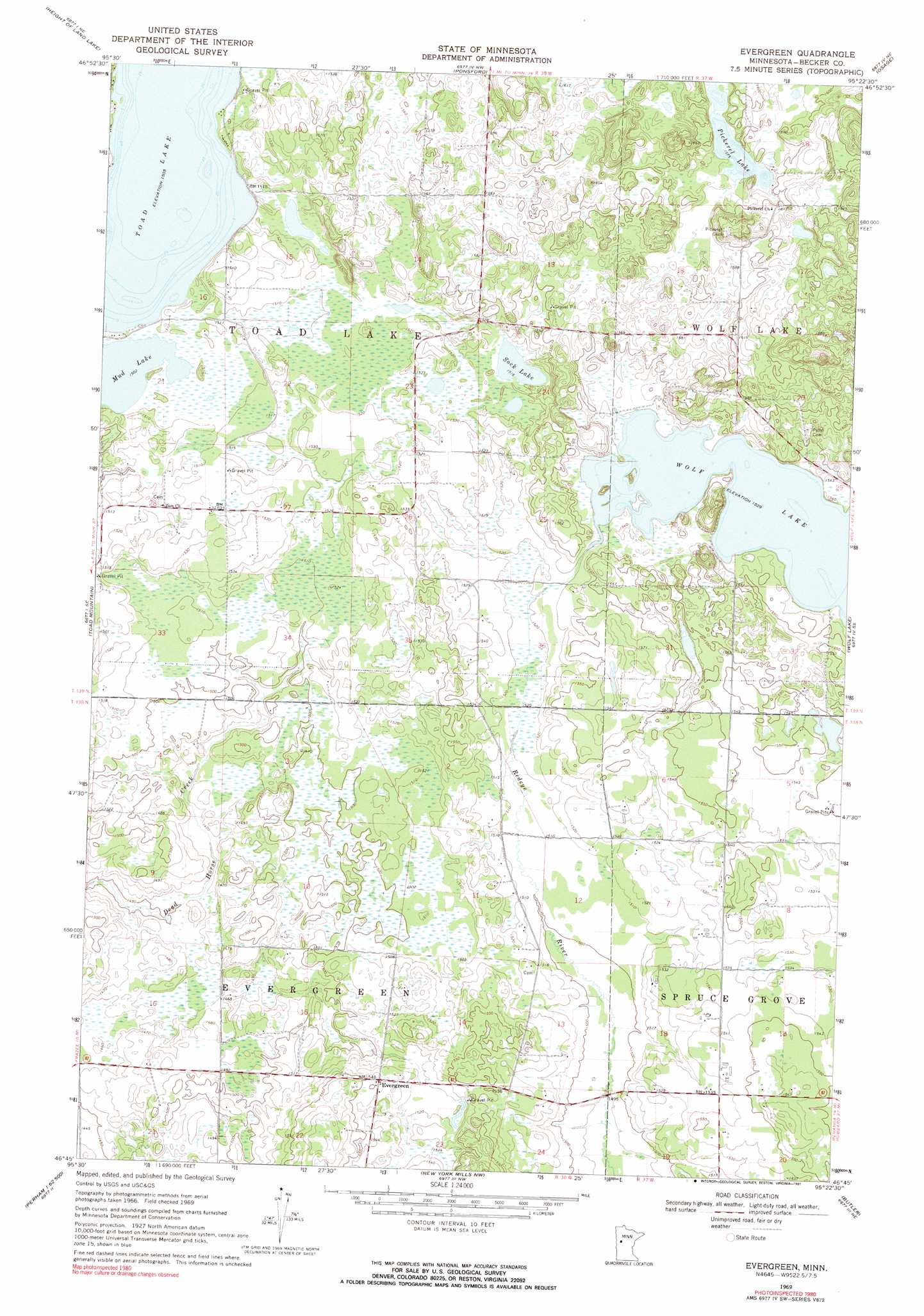
Evergreen Topo Map Minnesota
To zoom in, hover over the map of Evergreen
USGS Topo Quad 46095g4 - 1:24,000 scale
| Topo Map Name: | Evergreen |
| USGS Topo Quad ID: | 46095g4 |
| Print Size: | ca. 21 1/4" wide x 27" high |
| Southeast Coordinates: | 46.75° N latitude / 95.375° W longitude |
| Map Center Coordinates: | 46.8125° N latitude / 95.4375° W longitude |
| U.S. State: | MN |
| Filename: | o46095g4.jpg |
| Download Map JPG Image: | Evergreen topo map 1:24,000 scale |
| Map Type: | Topographic |
| Topo Series: | 7.5´ |
| Map Scale: | 1:24,000 |
| Source of Map Images: | United States Geological Survey (USGS) |
| Alternate Map Versions: |
Evergreen MN 1969, updated 1971 Download PDF Buy paper map Evergreen MN 1969, updated 1991 Download PDF Buy paper map Evergreen MN 2010 Download PDF Buy paper map Evergreen MN 2013 Download PDF Buy paper map Evergreen MN 2016 Download PDF Buy paper map |
1:24,000 Topo Quads surrounding Evergreen
Strawberry Lake |
Many Point Lake |
Big Rush Lake |
Big Basswood Lake |
Two Inlets |
Flat Lake |
Height Of Land Lake |
Ponsford |
Osage |
Park Rapids Nw |
Rochert |
Toad Mountain |
Evergreen |
Wolf Lake |
Park Rapids Sw |
Frazee |
Little Pine Lake |
New York Mills Nw |
Butler |
Sebeka Nw |
Dent |
Perham |
New York Mills West |
New York Mills East |
Sebeka Sw |
> Back to 46095e1 at 1:100,000 scale
> Back to 46094a1 at 1:250,000 scale
> Back to U.S. Topo Maps home
Evergreen topo map: Gazetteer
Evergreen: Lakes
Mud Lake elevation 458m 1502′Pickerel Lake elevation 480m 1574′
Sock Lake elevation 461m 1512′
Toad Lake elevation 459m 1505′
Wolf Lake elevation 466m 1528′
Evergreen: Populated Places
Evergreen elevation 471m 1545′Evergreen: Post Offices
Finn Post Office (historical) elevation 459m 1505′Evergreen digital topo map on disk
Buy this Evergreen topo map showing relief, roads, GPS coordinates and other geographical features, as a high-resolution digital map file on DVD: