Park Rapids Nw Topo Map Minnesota
To zoom in, hover over the map of Park Rapids Nw
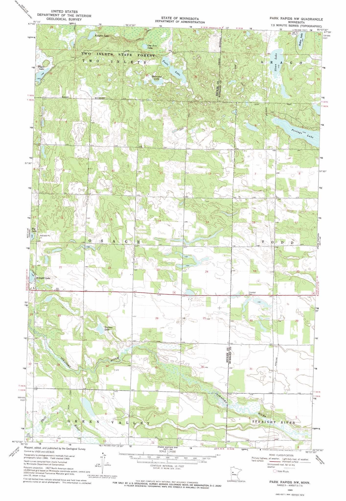
USGS Topo Quad 46095h2 - 1:24,000 scale
| Topo Map Name: | Park Rapids Nw |
| USGS Topo Quad ID: | 46095h2 |
| Print Size: | ca. 21 1/4" wide x 27" high |
| Southeast Coordinates: | 46.875° N latitude / 95.125° W longitude |
| Map Center Coordinates: | 46.9375° N latitude / 95.1875° W longitude |
| U.S. State: | MN |
| Filename: | o46095h2.jpg |
| Download Map JPG Image: | Park Rapids Nw topo map 1:24,000 scale |
| Map Type: | Topographic |
| Topo Series: | 7.5´ |
| Map Scale: | 1:24,000 |
| Source of Map Images: | United States Geological Survey (USGS) |
| Alternate Map Versions: |
Park Rapids NW MN 1969, updated 1971 Download PDF Buy paper map Park Rapids NW MN 2010 Download PDF Buy paper map Park Rapids NW MN 2013 Download PDF Buy paper map Park Rapids NW MN 2016 Download PDF Buy paper map |
1:24,000 Topo Quads surrounding Park Rapids Nw
Long Lost Lake |
Anchor Hill |
Lake Itasca |
Schoolcraft Lake |
Lake George |
Big Rush Lake |
Big Basswood Lake |
Two Inlets |
Skunk Lake |
Mantrap Lake |
Ponsford |
Osage |
Park Rapids Nw |
Park Rapids |
Dorset |
Evergreen |
Wolf Lake |
Park Rapids Sw |
Menahga |
Huntersville |
New York Mills Nw |
Butler |
Sebeka Nw |
Sebeka |
Nimrod |
> Back to 46095e1 at 1:100,000 scale
> Back to 46094a1 at 1:250,000 scale
> Back to U.S. Topo Maps home
Park Rapids Nw topo map: Gazetteer
Park Rapids Nw: Lakes
Beden Lake elevation 447m 1466′Fools Lake elevation 452m 1482′
Horseshoe Lake elevation 455m 1492′
Knights Lake elevation 456m 1496′
One Acre Lake elevation 449m 1473′
Sloan Lake elevation 449m 1473′
Valines Lake elevation 443m 1453′
Wapsi Lake elevation 457m 1499′
Park Rapids Nw digital topo map on disk
Buy this Park Rapids Nw topo map showing relief, roads, GPS coordinates and other geographical features, as a high-resolution digital map file on DVD: