Height Of Land Lake Topo Map Minnesota
To zoom in, hover over the map of Height Of Land Lake
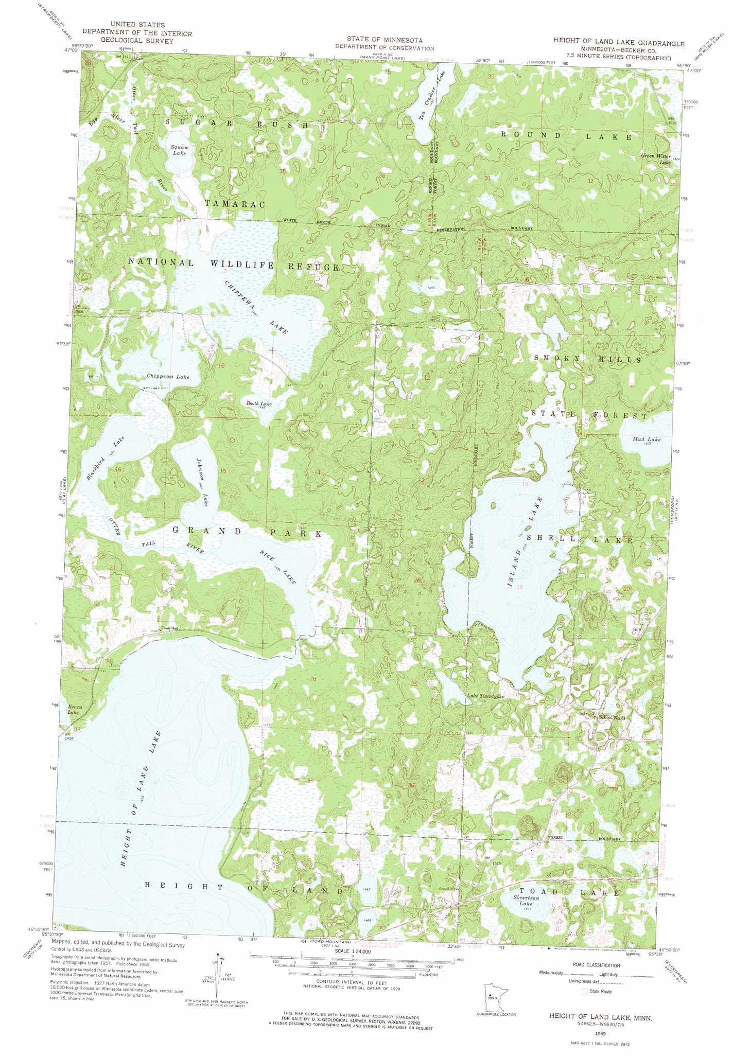
USGS Topo Quad 46095h5 - 1:24,000 scale
| Topo Map Name: | Height Of Land Lake |
| USGS Topo Quad ID: | 46095h5 |
| Print Size: | ca. 21 1/4" wide x 27" high |
| Southeast Coordinates: | 46.875° N latitude / 95.5° W longitude |
| Map Center Coordinates: | 46.9375° N latitude / 95.5625° W longitude |
| U.S. State: | MN |
| Filename: | o46095h5.jpg |
| Download Map JPG Image: | Height Of Land Lake topo map 1:24,000 scale |
| Map Type: | Topographic |
| Topo Series: | 7.5´ |
| Map Scale: | 1:24,000 |
| Source of Map Images: | United States Geological Survey (USGS) |
| Alternate Map Versions: |
Height Of Land Lake MN 1959, updated 1960 Download PDF Buy paper map Height Of Land Lake MN 1959, updated 1975 Download PDF Buy paper map Height of Land Lake MN 2010 Download PDF Buy paper map Height of Land Lake MN 2013 Download PDF Buy paper map Height of Land Lake MN 2016 Download PDF Buy paper map |
1:24,000 Topo Quads surrounding Height Of Land Lake
Ogema Ne |
Snider Lake |
Tulaby Lake |
Long Lost Lake |
Anchor Hill |
White Earth |
Strawberry Lake |
Many Point Lake |
Big Rush Lake |
Big Basswood Lake |
Richwood |
Flat Lake |
Height Of Land Lake |
Ponsford |
Osage |
Detroit Lakes |
Rochert |
Toad Mountain |
Evergreen |
Wolf Lake |
Vergas |
Frazee |
Little Pine Lake |
New York Mills Nw |
Butler |
> Back to 46095e1 at 1:100,000 scale
> Back to 46094a1 at 1:250,000 scale
> Back to U.S. Topo Maps home
Height Of Land Lake topo map: Gazetteer
Height Of Land Lake: Dams
Chippewa Dam elevation 446m 1463′Gary Lehman Dam elevation 470m 1541′
Rice Lake Dam elevation 445m 1459′
Height Of Land Lake: Lakes
Blackbird Lake elevation 443m 1453′Booth Lake elevation 446m 1463′
Chippewa Lake elevation 446m 1463′
Equay Lake elevation 448m 1469′
Height of Land Lake elevation 443m 1453′
Island Lake elevation 471m 1545′
Johnson Lake elevation 443m 1453′
Lake Twentyfive elevation 471m 1545′
Mud Lake elevation 465m 1525′
Rice Lake elevation 443m 1453′
Sivertson Lake elevation 461m 1512′
Tea Cracker Lake elevation 457m 1499′
Height Of Land Lake: Reservoirs
Chippewa Lake elevation 446m 1463′Rice Lake elevation 445m 1459′
Height Of Land Lake: Streams
Egg River elevation 447m 1466′Height Of Land Lake digital topo map on disk
Buy this Height Of Land Lake topo map showing relief, roads, GPS coordinates and other geographical features, as a high-resolution digital map file on DVD: