Wendell Topo Map Minnesota
To zoom in, hover over the map of Wendell
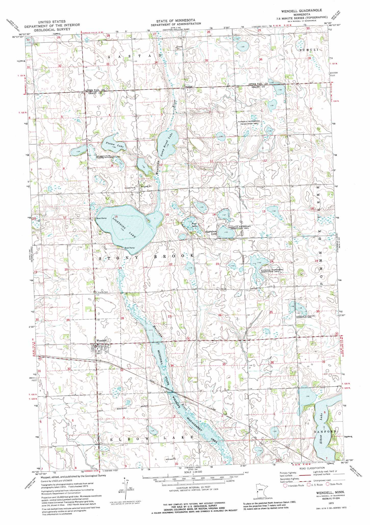
USGS Topo Quad 46096a1 - 1:24,000 scale
| Topo Map Name: | Wendell |
| USGS Topo Quad ID: | 46096a1 |
| Print Size: | ca. 21 1/4" wide x 27" high |
| Southeast Coordinates: | 46° N latitude / 96° W longitude |
| Map Center Coordinates: | 46.0625° N latitude / 96.0625° W longitude |
| U.S. State: | MN |
| Filename: | o46096a1.jpg |
| Download Map JPG Image: | Wendell topo map 1:24,000 scale |
| Map Type: | Topographic |
| Topo Series: | 7.5´ |
| Map Scale: | 1:24,000 |
| Source of Map Images: | United States Geological Survey (USGS) |
| Alternate Map Versions: |
Wendell MN 1973, updated 1975 Download PDF Buy paper map Wendell MN 1973, updated 1988 Download PDF Buy paper map Wendell MN 2010 Download PDF Buy paper map Wendell MN 2013 Download PDF Buy paper map Wendell MN 2016 Download PDF Buy paper map |
1:24,000 Topo Quads surrounding Wendell
Foxhome |
Carlisle |
Fergus Falls |
Wall Lake |
Underwood |
Campbell Ne |
Orwell Lake |
Dayton Hollow Dam |
Dalton |
Stalker Lake |
Tintah |
Stony Lake |
Wendell |
Fourmile Lake |
Ashby |
Charlesville |
Herman Nw |
Trisko Lake |
Elbow Lake |
Erdahl |
Wheaton Se |
Herman |
Niemackl Lakes |
Patchen Lake |
Hoffman |
> Back to 46096a1 at 1:100,000 scale
> Back to 46096a1 at 1:250,000 scale
> Back to U.S. Topo Maps home
Wendell topo map: Gazetteer
Wendell: Airports
Brutlag Farms Airport elevation 341m 1118′Swift Airport elevation 347m 1138′
Wendell: Lakes
Elbow Lake elevation 353m 1158′Engralson Lake elevation 346m 1135′
Foss Lake elevation 341m 1118′
Lightning Lake elevation 337m 1105′
Pletan Lake elevation 338m 1108′
Stony Brook Lake elevation 337m 1105′
Wendell: Parks
Bergerud State Wildlife Management Area elevation 344m 1128′Mustinka State Wildlife Management Area elevation 338m 1108′
Wendell: Populated Places
Wendell elevation 349m 1145′Wendell: Post Offices
Aastad Post Office (historical) elevation 350m 1148′Wendell Post Office (historical) elevation 349m 1145′
Wendell digital topo map on disk
Buy this Wendell topo map showing relief, roads, GPS coordinates and other geographical features, as a high-resolution digital map file on DVD:
Eastern North Dakota & Eastern South Dakota
Buy digital topo maps: Eastern North Dakota & Eastern South Dakota