Barnesville Topo Map Minnesota
To zoom in, hover over the map of Barnesville
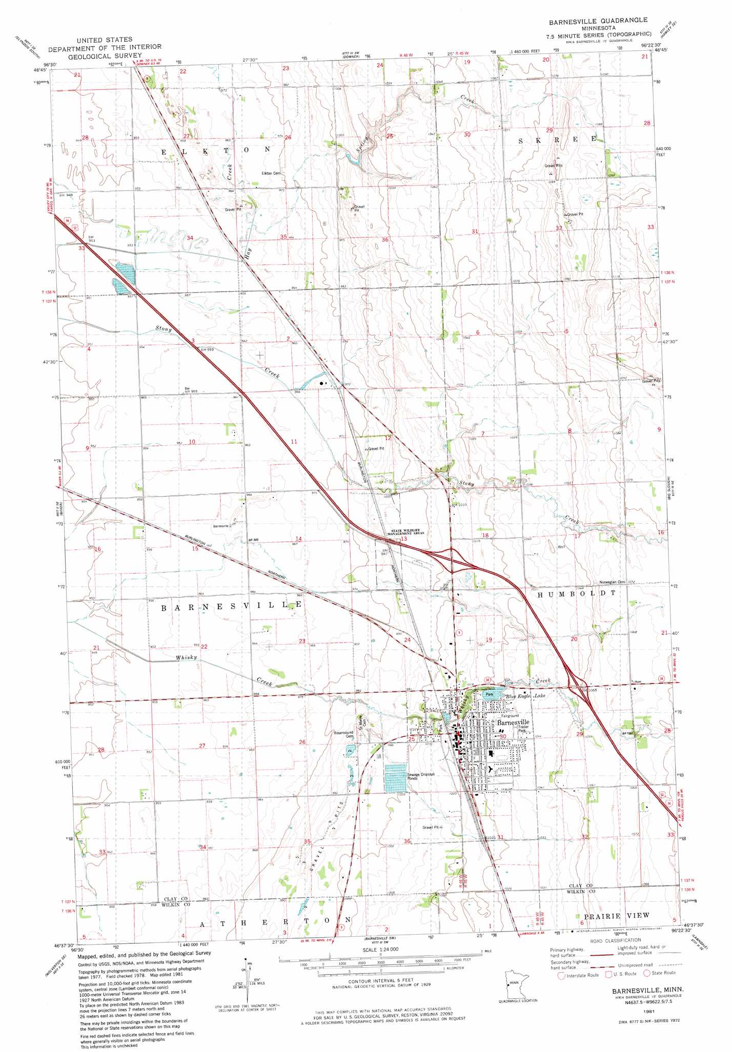
USGS Topo Quad 46096f4 - 1:24,000 scale
| Topo Map Name: | Barnesville |
| USGS Topo Quad ID: | 46096f4 |
| Print Size: | ca. 21 1/4" wide x 27" high |
| Southeast Coordinates: | 46.625° N latitude / 96.375° W longitude |
| Map Center Coordinates: | 46.6875° N latitude / 96.4375° W longitude |
| U.S. State: | MN |
| Filename: | o46096f4.jpg |
| Download Map JPG Image: | Barnesville topo map 1:24,000 scale |
| Map Type: | Topographic |
| Topo Series: | 7.5´ |
| Map Scale: | 1:24,000 |
| Source of Map Images: | United States Geological Survey (USGS) |
| Alternate Map Versions: |
Barnesville MN 1981, updated 1981 Download PDF Buy paper map Barnesville MN 2010 Download PDF Buy paper map Barnesville MN 2013 Download PDF Buy paper map Barnesville MN 2016 Download PDF Buy paper map |
1:24,000 Topo Quads surrounding Barnesville
Dilworth |
Glyndon North |
Hawley Nw |
Hawley |
Dale |
Sabin |
Glyndon South |
Downer |
Hawley Se |
Lake Park Sw |
Comstock |
Baker |
Barnesville |
Big Slough |
Rollag |
Wolverton |
Wolverton Se |
Barnesville Sw |
Lawndale |
Lake Olaf |
Abercrombie |
Wahpeton Ne |
Rothsay Nw |
Rothsay |
Elizabeth |
> Back to 46096e1 at 1:100,000 scale
> Back to 46096a1 at 1:250,000 scale
> Back to U.S. Topo Maps home
Barnesville topo map: Gazetteer
Barnesville: Airports
Barnesville Municipal Airport elevation 297m 974′Mathew Field elevation 294m 964′
Barnesville: Crossings
Interchange 22 elevation 309m 1013′Interchange 24 elevation 319m 1046′
Barnesville: Lakes
Blue Eagle Lake elevation 312m 1023′Barnesville: Parks
Blue Eagle Park elevation 312m 1023′McGrath Park elevation 308m 1010′
Barnesville: Populated Places
Barnesville elevation 312m 1023′Barnesville: Post Offices
Barnesville Post Office elevation 312m 1023′Barnesville: Streams
Spring Creek elevation 293m 961′Barnesville digital topo map on disk
Buy this Barnesville topo map showing relief, roads, GPS coordinates and other geographical features, as a high-resolution digital map file on DVD:
Eastern North Dakota & Eastern South Dakota
Buy digital topo maps: Eastern North Dakota & Eastern South Dakota