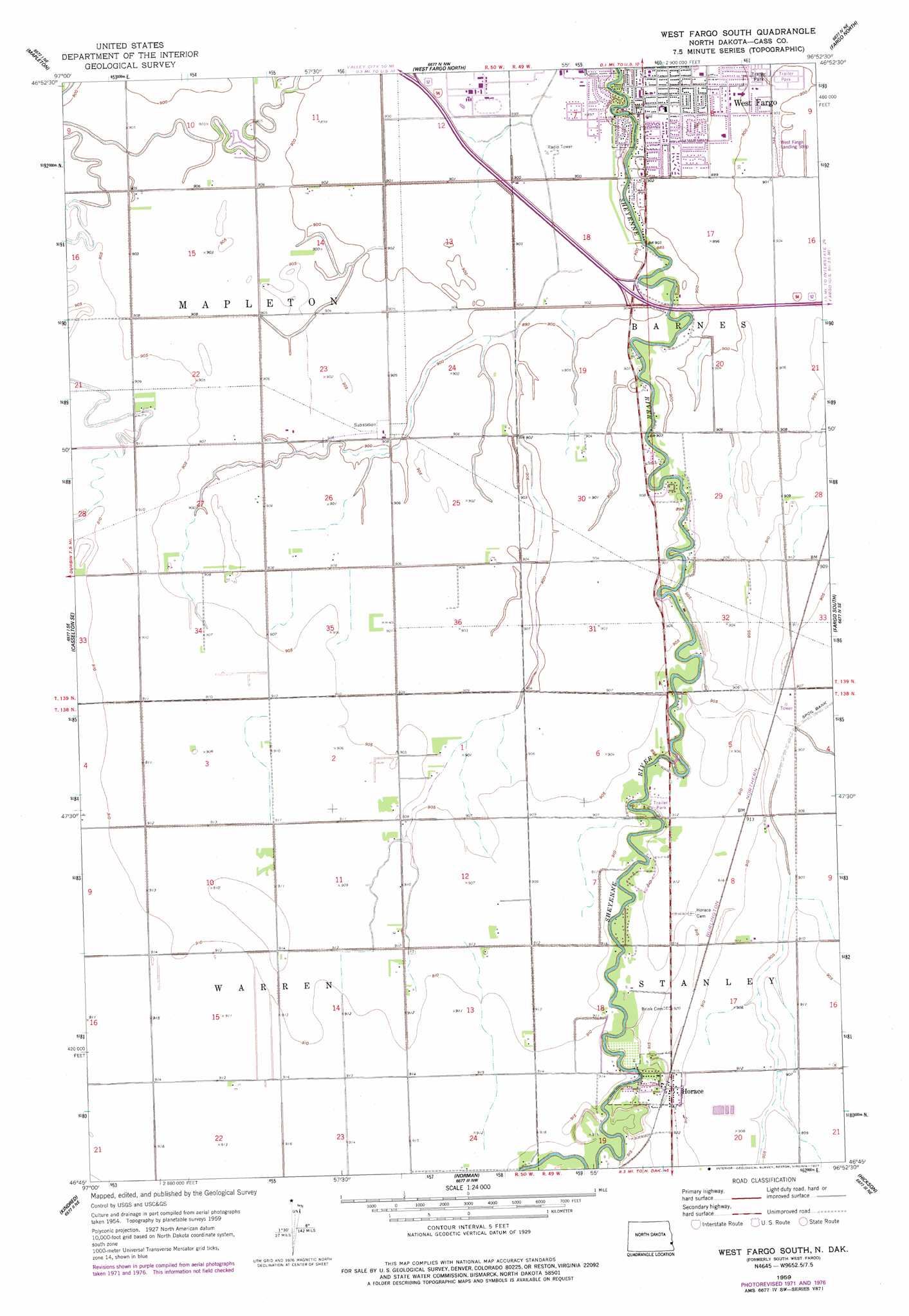
West Fargo South Topo Map North Dakota
To zoom in, hover over the map of West Fargo South
USGS Topo Quad 46096g8 - 1:24,000 scale
| Topo Map Name: | West Fargo South |
| USGS Topo Quad ID: | 46096g8 |
| Print Size: | ca. 21 1/4" wide x 27" high |
| Southeast Coordinates: | 46.75° N latitude / 96.875° W longitude |
| Map Center Coordinates: | 46.8125° N latitude / 96.9375° W longitude |
| U.S. State: | ND |
| Filename: | O46096G8.jpg |
| Download Map JPG Image: | West Fargo South topo map 1:24,000 scale |
| Map Type: | Topographic |
| Topo Series: | 7.5´ |
| Map Scale: | 1:24,000 |
| Source of Map Images: | United States Geological Survey (USGS) |
| Alternate Map Versions: |
South West Fargo ND 1959, updated 1960 Download PDF Buy paper map South West Fargo ND 1959, updated 1973 Download PDF Buy paper map West Fargo South ND 1959, updated 1977 Download PDF Buy paper map West Fargo South ND 2011 Download PDF Buy paper map West Fargo South ND 2014 Download PDF Buy paper map |
1:24,000 Topo Quads surrounding West Fargo South
Arthur |
Arthur Se |
Argusville |
Georgetown |
Felton Sw |
Casselton |
Mapleton |
West Fargo North |
Fargo North |
Dilworth |
Durbin |
Casselton Se |
West Fargo South |
Fargo South |
Sabin |
Leonard |
Kindred |
Norman |
Hickson |
Comstock |
Power |
Barrie |
Walcott |
Christine |
Wolverton |
> Back to 46096e1 at 1:100,000 scale
> Back to 46096a1 at 1:250,000 scale
> Back to U.S. Topo Maps home
West Fargo South topo map: Gazetteer
West Fargo South: Airports
West Fargo Airport elevation 275m 902′West Fargo South: Dams
Sheyenne River Diversion Dam elevation 278m 912′West Fargo South: Populated Places
Horace elevation 279m 915′South West Fargo elevation 274m 898′
West Fargo elevation 273m 895′
West Fargo South digital topo map on disk
Buy this West Fargo South topo map showing relief, roads, GPS coordinates and other geographical features, as a high-resolution digital map file on DVD:
Eastern North Dakota & Eastern South Dakota
Buy digital topo maps: Eastern North Dakota & Eastern South Dakota