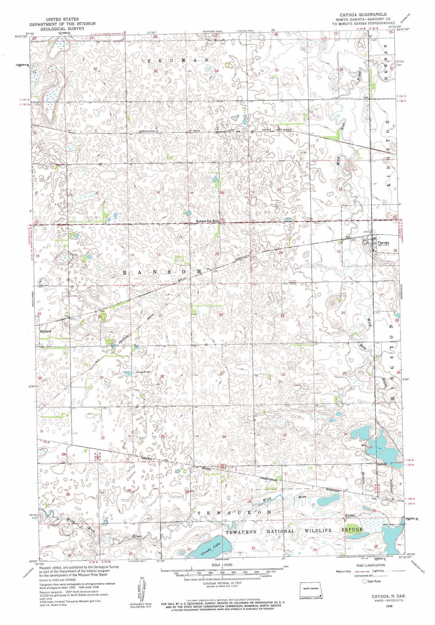
Cayuga Topo Map North Dakota
To zoom in, hover over the map of Cayuga
USGS Topo Quad 46097a4 - 1:24,000 scale
| Topo Map Name: | Cayuga |
| USGS Topo Quad ID: | 46097a4 |
| Print Size: | ca. 21 1/4" wide x 27" high |
| Southeast Coordinates: | 46° N latitude / 97.375° W longitude |
| Map Center Coordinates: | 46.0625° N latitude / 97.4375° W longitude |
| U.S. State: | ND |
| Filename: | O46097A4.jpg |
| Download Map JPG Image: | Cayuga topo map 1:24,000 scale |
| Map Type: | Topographic |
| Topo Series: | 7.5´ |
| Map Scale: | 1:24,000 |
| Source of Map Images: | United States Geological Survey (USGS) |
| Alternate Map Versions: |
Cayuga ND 1958, updated 1960 Download PDF Buy paper map Cayuga ND 2011 Download PDF Buy paper map Cayuga ND 2014 Download PDF Buy paper map |
1:24,000 Topo Quads surrounding Cayuga
Lisbon Sw |
Lisbon Se |
Milnor |
De Lamere |
Wyndmere |
Gwinner |
Hoving |
Cayuga Nw |
Hamlin |
Kreiser Lake |
Forman |
Rutland |
Cayuga |
Geneseo |
Lidgerwood |
Kidder |
Havana |
Marlow |
Veblen Ne |
Claire City Nw |
Britton East |
Kidder Se |
Hillhead |
Veblen |
Claire City Sw |
> Back to 46097a1 at 1:100,000 scale
> Back to 46096a1 at 1:250,000 scale
> Back to U.S. Topo Maps home
Cayuga topo map: Gazetteer
Cayuga: Dams
Tewaukon WS-T-2 Dam elevation 363m 1190′Cayuga: Lakes
Clouds Lake elevation 360m 1181′Cayuga: Parks
Tewaukon National Wildlife Refuge elevation 357m 1171′Cayuga: Populated Places
Cayuga elevation 348m 1141′Ransom City (historical) elevation 345m 1131′
Cayuga: Streams
Crooked Creek elevation 339m 1112′Shortfoot Creek elevation 337m 1105′
Shortfoot Creek elevation 337m 1105′
Cayuga digital topo map on disk
Buy this Cayuga topo map showing relief, roads, GPS coordinates and other geographical features, as a high-resolution digital map file on DVD:
Eastern North Dakota & Eastern South Dakota
Buy digital topo maps: Eastern North Dakota & Eastern South Dakota