Lisbon Topo Map North Dakota
To zoom in, hover over the map of Lisbon
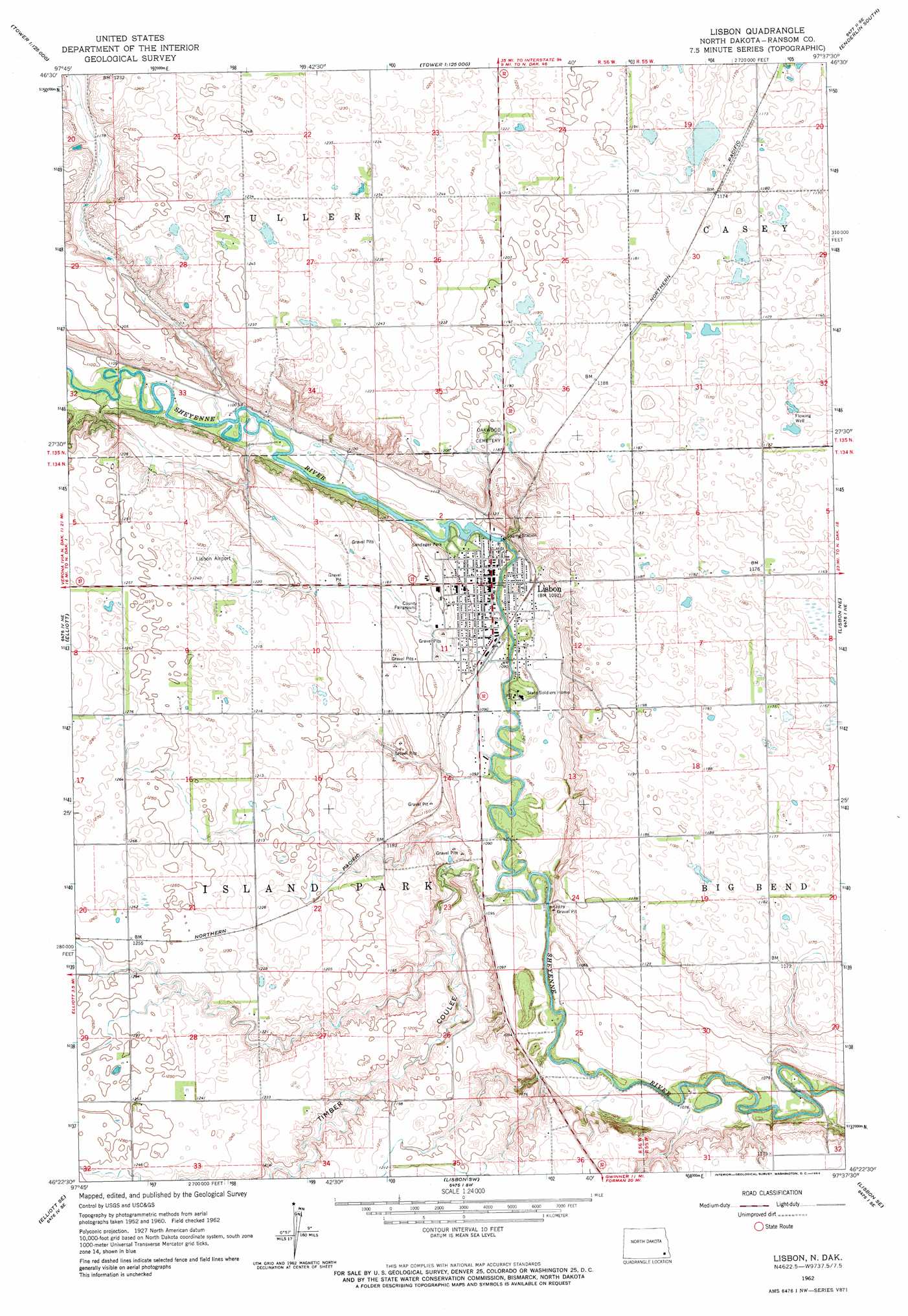
USGS Topo Quad 46097d6 - 1:24,000 scale
| Topo Map Name: | Lisbon |
| USGS Topo Quad ID: | 46097d6 |
| Print Size: | ca. 21 1/4" wide x 27" high |
| Southeast Coordinates: | 46.375° N latitude / 97.625° W longitude |
| Map Center Coordinates: | 46.4375° N latitude / 97.6875° W longitude |
| U.S. State: | ND |
| Filename: | O46097D6.jpg |
| Download Map JPG Image: | Lisbon topo map 1:24,000 scale |
| Map Type: | Topographic |
| Topo Series: | 7.5´ |
| Map Scale: | 1:24,000 |
| Source of Map Images: | United States Geological Survey (USGS) |
| Alternate Map Versions: |
Lisbon ND 1962, updated 1964 Download PDF Buy paper map Lisbon ND 2011 Download PDF Buy paper map Lisbon ND 2014 Download PDF Buy paper map |
1:24,000 Topo Quads surrounding Lisbon
Kathryn |
Nome |
Lucca |
Enderlin North |
Sheldon Nw |
Fort Ransom |
Nome Se |
Buttzville |
Enderlin South |
Sheldon |
Englevale |
Elliott |
Lisbon |
Lisbon Ne |
Venlo |
Elliott Sw |
Elliott Se |
Lisbon Sw |
Lisbon Se |
Milnor |
Crete |
Stirum |
Gwinner |
Hoving |
Cayuga Nw |
> Back to 46097a1 at 1:100,000 scale
> Back to 46096a1 at 1:250,000 scale
> Back to U.S. Topo Maps home
Lisbon topo map: Gazetteer
Lisbon: Airports
Lisbon Municipal Airport elevation 372m 1220′Lisbon: Dams
Lisbon Dam elevation 331m 1085′Soldiers Home Dam elevation 334m 1095′
Lisbon: Parks
Sandager Park elevation 331m 1085′Lisbon: Populated Places
Lisbon elevation 330m 1082′Lisbon: Valleys
Timber Coulee elevation 326m 1069′Lisbon digital topo map on disk
Buy this Lisbon topo map showing relief, roads, GPS coordinates and other geographical features, as a high-resolution digital map file on DVD:
Eastern North Dakota & Eastern South Dakota
Buy digital topo maps: Eastern North Dakota & Eastern South Dakota