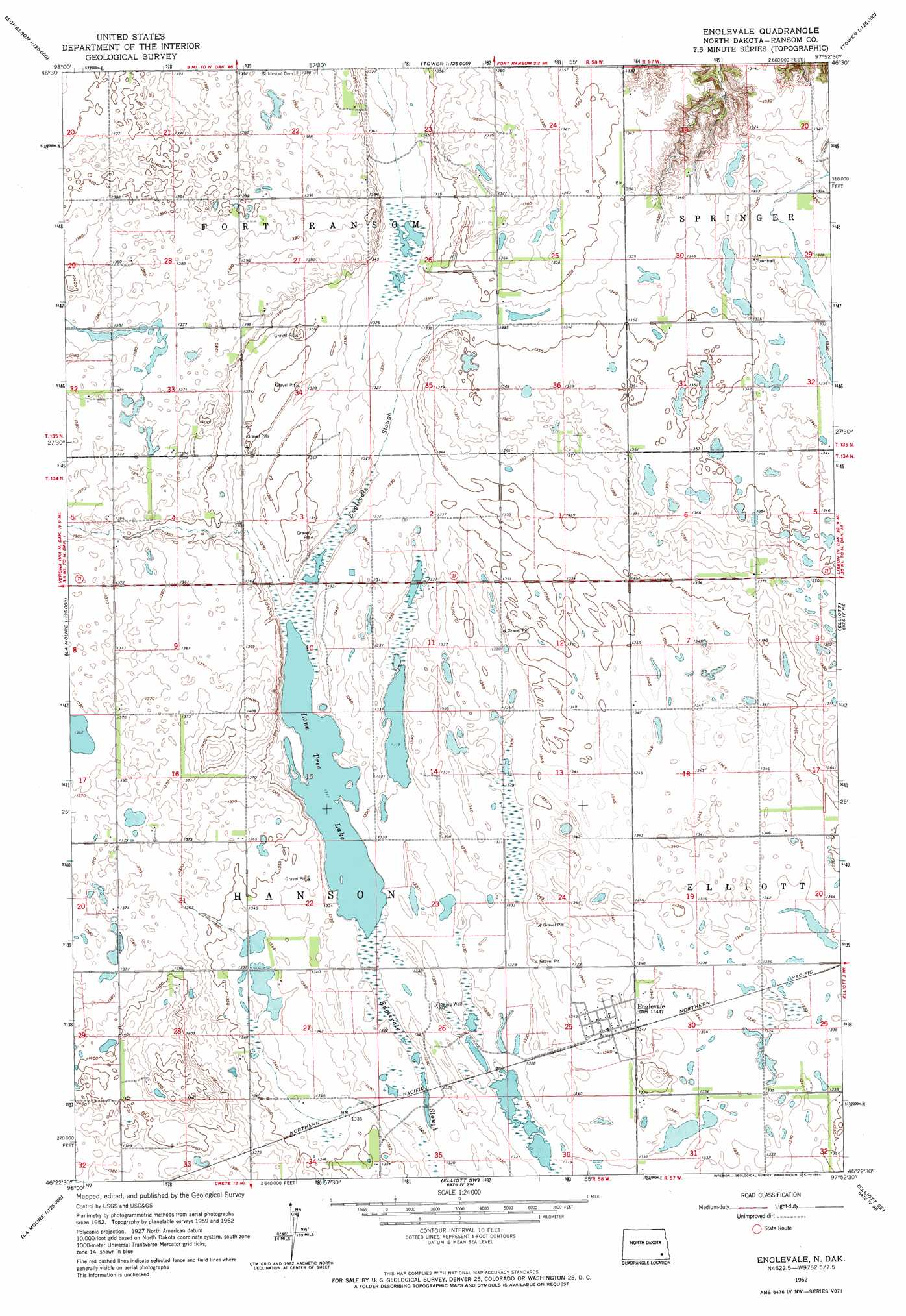
Englevale Topo Map North Dakota
To zoom in, hover over the map of Englevale
USGS Topo Quad 46097d8 - 1:24,000 scale
| Topo Map Name: | Englevale |
| USGS Topo Quad ID: | 46097d8 |
| Print Size: | ca. 21 1/4" wide x 27" high |
| Southeast Coordinates: | 46.375° N latitude / 97.875° W longitude |
| Map Center Coordinates: | 46.4375° N latitude / 97.9375° W longitude |
| U.S. State: | ND |
| Filename: | O46097D8.jpg |
| Download Map JPG Image: | Englevale topo map 1:24,000 scale |
| Map Type: | Topographic |
| Topo Series: | 7.5´ |
| Map Scale: | 1:24,000 |
| Source of Map Images: | United States Geological Survey (USGS) |
| Alternate Map Versions: |
Englevale ND 1962, updated 1964 Download PDF Buy paper map Englevale ND 2011 Download PDF Buy paper map Englevale ND 2014 Download PDF Buy paper map |
1:24,000 Topo Quads surrounding Englevale
Litchville |
Hastings |
Kathryn |
Nome |
Lucca |
Litchville Sw |
Litchville Se |
Fort Ransom |
Nome Se |
Buttzville |
Verona Nw |
Verona Ne |
Englevale |
Elliott |
Lisbon |
Independence |
Verona |
Elliott Sw |
Elliott Se |
Lisbon Sw |
Glover |
Oakes |
Crete |
Stirum |
Gwinner |
> Back to 46097a1 at 1:100,000 scale
> Back to 46096a1 at 1:250,000 scale
> Back to U.S. Topo Maps home
Englevale topo map: Gazetteer
Englevale: Airports
Streich Farm Landing Strip elevation 406m 1332′Englevale: Lakes
Lone Tree Lake elevation 402m 1318′Englevale: Populated Places
Englevale elevation 409m 1341′Englevale digital topo map on disk
Buy this Englevale topo map showing relief, roads, GPS coordinates and other geographical features, as a high-resolution digital map file on DVD:
Eastern North Dakota & Eastern South Dakota
Buy digital topo maps: Eastern North Dakota & Eastern South Dakota