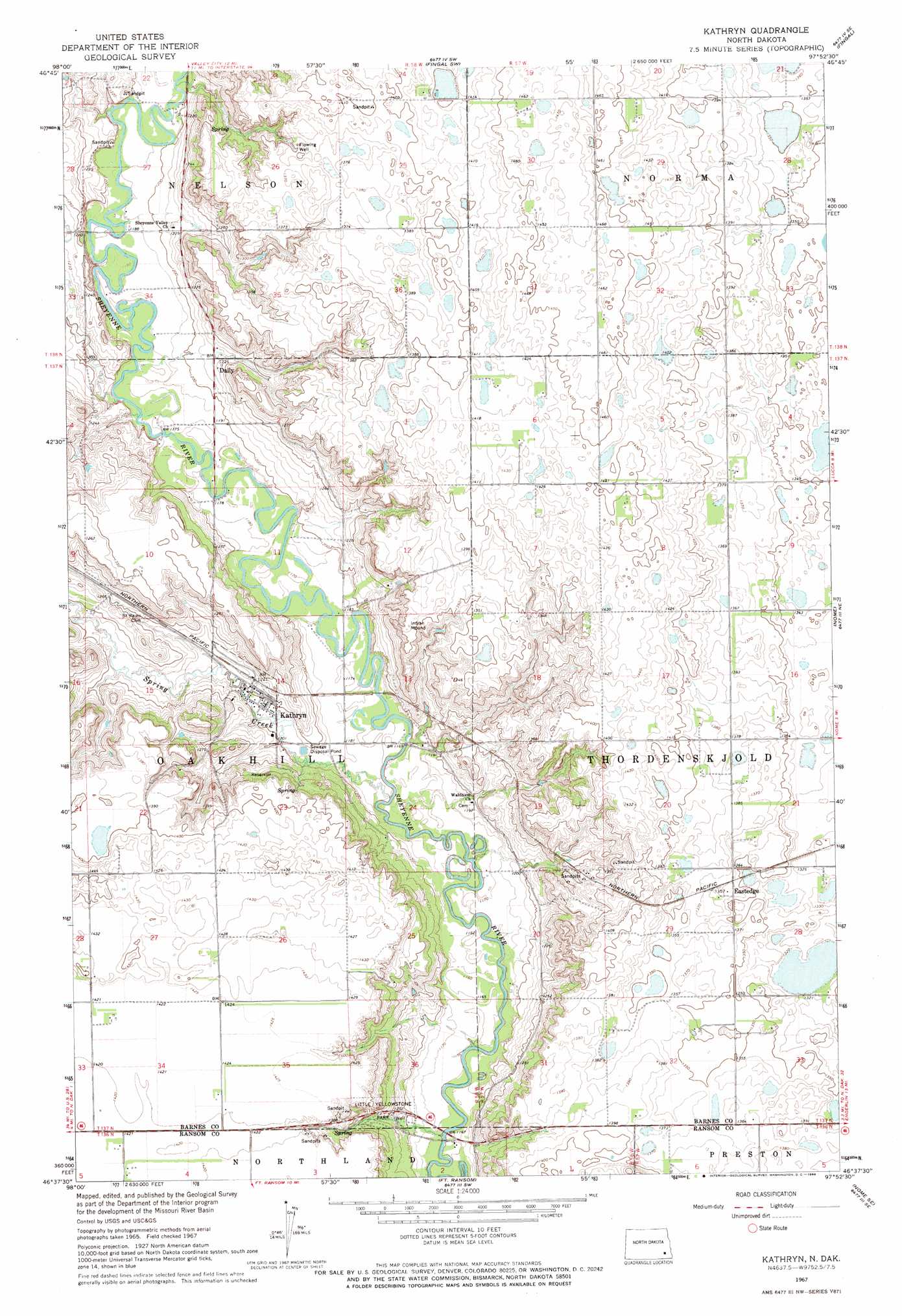
Kathryn Topo Map North Dakota
To zoom in, hover over the map of Kathryn
USGS Topo Quad 46097f8 - 1:24,000 scale
| Topo Map Name: | Kathryn |
| USGS Topo Quad ID: | 46097f8 |
| Print Size: | ca. 21 1/4" wide x 27" high |
| Southeast Coordinates: | 46.625° N latitude / 97.875° W longitude |
| Map Center Coordinates: | 46.6875° N latitude / 97.9375° W longitude |
| U.S. State: | ND |
| Filename: | O46097F8.jpg |
| Download Map JPG Image: | Kathryn topo map 1:24,000 scale |
| Map Type: | Topographic |
| Topo Series: | 7.5´ |
| Map Scale: | 1:24,000 |
| Source of Map Images: | United States Geological Survey (USGS) |
| Alternate Map Versions: |
Kathryn ND 1967, updated 1969 Download PDF Buy paper map Kathryn ND 2011 Download PDF Buy paper map Kathryn ND 2014 Download PDF Buy paper map |
1:24,000 Topo Quads surrounding Kathryn
Sanborn |
Valley City West |
Valley City East |
Oriska |
Tower City |
Moon Lake |
Sanborn Se |
Fingal Sw |
Fingal |
Tower City Sw |
Litchville |
Hastings |
Kathryn |
Nome |
Lucca |
Litchville Sw |
Litchville Se |
Fort Ransom |
Nome Se |
Buttzville |
Verona Nw |
Verona Ne |
Englevale |
Elliott |
Lisbon |
> Back to 46097e1 at 1:100,000 scale
> Back to 46096a1 at 1:250,000 scale
> Back to U.S. Topo Maps home
Kathryn topo map: Gazetteer
Kathryn: Dams
Brown Dam elevation 358m 1174′Kathryn Dam elevation 373m 1223′
Kathryn: Parks
Little Yellowstone Park elevation 392m 1286′Kathryn: Populated Places
Daily elevation 372m 1220′Eastedge elevation 415m 1361′
Kathryn elevation 364m 1194′
Kathryn: Streams
Spring Creek elevation 351m 1151′Kathryn digital topo map on disk
Buy this Kathryn topo map showing relief, roads, GPS coordinates and other geographical features, as a high-resolution digital map file on DVD:
Eastern North Dakota & Eastern South Dakota
Buy digital topo maps: Eastern North Dakota & Eastern South Dakota