Casselton Topo Map North Dakota
To zoom in, hover over the map of Casselton
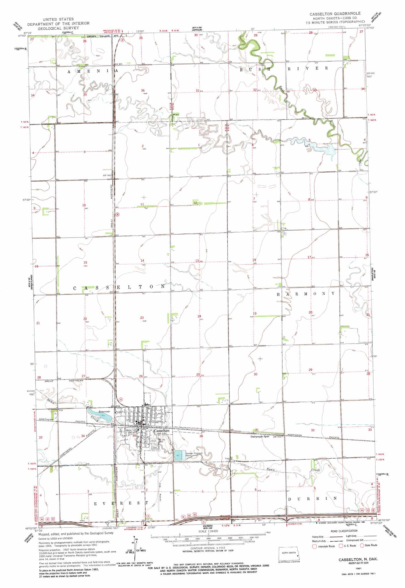
USGS Topo Quad 46097h2 - 1:24,000 scale
| Topo Map Name: | Casselton |
| USGS Topo Quad ID: | 46097h2 |
| Print Size: | ca. 21 1/4" wide x 27" high |
| Southeast Coordinates: | 46.875° N latitude / 97.125° W longitude |
| Map Center Coordinates: | 46.9375° N latitude / 97.1875° W longitude |
| U.S. State: | ND |
| Filename: | O46097H2.jpg |
| Download Map JPG Image: | Casselton topo map 1:24,000 scale |
| Map Type: | Topographic |
| Topo Series: | 7.5´ |
| Map Scale: | 1:24,000 |
| Source of Map Images: | United States Geological Survey (USGS) |
| Alternate Map Versions: |
Casselton ND 1961, updated 1963 Download PDF Buy paper map Casselton ND 1961, updated 1986 Download PDF Buy paper map Casselton ND 2011 Download PDF Buy paper map Casselton ND 2014 Download PDF Buy paper map |
1:24,000 Topo Quads surrounding Casselton
Ayr Nw |
Ayr Ne |
Hunter |
Grandin |
Gardner |
Ayr |
Ayr Se |
Arthur |
Arthur Se |
Argusville |
Absaraka |
Wheatland |
Casselton |
Mapleton |
West Fargo North |
Embden |
Chaffee |
Durbin |
Casselton Se |
West Fargo South |
Sheldon Nw |
Sheldon Ne |
Leonard |
Kindred |
Norman |
> Back to 46097e1 at 1:100,000 scale
> Back to 46096a1 at 1:250,000 scale
> Back to U.S. Topo Maps home
Casselton topo map: Gazetteer
Casselton: Populated Places
Casselton elevation 285m 935′Casselton: Post Offices
Casselton Post Office elevation 285m 935′Casselton digital topo map on disk
Buy this Casselton topo map showing relief, roads, GPS coordinates and other geographical features, as a high-resolution digital map file on DVD:
Eastern North Dakota & Eastern South Dakota
Buy digital topo maps: Eastern North Dakota & Eastern South Dakota