Guelph Topo Map North Dakota
To zoom in, hover over the map of Guelph
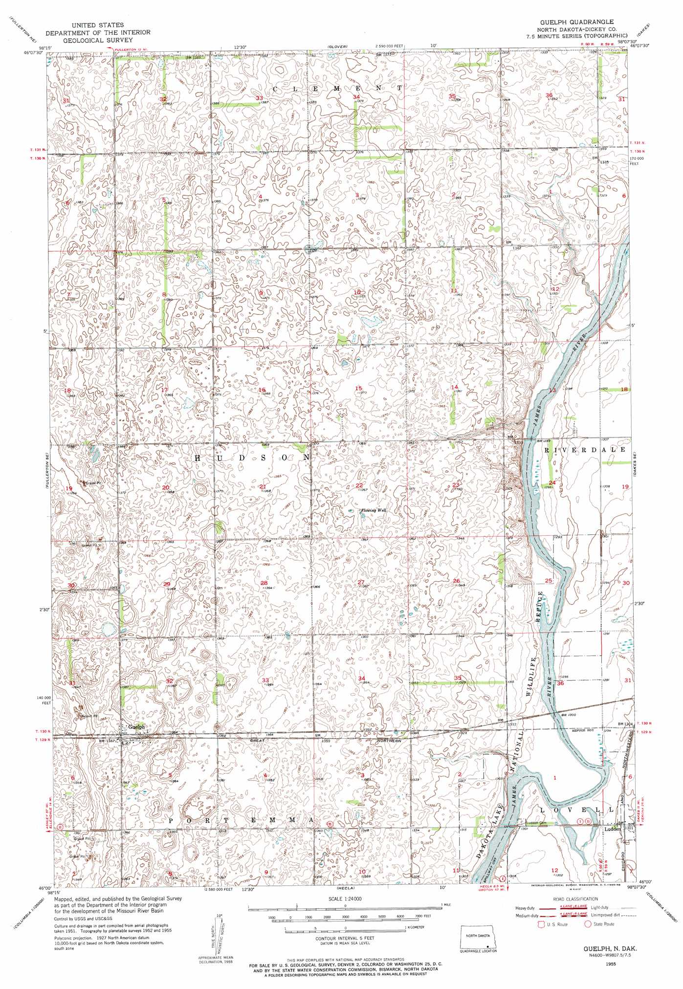
USGS Topo Quad 46098a2 - 1:24,000 scale
| Topo Map Name: | Guelph |
| USGS Topo Quad ID: | 46098a2 |
| Print Size: | ca. 21 1/4" wide x 27" high |
| Southeast Coordinates: | 46° N latitude / 98.125° W longitude |
| Map Center Coordinates: | 46.0625° N latitude / 98.1875° W longitude |
| U.S. State: | ND |
| Filename: | O46098A2.jpg |
| Download Map JPG Image: | Guelph topo map 1:24,000 scale |
| Map Type: | Topographic |
| Topo Series: | 7.5´ |
| Map Scale: | 1:24,000 |
| Source of Map Images: | United States Geological Survey (USGS) |
| Alternate Map Versions: |
Guelph ND 1955, updated 1956 Download PDF Buy paper map Guelph ND 2011 Download PDF Buy paper map Guelph ND 2014 Download PDF Buy paper map |
1:24,000 Topo Quads surrounding Guelph
La Moure Sw |
La Moure |
Independence |
Verona |
Elliott Sw |
Fullerton |
Fullerton Ne |
Glover |
Oakes |
Crete |
Silverleaf |
Fullerton Se |
Guelph |
Oakes Se |
Straubville |
Savo Nw |
Savo Ne |
Hecla |
Hecla Ne |
Newark Nw |
Savo Sw |
Savo Se |
Houghton |
Hecla Se |
Newark Sw |
> Back to 46098a1 at 1:100,000 scale
> Back to 46098a1 at 1:250,000 scale
> Back to U.S. Topo Maps home
Guelph topo map: Gazetteer
Guelph: Airports
Spear Airport elevation 409m 1341′Guelph: Populated Places
Guelph elevation 416m 1364′Ludden elevation 397m 1302′
Port Emma (historical) elevation 400m 1312′
Guelph digital topo map on disk
Buy this Guelph topo map showing relief, roads, GPS coordinates and other geographical features, as a high-resolution digital map file on DVD:
Eastern North Dakota & Eastern South Dakota
Buy digital topo maps: Eastern North Dakota & Eastern South Dakota