Hastings Topo Map North Dakota
To zoom in, hover over the map of Hastings
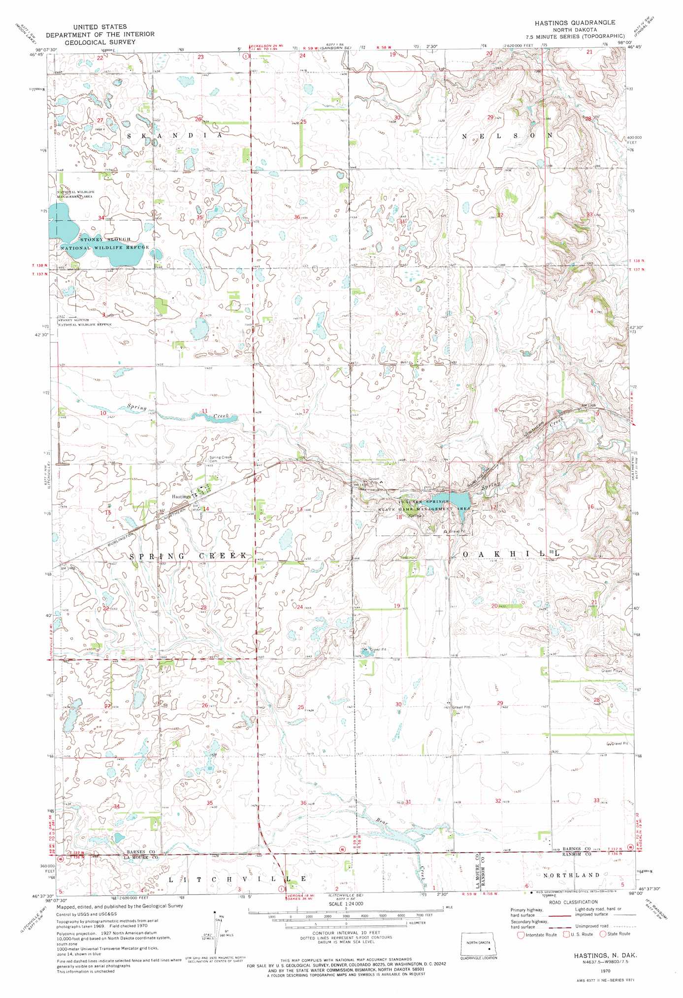
USGS Topo Quad 46098f1 - 1:24,000 scale
| Topo Map Name: | Hastings |
| USGS Topo Quad ID: | 46098f1 |
| Print Size: | ca. 21 1/4" wide x 27" high |
| Southeast Coordinates: | 46.625° N latitude / 98° W longitude |
| Map Center Coordinates: | 46.6875° N latitude / 98.0625° W longitude |
| U.S. State: | ND |
| Filename: | O46098F1.jpg |
| Download Map JPG Image: | Hastings topo map 1:24,000 scale |
| Map Type: | Topographic |
| Topo Series: | 7.5´ |
| Map Scale: | 1:24,000 |
| Source of Map Images: | United States Geological Survey (USGS) |
| Alternate Map Versions: |
Hastings ND 1970, updated 1973 Download PDF Buy paper map Hastings ND 2011 Download PDF Buy paper map Hastings ND 2014 Download PDF Buy paper map |
1:24,000 Topo Quads surrounding Hastings
Eckelson |
Sanborn |
Valley City West |
Valley City East |
Oriska |
Eckelson Se |
Moon Lake |
Sanborn Se |
Fingal Sw |
Fingal |
Marion Ne |
Litchville |
Hastings |
Kathryn |
Nome |
Marion |
Litchville Sw |
Litchville Se |
Fort Ransom |
Nome Se |
Grand Rapids |
Verona Nw |
Verona Ne |
Englevale |
Elliott |
> Back to 46098e1 at 1:100,000 scale
> Back to 46098a1 at 1:250,000 scale
> Back to U.S. Topo Maps home
Hastings topo map: Gazetteer
Hastings: Dams
Clausen Springs Dam elevation 426m 1397′Hastings: Parks
Clausen Springs State Game Management Area elevation 424m 1391′Stoney Slough National Wildlife Refuge elevation 438m 1437′
Hastings: Populated Places
Hastings elevation 444m 1456′Hastings digital topo map on disk
Buy this Hastings topo map showing relief, roads, GPS coordinates and other geographical features, as a high-resolution digital map file on DVD:
Eastern North Dakota & Eastern South Dakota
Buy digital topo maps: Eastern North Dakota & Eastern South Dakota