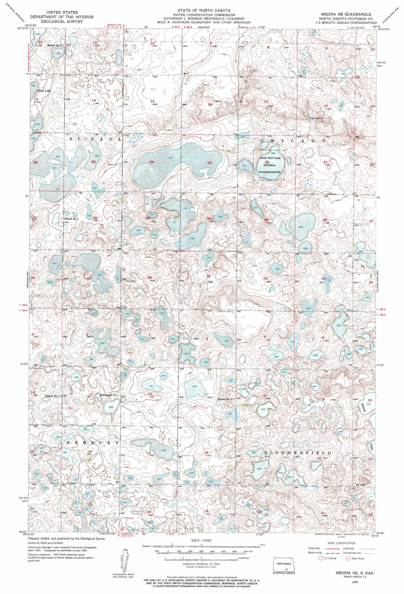
Medina Se Topo Map North Dakota
To zoom in, hover over the map of Medina Se
USGS Topo Quad 46099g3 - 1:24,000 scale
| Topo Map Name: | Medina Se |
| USGS Topo Quad ID: | 46099g3 |
| Print Size: | ca. 21 1/4" wide x 27" high |
| Southeast Coordinates: | 46.75° N latitude / 99.25° W longitude |
| Map Center Coordinates: | 46.8125° N latitude / 99.3125° W longitude |
| U.S. State: | ND |
| Filename: | O46099G3.jpg |
| Download Map JPG Image: | Medina Se topo map 1:24,000 scale |
| Map Type: | Topographic |
| Topo Series: | 7.5´ |
| Map Scale: | 1:24,000 |
| Source of Map Images: | United States Geological Survey (USGS) |
| Alternate Map Versions: |
Medina SE ND 1955, updated 1957 Download PDF Buy paper map Medina SE ND 2011 Download PDF Buy paper map Medina SE ND 2014 Download PDF Buy paper map |
1:24,000 Topo Quads surrounding Medina Se
Pettibone |
Lake Louise |
Pearl Lake |
Goldwin Sw |
Goldwin Se |
Tappen Ne |
Crystal Springs |
Medina |
Cleveland Nw |
Cleveland |
Tappen Se |
Medina Sw |
Medina Se |
Cleveland Sw |
Cleveland Se |
Alkaline Lake |
Streeter Nw |
Streeter |
Gackle North |
Gackle Ne |
Streeter Flats |
Streeter Sw |
Streeter Se |
Gackle South |
Alfred |
> Back to 46099e1 at 1:100,000 scale
> Back to 46098a1 at 1:250,000 scale
> Back to U.S. Topo Maps home
Medina Se topo map: Gazetteer
Medina Se: Airports
Rau Field elevation 557m 1827′Medina Se: Dams
Rueb Dam elevation 588m 1929′Medina Se: Parks
Half-Way Lake National Wildlife Refuge elevation 532m 1745′Medina Se digital topo map on disk
Buy this Medina Se topo map showing relief, roads, GPS coordinates and other geographical features, as a high-resolution digital map file on DVD:
Eastern North Dakota & Eastern South Dakota
Buy digital topo maps: Eastern North Dakota & Eastern South Dakota