Tappen North Topo Map North Dakota
To zoom in, hover over the map of Tappen North
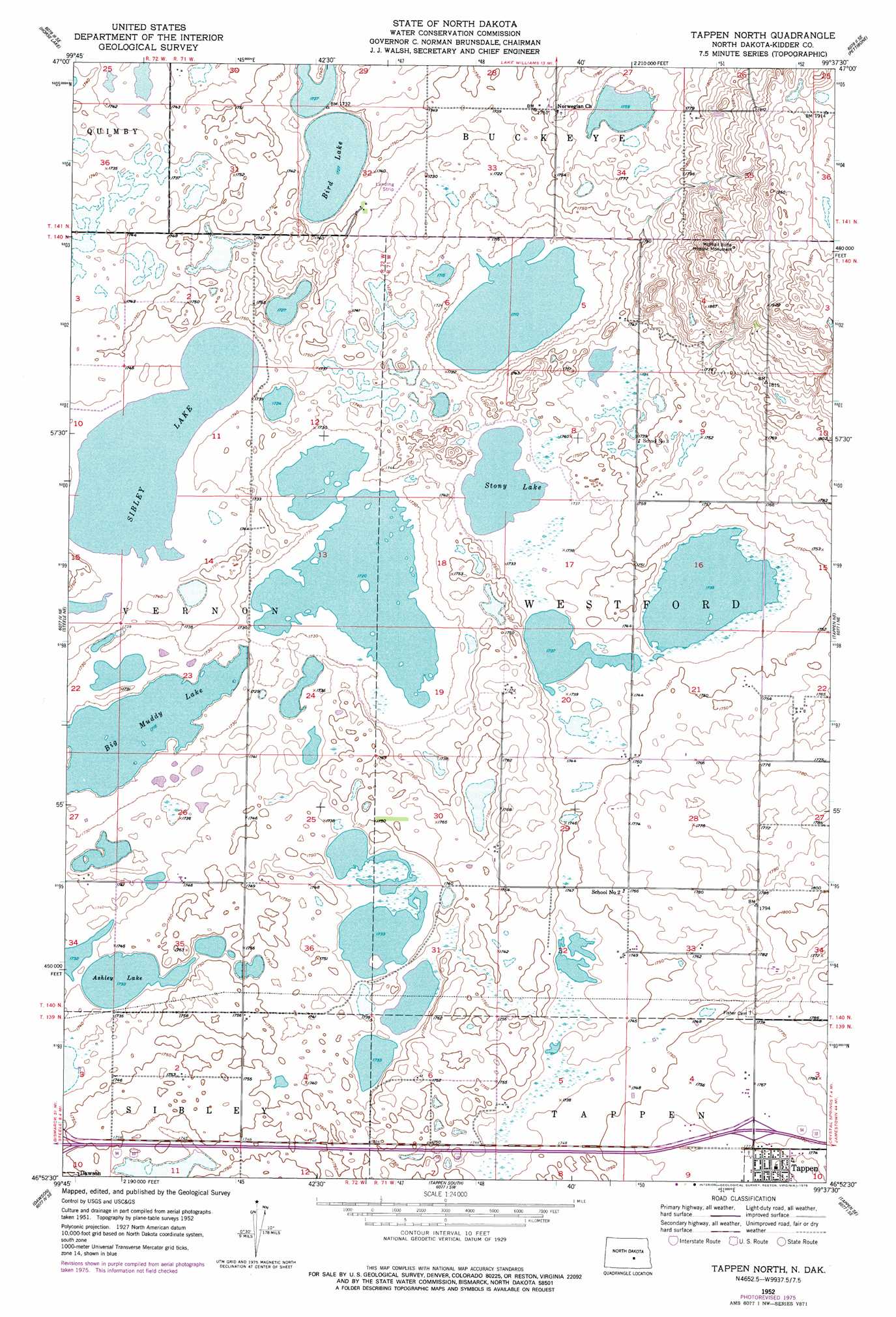
USGS Topo Quad 46099h6 - 1:24,000 scale
| Topo Map Name: | Tappen North |
| USGS Topo Quad ID: | 46099h6 |
| Print Size: | ca. 21 1/4" wide x 27" high |
| Southeast Coordinates: | 46.875° N latitude / 99.625° W longitude |
| Map Center Coordinates: | 46.9375° N latitude / 99.6875° W longitude |
| U.S. State: | ND |
| Filename: | O46099H6.jpg |
| Download Map JPG Image: | Tappen North topo map 1:24,000 scale |
| Map Type: | Topographic |
| Topo Series: | 7.5´ |
| Map Scale: | 1:24,000 |
| Source of Map Images: | United States Geological Survey (USGS) |
| Alternate Map Versions: |
Tappen North ND 1952, updated 1954 Download PDF Buy paper map Tappen North ND 1975, updated 1978 Download PDF Buy paper map Tappen North ND 2011 Download PDF Buy paper map Tappen North ND 2014 Download PDF Buy paper map |
1:24,000 Topo Quads surrounding Tappen North
Tuttle |
Robinson |
Des Moines Lake |
Lake Williams |
Woodworth Nw |
Tuttle Sw |
Horsehead Lake |
Kunkel Lake |
Pettibone |
Lake Louise |
Steele Nw |
Steele Ne |
Tappen North |
Tappen Ne |
Crystal Springs |
Steele |
Dawson |
Tappen South |
Tappen Se |
Medina Sw |
Pursian Lake |
Kintyre Ne |
Alkaline Lake Nw |
Alkaline Lake |
Streeter Nw |
> Back to 46099e1 at 1:100,000 scale
> Back to 46098a1 at 1:250,000 scale
> Back to U.S. Topo Maps home
Tappen North topo map: Gazetteer
Tappen North: Airports
White Field elevation 529m 1735′Tappen North: Lakes
Ashley Lake elevation 529m 1735′Big Muddy Lake elevation 524m 1719′
Bird Lake elevation 527m 1729′
McPhail Slough elevation 522m 1712′
Mud Lake elevation 525m 1722′
Pass Lakes elevation 528m 1732′
Sibley Lake elevation 529m 1735′
Stony Lake elevation 529m 1735′
Tappen Slough elevation 530m 1738′
Tappen North: Parks
McPhail Butte Historic Monument elevation 589m 1932′Tappen North: Summits
McPhail Butte elevation 587m 1925′Tappen North digital topo map on disk
Buy this Tappen North topo map showing relief, roads, GPS coordinates and other geographical features, as a high-resolution digital map file on DVD:
Eastern North Dakota & Eastern South Dakota
Buy digital topo maps: Eastern North Dakota & Eastern South Dakota