Steele Nw Topo Map North Dakota
To zoom in, hover over the map of Steele Nw
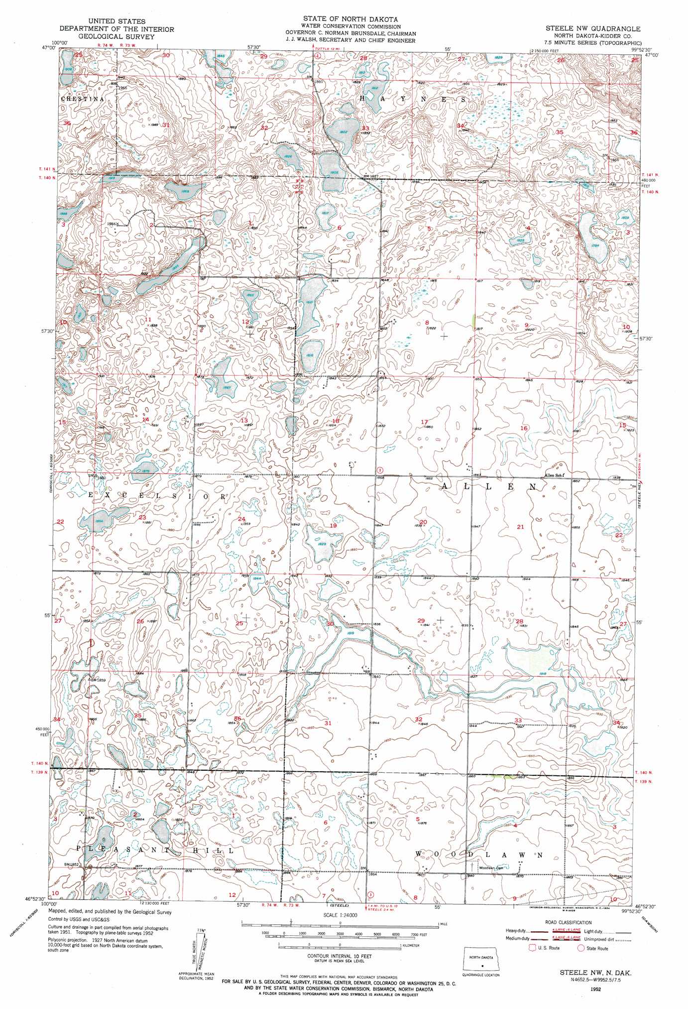
USGS Topo Quad 46099h8 - 1:24,000 scale
| Topo Map Name: | Steele Nw |
| USGS Topo Quad ID: | 46099h8 |
| Print Size: | ca. 21 1/4" wide x 27" high |
| Southeast Coordinates: | 46.875° N latitude / 99.875° W longitude |
| Map Center Coordinates: | 46.9375° N latitude / 99.9375° W longitude |
| U.S. State: | ND |
| Filename: | O46099H8.jpg |
| Download Map JPG Image: | Steele Nw topo map 1:24,000 scale |
| Map Type: | Topographic |
| Topo Series: | 7.5´ |
| Map Scale: | 1:24,000 |
| Source of Map Images: | United States Geological Survey (USGS) |
| Alternate Map Versions: |
Steele NW ND 1952, updated 1954 Download PDF Buy paper map Steele NW ND 2011 Download PDF Buy paper map Steele NW ND 2014 Download PDF Buy paper map |
1:24,000 Topo Quads surrounding Steele Nw
Arena |
Lake Helen |
Tuttle |
Robinson |
Des Moines Lake |
Harriet Lake |
Harriet Lake Se |
Tuttle Sw |
Horsehead Lake |
Kunkel Lake |
Clear Lake |
Stony Slough |
Steele Nw |
Steele Ne |
Tappen North |
Driscoll |
Lake Geneva |
Steele |
Dawson |
Tappen South |
Braddock Nw |
Braddock Ne |
Pursian Lake |
Kintyre Ne |
Alkaline Lake Nw |
> Back to 46099e1 at 1:100,000 scale
> Back to 46098a1 at 1:250,000 scale
> Back to U.S. Topo Maps home
No gazetteer data is available for the Steele Nw topo map sheet.
Steele Nw digital topo map on disk
Buy this Steele Nw topo map showing relief, roads, GPS coordinates and other geographical features, as a high-resolution digital map file on DVD:
Eastern North Dakota & Eastern South Dakota
Buy digital topo maps: Eastern North Dakota & Eastern South Dakota