Kiefer Buttes Topo Map North Dakota
To zoom in, hover over the map of Kiefer Buttes
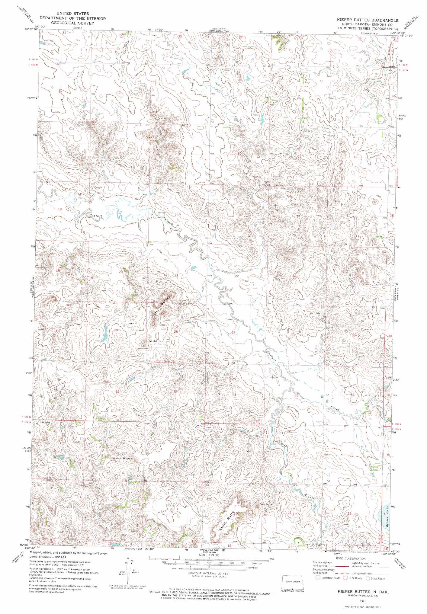
USGS Topo Quad 46100a4 - 1:24,000 scale
| Topo Map Name: | Kiefer Buttes |
| USGS Topo Quad ID: | 46100a4 |
| Print Size: | ca. 21 1/4" wide x 27" high |
| Southeast Coordinates: | 46° N latitude / 100.375° W longitude |
| Map Center Coordinates: | 46.0625° N latitude / 100.4375° W longitude |
| U.S. State: | ND |
| Filename: | O46100A4.jpg |
| Download Map JPG Image: | Kiefer Buttes topo map 1:24,000 scale |
| Map Type: | Topographic |
| Topo Series: | 7.5´ |
| Map Scale: | 1:24,000 |
| Source of Map Images: | United States Geological Survey (USGS) |
| Alternate Map Versions: |
Kiefer Buttes ND 1971, updated 1973 Download PDF Buy paper map Kiefer Buttes ND 2011 Download PDF Buy paper map Kiefer Buttes ND 2014 Download PDF Buy paper map |
1:24,000 Topo Quads surrounding Kiefer Buttes
Cannon Ball Sw |
Cannon Ball Se |
Hazelton Sw |
Temvik |
Linton |
Fort Yates Nw |
Fort Yates Ne |
Grassna Nw |
Grassna Ne |
Strasburg |
Fort Yates |
Fort Yates Se |
Kiefer Buttes |
Grassna |
Westfield |
Mahto Nw |
Mahto Ne |
Pollock Nw |
Pollock |
Herreid Nw |
Mahto |
Kline Buttes |
Kenel |
Pollock Se |
Herreid Sw |
> Back to 46100a1 at 1:100,000 scale
> Back to 46100a1 at 1:250,000 scale
> Back to U.S. Topo Maps home
Kiefer Buttes topo map: Gazetteer
Kiefer Buttes: Ranges
Kiefer Buttes elevation 609m 1998′Kiefer Buttes: Streams
South Branch Cattail Creek elevation 529m 1735′Kiefer Buttes: Summits
Fritz Butte elevation 641m 2103′Hall Hill elevation 611m 2004′
Lookout Butte elevation 640m 2099′
Smith Butte elevation 656m 2152′
Kiefer Buttes digital topo map on disk
Buy this Kiefer Buttes topo map showing relief, roads, GPS coordinates and other geographical features, as a high-resolution digital map file on DVD:
Eastern North Dakota & Eastern South Dakota
Buy digital topo maps: Eastern North Dakota & Eastern South Dakota