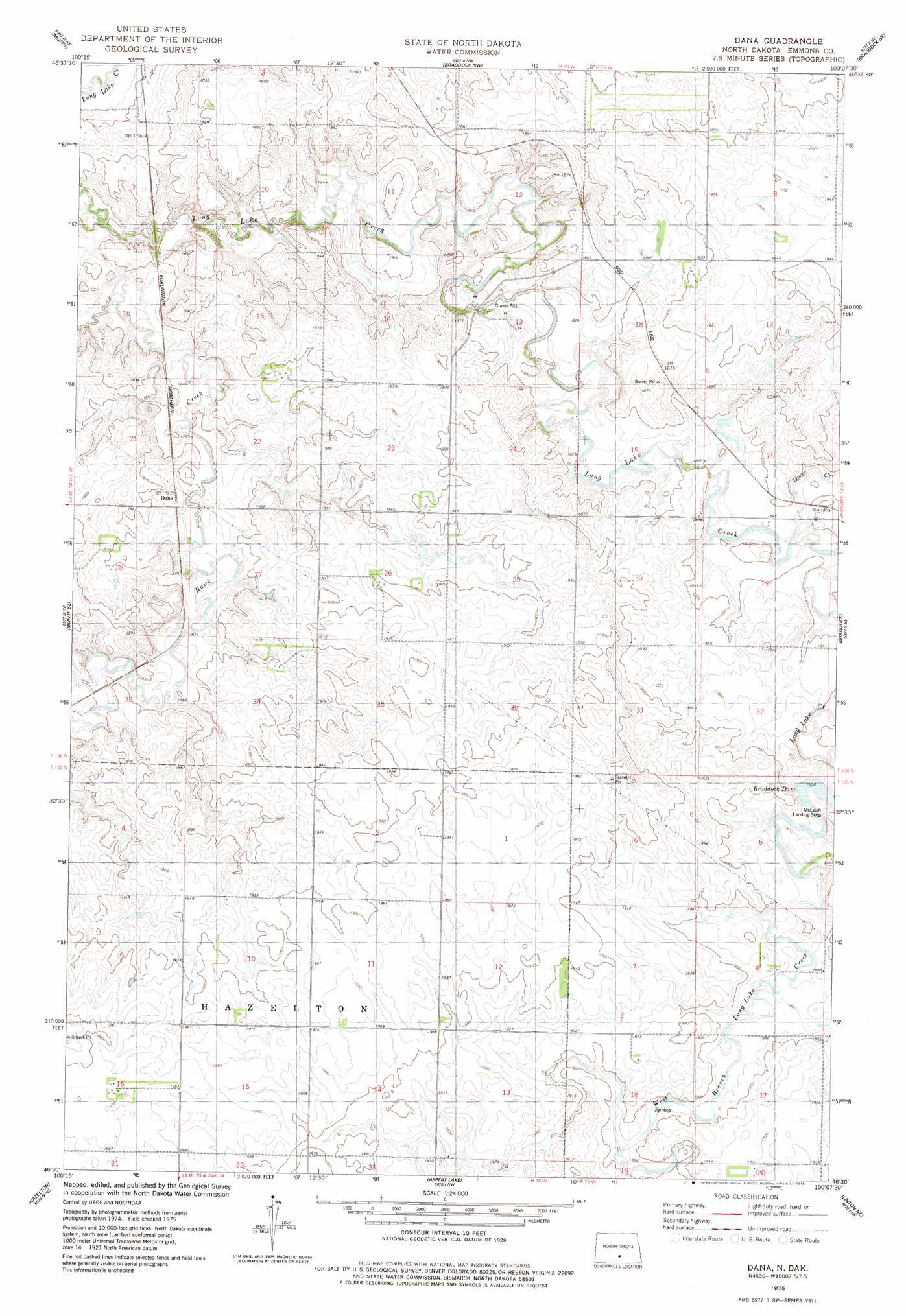
Dana Topo Map North Dakota
To zoom in, hover over the map of Dana
USGS Topo Quad 46100e2 - 1:24,000 scale
| Topo Map Name: | Dana |
| USGS Topo Quad ID: | 46100e2 |
| Print Size: | ca. 21 1/4" wide x 27" high |
| Southeast Coordinates: | 46.5° N latitude / 100.125° W longitude |
| Map Center Coordinates: | 46.5625° N latitude / 100.1875° W longitude |
| U.S. State: | ND |
| Filename: | O46100E2.jpg |
| Download Map JPG Image: | Dana topo map 1:24,000 scale |
| Map Type: | Topographic |
| Topo Series: | 7.5´ |
| Map Scale: | 1:24,000 |
| Source of Map Images: | United States Geological Survey (USGS) |
| Alternate Map Versions: |
Dana ND 1975, updated 1978 Download PDF Buy paper map Dana ND 2011 Download PDF Buy paper map Dana ND 2014 Download PDF Buy paper map |
1:24,000 Topo Quads surrounding Dana
Mckenzie |
Sterling |
Driscoll |
Lake Geneva |
Steele |
Moffit Nw |
Moffit |
Braddock Nw |
Braddock Ne |
Pursian Lake |
Moffit Sw |
Moffit Se |
Dana |
Braddock |
Kintyre |
Hazelton Nw |
Hazelton |
Appert Lake |
Linton Ne |
Schell Buttes Nw |
Hazelton Sw |
Temvik |
Linton |
Rohrich Dam |
Schell Buttes Sw |
> Back to 46100e1 at 1:100,000 scale
> Back to 46100a1 at 1:250,000 scale
> Back to U.S. Topo Maps home
Dana topo map: Gazetteer
Dana: Populated Places
Dana elevation 557m 1827′Dana: Streams
Goose Creek elevation 557m 1827′Dana digital topo map on disk
Buy this Dana topo map showing relief, roads, GPS coordinates and other geographical features, as a high-resolution digital map file on DVD:
Eastern North Dakota & Eastern South Dakota
Buy digital topo maps: Eastern North Dakota & Eastern South Dakota