Moffit Nw Topo Map North Dakota
To zoom in, hover over the map of Moffit Nw
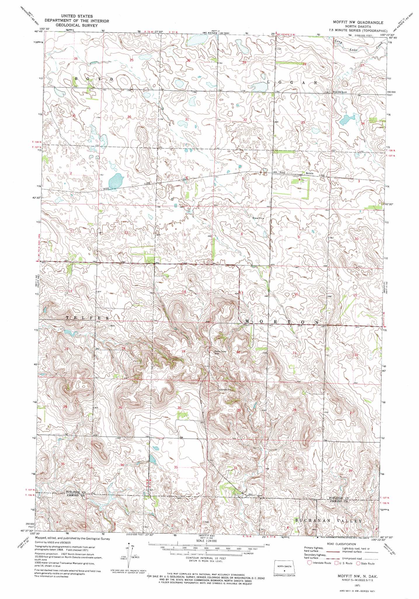
USGS Topo Quad 46100f4 - 1:24,000 scale
| Topo Map Name: | Moffit Nw |
| USGS Topo Quad ID: | 46100f4 |
| Print Size: | ca. 21 1/4" wide x 27" high |
| Southeast Coordinates: | 46.625° N latitude / 100.375° W longitude |
| Map Center Coordinates: | 46.6875° N latitude / 100.4375° W longitude |
| U.S. State: | ND |
| Filename: | O46100F4.jpg |
| Download Map JPG Image: | Moffit Nw topo map 1:24,000 scale |
| Map Type: | Topographic |
| Topo Series: | 7.5´ |
| Map Scale: | 1:24,000 |
| Source of Map Images: | United States Geological Survey (USGS) |
| Alternate Map Versions: |
Moffit NW ND 1971, updated 1973 Download PDF Buy paper map Moffit NW ND 2011 Download PDF Buy paper map Moffit NW ND 2014 Download PDF Buy paper map |
1:24,000 Topo Quads surrounding Moffit Nw
Keever Butte |
Solberg Butte |
Mckenzie Nw |
Sibley Butte |
Clear Lake |
Menoken Sw |
Menoken |
Mckenzie |
Sterling |
Driscoll |
Sugarloaf Butte |
Huff Ne |
Moffit Nw |
Moffit |
Braddock Nw |
Huff |
Fort Rice |
Moffit Sw |
Moffit Se |
Dana |
Cannon Ball Nw |
Cannon Ball |
Hazelton Nw |
Hazelton |
Appert Lake |
> Back to 46100e1 at 1:100,000 scale
> Back to 46100a1 at 1:250,000 scale
> Back to U.S. Topo Maps home
Moffit Nw digital topo map on disk
Buy this Moffit Nw topo map showing relief, roads, GPS coordinates and other geographical features, as a high-resolution digital map file on DVD:
Eastern North Dakota & Eastern South Dakota
Buy digital topo maps: Eastern North Dakota & Eastern South Dakota