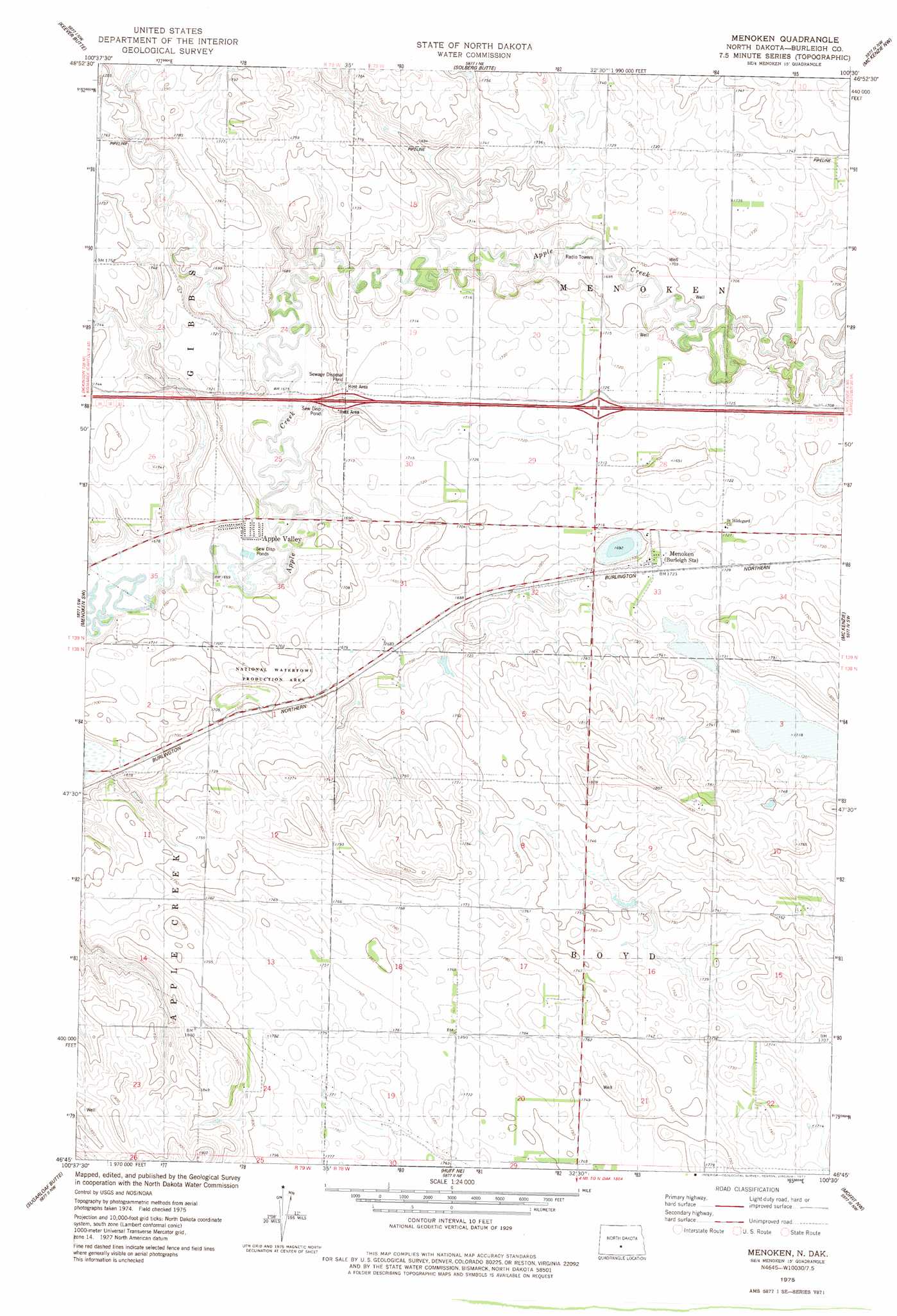
Menoken Topo Map North Dakota
To zoom in, hover over the map of Menoken
USGS Topo Quad 46100g5 - 1:24,000 scale
| Topo Map Name: | Menoken |
| USGS Topo Quad ID: | 46100g5 |
| Print Size: | ca. 21 1/4" wide x 27" high |
| Southeast Coordinates: | 46.75° N latitude / 100.5° W longitude |
| Map Center Coordinates: | 46.8125° N latitude / 100.5625° W longitude |
| U.S. State: | ND |
| Filename: | O46100G5.jpg |
| Download Map JPG Image: | Menoken topo map 1:24,000 scale |
| Map Type: | Topographic |
| Topo Series: | 7.5´ |
| Map Scale: | 1:24,000 |
| Source of Map Images: | United States Geological Survey (USGS) |
| Alternate Map Versions: |
Menoken ND 1975, updated 1977 Download PDF Buy paper map Menoken ND 1975, updated 1977 Download PDF Buy paper map Menoken ND 2011 Download PDF Buy paper map Menoken ND 2014 Download PDF Buy paper map |
1:24,000 Topo Quads surrounding Menoken
Wilton Se |
Baldwin |
Regan Se |
Wing Sw |
Wing Se |
Burnt Butte |
Keever Butte |
Solberg Butte |
Mckenzie Nw |
Sibley Butte |
Bismarck |
Menoken Sw |
Menoken |
Mckenzie |
Sterling |
Schmidt |
Sugarloaf Butte |
Huff Ne |
Moffit Nw |
Moffit |
The Hogback |
Huff |
Fort Rice |
Moffit Sw |
Moffit Se |
> Back to 46100e1 at 1:100,000 scale
> Back to 46100a1 at 1:250,000 scale
> Back to U.S. Topo Maps home
Menoken topo map: Gazetteer
Menoken: Populated Places
Apple Valley elevation 513m 1683′Menoken elevation 525m 1722′
Menoken digital topo map on disk
Buy this Menoken topo map showing relief, roads, GPS coordinates and other geographical features, as a high-resolution digital map file on DVD:
Eastern North Dakota & Eastern South Dakota
Buy digital topo maps: Eastern North Dakota & Eastern South Dakota