Mandan Topo Map North Dakota
To zoom in, hover over the map of Mandan
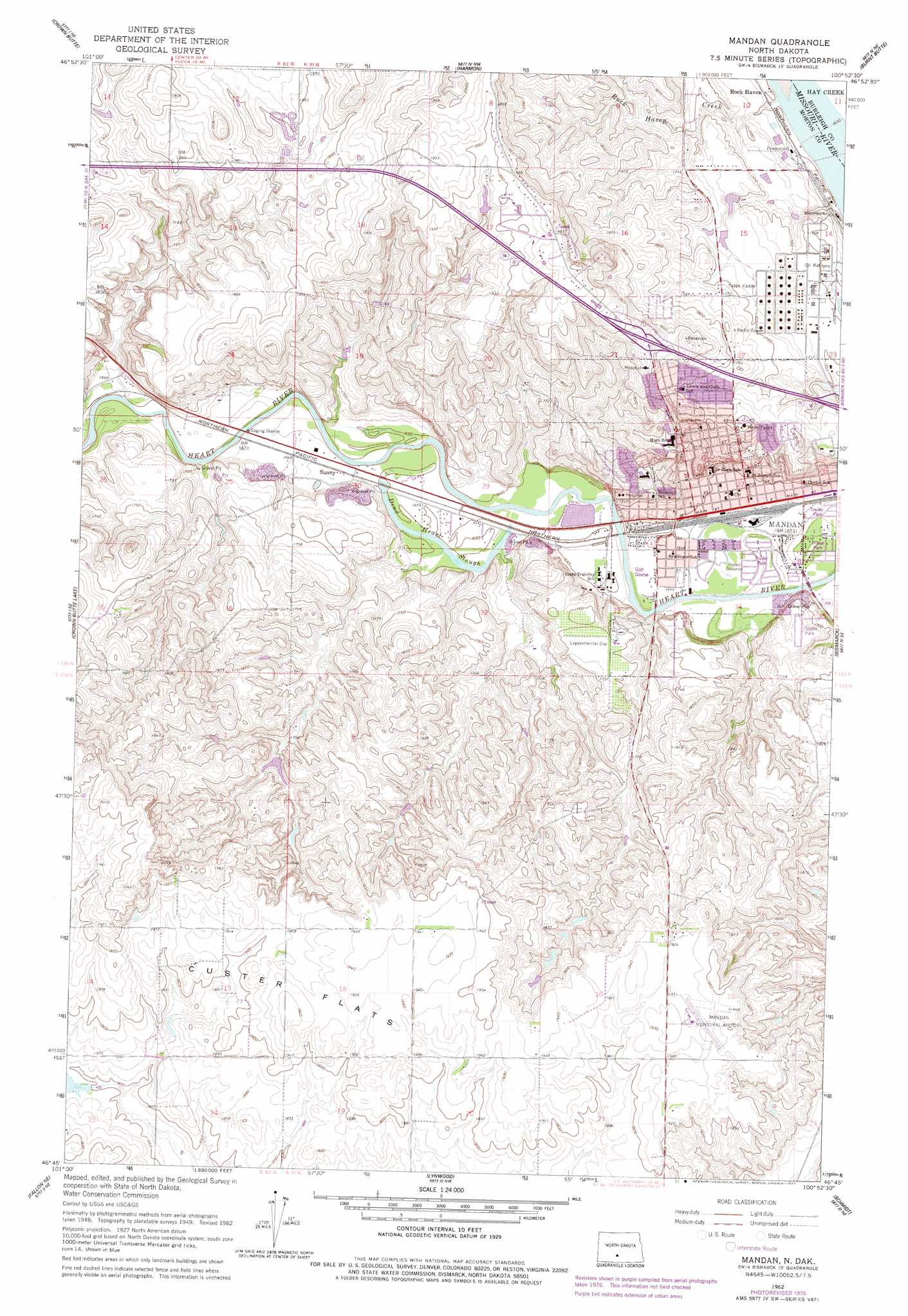
USGS Topo Quad 46100g8 - 1:24,000 scale
| Topo Map Name: | Mandan |
| USGS Topo Quad ID: | 46100g8 |
| Print Size: | ca. 21 1/4" wide x 27" high |
| Southeast Coordinates: | 46.75° N latitude / 100.875° W longitude |
| Map Center Coordinates: | 46.8125° N latitude / 100.9375° W longitude |
| U.S. State: | ND |
| Filename: | O46100G8.jpg |
| Download Map JPG Image: | Mandan topo map 1:24,000 scale |
| Map Type: | Topographic |
| Topo Series: | 7.5´ |
| Map Scale: | 1:24,000 |
| Source of Map Images: | United States Geological Survey (USGS) |
| Alternate Map Versions: |
Mandan ND 1951, updated 1951 Download PDF Buy paper map Mandan ND 1962, updated 1964 Download PDF Buy paper map Mandan ND 1962, updated 1977 Download PDF Buy paper map Mandan ND 2011 Download PDF Buy paper map Mandan ND 2014 Download PDF Buy paper map |
1:24,000 Topo Quads surrounding Mandan
Nelson Lake |
Fort Clark Se |
Price |
Wilton Se |
Baldwin |
Crown Butte Nw |
Crown Butte |
Harmon |
Burnt Butte |
Keever Butte |
Sweet Briar |
Crown Butte Lake |
Mandan |
Bismarck |
Menoken Sw |
Fish Creek Lane |
Fallon Ne |
Lynwood |
Schmidt |
Sugarloaf Butte |
Nygren Dam |
Fallon |
Saint Anthony |
The Hogback |
Huff |
> Back to 46100e1 at 1:100,000 scale
> Back to 46100a1 at 1:250,000 scale
> Back to U.S. Topo Maps home
Mandan topo map: Gazetteer
Mandan: Airports
Mandan Municipal Airport elevation 590m 1935′Mandan: Flats
Custer Flats elevation 590m 1935′Mandan: Guts
Dead Heart Slough elevation 501m 1643′Mandan: Populated Places
El Rancho Mobile Home Park elevation 500m 1640′Kens Mobile Home Park elevation 500m 1640′
Mandan elevation 502m 1646′
Meadow Park elevation 500m 1640′
Rock Haven elevation 504m 1653′
Sunny elevation 507m 1663′
Wildwood Mobile Home Park elevation 501m 1643′
Mandan: Streams
Rock Haven Creek elevation 497m 1630′Mandan digital topo map on disk
Buy this Mandan topo map showing relief, roads, GPS coordinates and other geographical features, as a high-resolution digital map file on DVD:
Eastern North Dakota & Eastern South Dakota
Buy digital topo maps: Eastern North Dakota & Eastern South Dakota