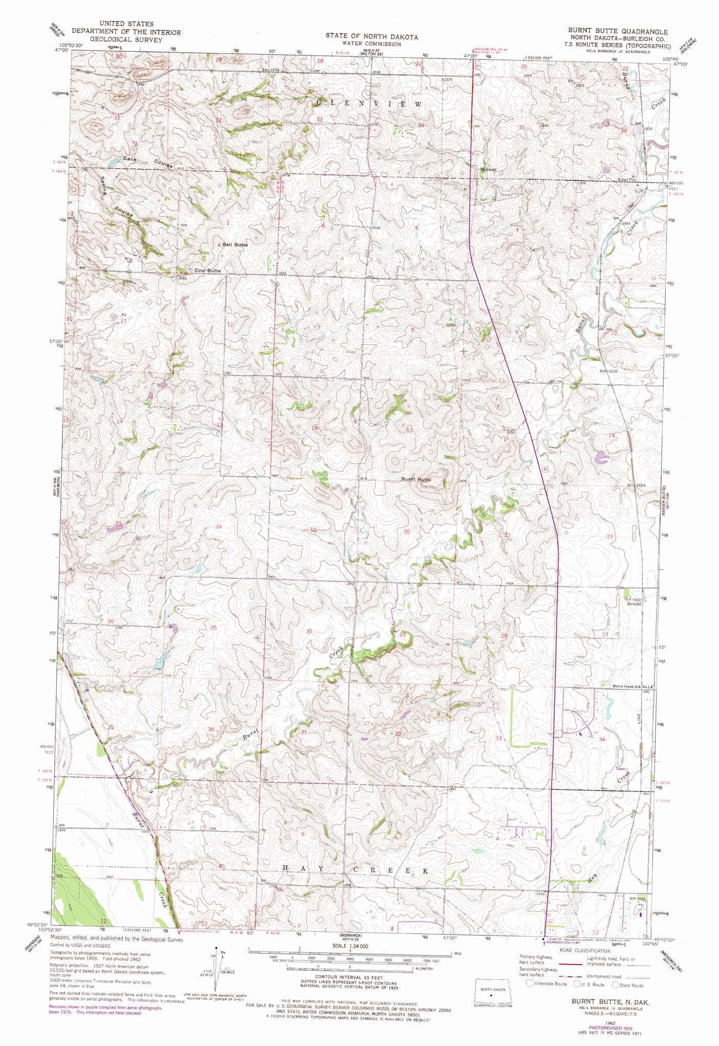
Burnt Butte Topo Map North Dakota
To zoom in, hover over the map of Burnt Butte
USGS Topo Quad 46100h7 - 1:24,000 scale
| Topo Map Name: | Burnt Butte |
| USGS Topo Quad ID: | 46100h7 |
| Print Size: | ca. 21 1/4" wide x 27" high |
| Southeast Coordinates: | 46.875° N latitude / 100.75° W longitude |
| Map Center Coordinates: | 46.9375° N latitude / 100.8125° W longitude |
| U.S. State: | ND |
| Filename: | O46100H7.jpg |
| Download Map JPG Image: | Burnt Butte topo map 1:24,000 scale |
| Map Type: | Topographic |
| Topo Series: | 7.5´ |
| Map Scale: | 1:24,000 |
| Source of Map Images: | United States Geological Survey (USGS) |
| Alternate Map Versions: |
Burnt Butte ND 1962, updated 1964 Download PDF Buy paper map Burnt Butte ND 1962, updated 1976 Download PDF Buy paper map Burnt Butte ND 2011 Download PDF Buy paper map Burnt Butte ND 2014 Download PDF Buy paper map |
1:24,000 Topo Quads surrounding Burnt Butte
Fort Clark Ne |
Sanger |
Wilton |
Grass Lake |
Regan |
Fort Clark Se |
Price |
Wilton Se |
Baldwin |
Regan Se |
Crown Butte |
Harmon |
Burnt Butte |
Keever Butte |
Solberg Butte |
Crown Butte Lake |
Mandan |
Bismarck |
Menoken Sw |
Menoken |
Fallon Ne |
Lynwood |
Schmidt |
Sugarloaf Butte |
Huff Ne |
> Back to 46100e1 at 1:100,000 scale
> Back to 46100a1 at 1:250,000 scale
> Back to U.S. Topo Maps home
Burnt Butte topo map: Gazetteer
Burnt Butte: Airports
Kinnischtzke Airfield elevation 554m 1817′Burnt Butte: Populated Places
Arnold elevation 577m 1893′Midway elevation 591m 1938′
Burnt Butte: Summits
Burnt Butte elevation 613m 2011′Coal Butte elevation 642m 2106′
Burnt Butte: Valleys
Cave Coulee elevation 519m 1702′Spring Coulee elevation 519m 1702′
Burnt Butte digital topo map on disk
Buy this Burnt Butte topo map showing relief, roads, GPS coordinates and other geographical features, as a high-resolution digital map file on DVD:
Eastern North Dakota & Eastern South Dakota
Buy digital topo maps: Eastern North Dakota & Eastern South Dakota