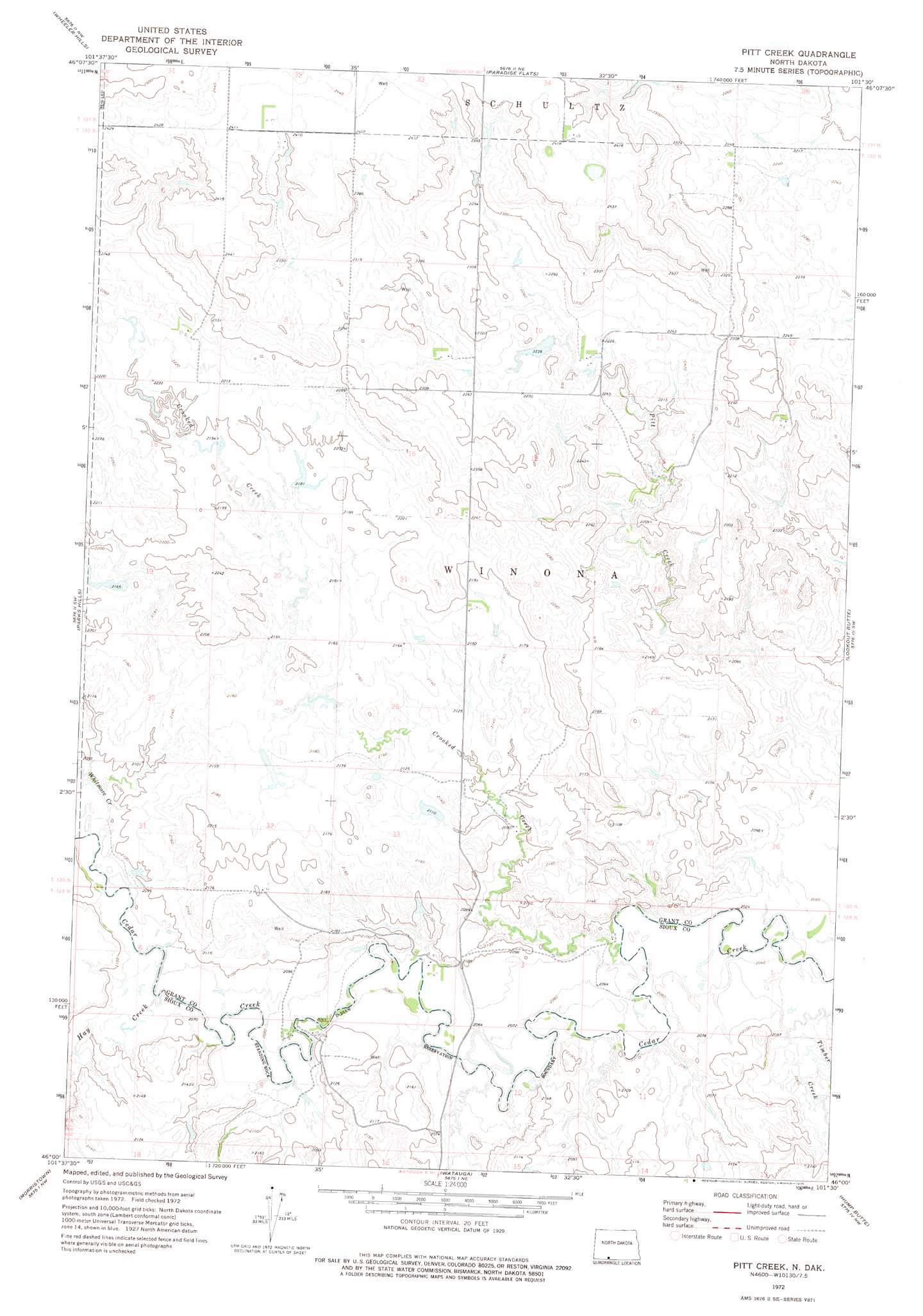
Pitt Creek Topo Map North Dakota
To zoom in, hover over the map of Pitt Creek
USGS Topo Quad 46101a5 - 1:24,000 scale
| Topo Map Name: | Pitt Creek |
| USGS Topo Quad ID: | 46101a5 |
| Print Size: | ca. 21 1/4" wide x 27" high |
| Southeast Coordinates: | 46° N latitude / 101.5° W longitude |
| Map Center Coordinates: | 46.0625° N latitude / 101.5625° W longitude |
| U.S. State: | ND |
| Filename: | O46101A5.jpg |
| Download Map JPG Image: | Pitt Creek topo map 1:24,000 scale |
| Map Type: | Topographic |
| Topo Series: | 7.5´ |
| Map Scale: | 1:24,000 |
| Source of Map Images: | United States Geological Survey (USGS) |
| Alternate Map Versions: |
Pitt Creek ND 1972, updated 1975 Download PDF Buy paper map Pitt Creek ND 1998, updated 2001 Download PDF Buy paper map Pitt Creek ND 2011 Download PDF Buy paper map Pitt Creek ND 2014 Download PDF Buy paper map |
| FStopo: | US Forest Service topo Pitt Creek is available: Download FStopo PDF Download FStopo TIF |
1:24,000 Topo Quads surrounding Pitt Creek
Sheep Creek Dam |
Leith |
Carson Se |
Brisbane |
Raleigh |
Pretty Rock Butte |
Wheeler Hills |
Paradise Flats |
Bell Coulee West |
Bell Coulee East |
Pretty Rock Butte Se |
Parks Hills |
Pitt Creek |
Lookout Butte |
Lookout Butte Se |
Keldron |
Morristown |
Watauga |
Hump Butte |
Mcintosh |
Thunder Hawk Se |
Skull Butte |
Morristown Se |
Mcintosh Sw |
Mcintosh Se |
> Back to 46101a1 at 1:100,000 scale
> Back to 46100a1 at 1:250,000 scale
> Back to U.S. Topo Maps home
Pitt Creek topo map: Gazetteer
Pitt Creek: Forests
Cedar River National Grassland elevation 641m 2103′Pitt Creek: Streams
Crooked Creek elevation 621m 2037′Hay Creek elevation 628m 2060′
Hay Creek elevation 628m 2060′
Whitmore Creek elevation 634m 2080′
Pitt Creek digital topo map on disk
Buy this Pitt Creek topo map showing relief, roads, GPS coordinates and other geographical features, as a high-resolution digital map file on DVD:
Eastern North Dakota & Eastern South Dakota
Buy digital topo maps: Eastern North Dakota & Eastern South Dakota