Leith Topo Map North Dakota
To zoom in, hover over the map of Leith
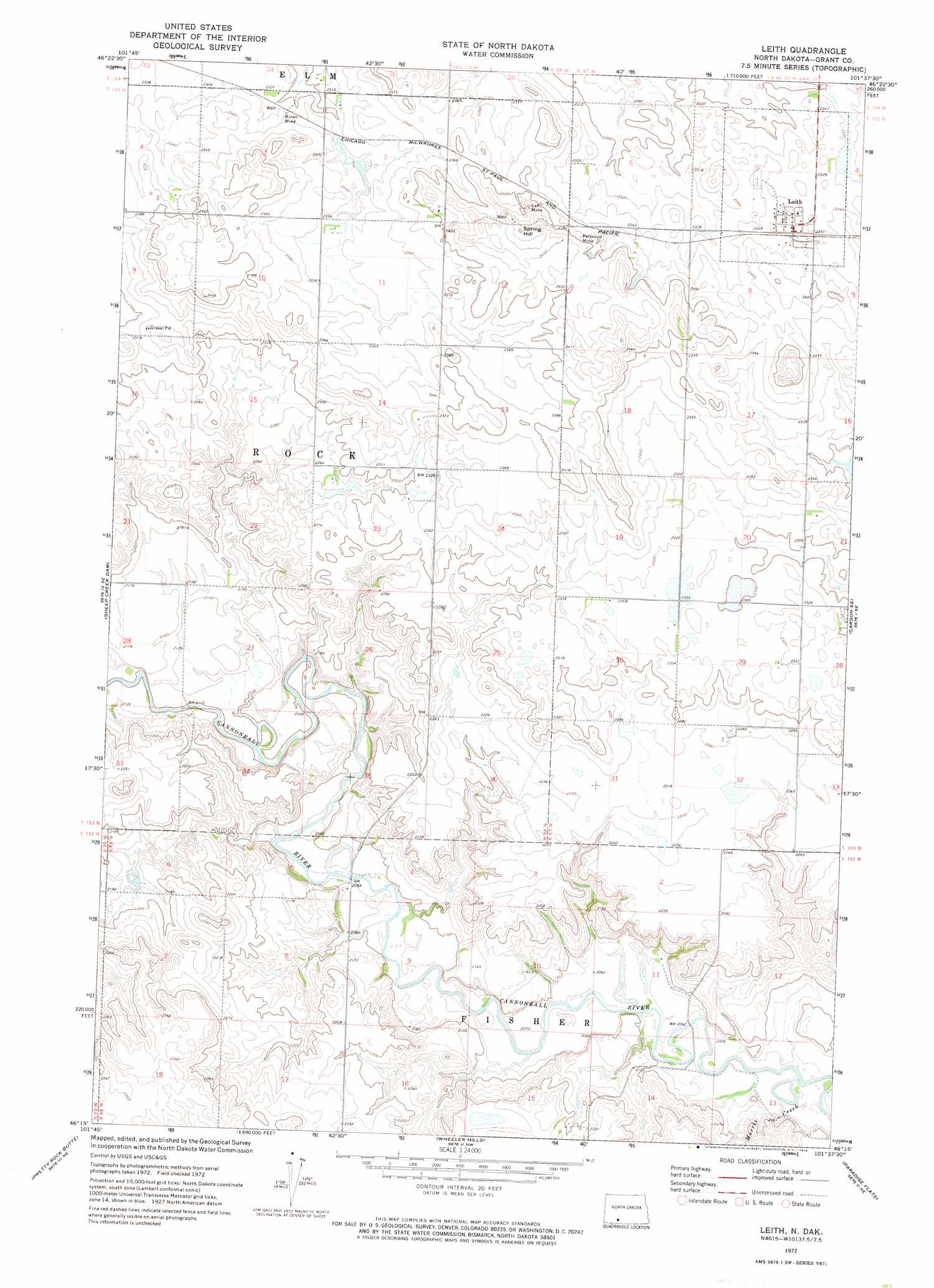
USGS Topo Quad 46101c6 - 1:24,000 scale
| Topo Map Name: | Leith |
| USGS Topo Quad ID: | 46101c6 |
| Print Size: | ca. 21 1/4" wide x 27" high |
| Southeast Coordinates: | 46.25° N latitude / 101.625° W longitude |
| Map Center Coordinates: | 46.3125° N latitude / 101.6875° W longitude |
| U.S. State: | ND |
| Filename: | O46101C6.jpg |
| Download Map JPG Image: | Leith topo map 1:24,000 scale |
| Map Type: | Topographic |
| Topo Series: | 7.5´ |
| Map Scale: | 1:24,000 |
| Source of Map Images: | United States Geological Survey (USGS) |
| Alternate Map Versions: |
Leith ND 1972, updated 1974 Download PDF Buy paper map Leith ND 2011 Download PDF Buy paper map Leith ND 2014 Download PDF Buy paper map |
1:24,000 Topo Quads surrounding Leith
Lake Tschida West |
Lake Tschida East |
Crown Butte Creek Sw |
Crown Butte Creek Se |
Otter Creek West |
New Leipzig North |
Elgin |
Heil |
Carson |
Lark |
New Leipzig South |
Sheep Creek Dam |
Leith |
Carson Se |
Brisbane |
Coffin Buttes |
Pretty Rock Butte |
Wheeler Hills |
Paradise Flats |
Bell Coulee West |
Round Top |
Pretty Rock Butte Se |
Parks Hills |
Pitt Creek |
Lookout Butte |
> Back to 46101a1 at 1:100,000 scale
> Back to 46100a1 at 1:250,000 scale
> Back to U.S. Topo Maps home
Leith topo map: Gazetteer
Leith: Mines
Binek Mine elevation 710m 2329′Lah Mine elevation 739m 2424′
Peterson Mine elevation 730m 2395′
Leith: Populated Places
Leith elevation 714m 2342′Leith: Streams
Morris Creek elevation 622m 2040′Leith: Summits
Spring Hill elevation 763m 2503′Leith digital topo map on disk
Buy this Leith topo map showing relief, roads, GPS coordinates and other geographical features, as a high-resolution digital map file on DVD:
Eastern North Dakota & Eastern South Dakota
Buy digital topo maps: Eastern North Dakota & Eastern South Dakota