Lake Tschida West Topo Map North Dakota
To zoom in, hover over the map of Lake Tschida West
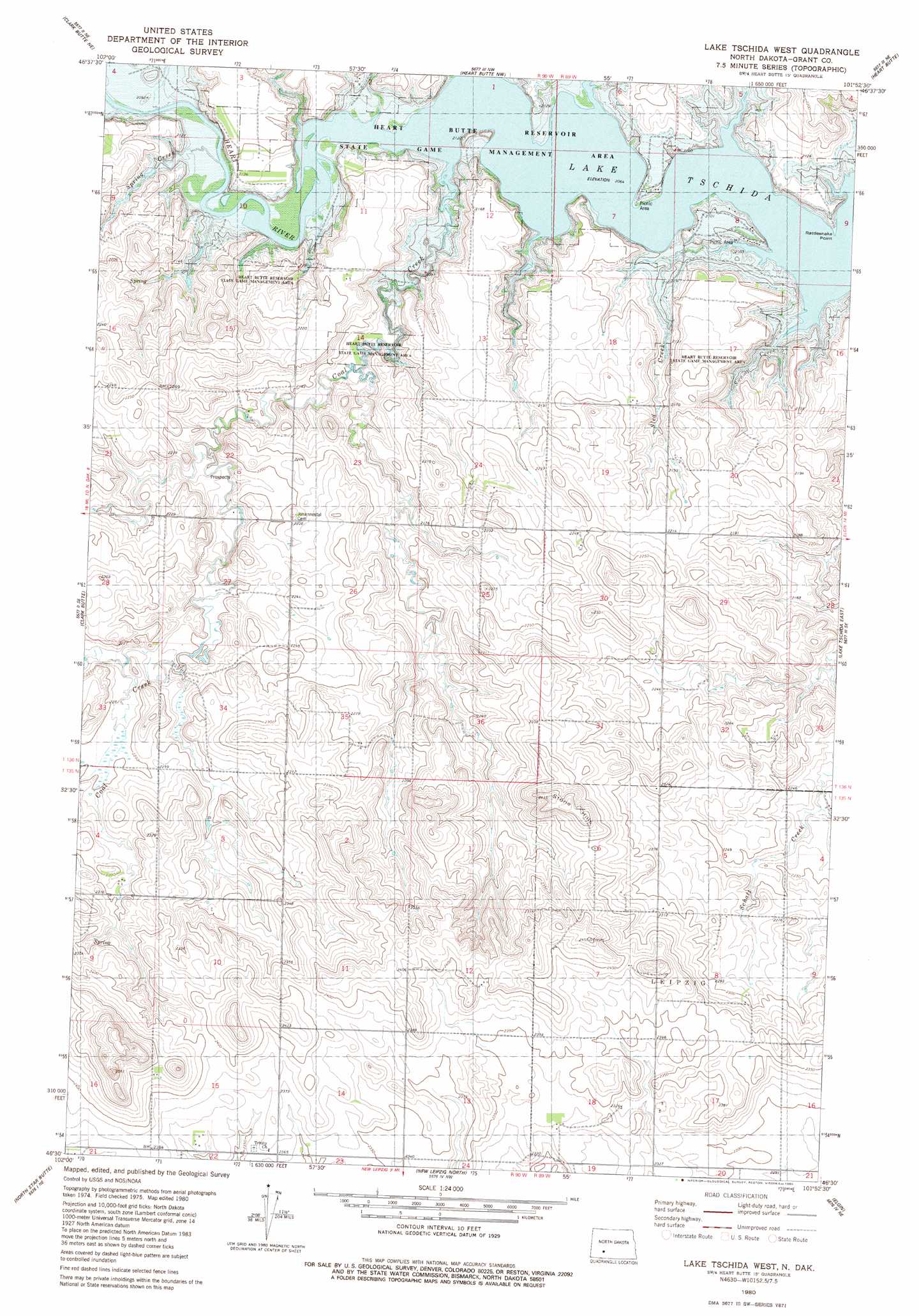
USGS Topo Quad 46101e8 - 1:24,000 scale
| Topo Map Name: | Lake Tschida West |
| USGS Topo Quad ID: | 46101e8 |
| Print Size: | ca. 21 1/4" wide x 27" high |
| Southeast Coordinates: | 46.5° N latitude / 101.875° W longitude |
| Map Center Coordinates: | 46.5625° N latitude / 101.9375° W longitude |
| U.S. State: | ND |
| Filename: | O46101E8.jpg |
| Download Map JPG Image: | Lake Tschida West topo map 1:24,000 scale |
| Map Type: | Topographic |
| Topo Series: | 7.5´ |
| Map Scale: | 1:24,000 |
| Source of Map Images: | United States Geological Survey (USGS) |
| Alternate Map Versions: |
Lake Tschida West ND 1980, updated 1980 Download PDF Buy paper map Lake Tschida West ND 2011 Download PDF Buy paper map Lake Tschida West ND 2014 Download PDF Buy paper map |
1:24,000 Topo Quads surrounding Lake Tschida West
Antelope |
Hebron Se |
Glen Ullin Sw |
Glen Ullin |
Dengate |
Clark Butte Nw |
Clark Butte Ne |
Heart Butte Nw |
Heart Butte |
Crown Butte Creek Nw |
Clark Butte Sw |
Clark Butte |
Lake Tschida West |
Lake Tschida East |
Crown Butte Creek Sw |
Burt Nw |
North Star Butte |
New Leipzig North |
Elgin |
Heil |
Burt |
Bentley |
New Leipzig South |
Sheep Creek Dam |
Leith |
> Back to 46101e1 at 1:100,000 scale
> Back to 46100a1 at 1:250,000 scale
> Back to U.S. Topo Maps home
Lake Tschida West topo map: Gazetteer
Lake Tschida West: Mines
Lignite Mine elevation 665m 2181′Lake Tschida West: Streams
Coal Creek elevation 630m 2066′Red Creek elevation 630m 2066′
Sled Creek elevation 630m 2066′
Spring Creek elevation 633m 2076′
Swamp Creek elevation 630m 2066′
Lake Tschida West digital topo map on disk
Buy this Lake Tschida West topo map showing relief, roads, GPS coordinates and other geographical features, as a high-resolution digital map file on DVD:
Eastern North Dakota & Eastern South Dakota
Buy digital topo maps: Eastern North Dakota & Eastern South Dakota