Ehler Lake Topo Map North Dakota
To zoom in, hover over the map of Ehler Lake
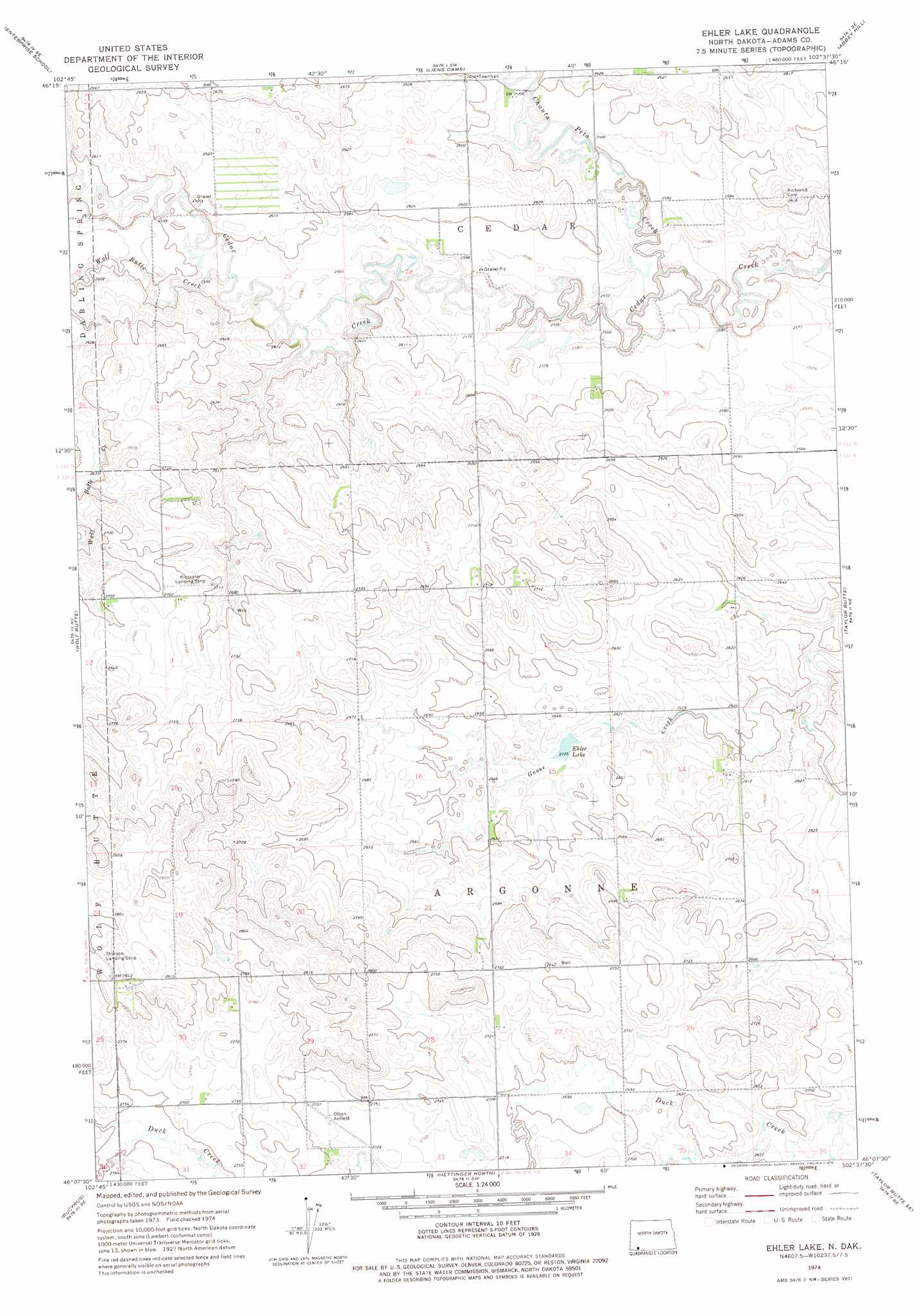
USGS Topo Quad 46102b6 - 1:24,000 scale
| Topo Map Name: | Ehler Lake |
| USGS Topo Quad ID: | 46102b6 |
| Print Size: | ca. 21 1/4" wide x 27" high |
| Southeast Coordinates: | 46.125° N latitude / 102.625° W longitude |
| Map Center Coordinates: | 46.1875° N latitude / 102.6875° W longitude |
| U.S. State: | ND |
| Filename: | O46102B6.jpg |
| Download Map JPG Image: | Ehler Lake topo map 1:24,000 scale |
| Map Type: | Topographic |
| Topo Series: | 7.5´ |
| Map Scale: | 1:24,000 |
| Source of Map Images: | United States Geological Survey (USGS) |
| Alternate Map Versions: |
Ehler Lake ND 2011 Download PDF Buy paper map Ehler Lake ND 2014 Download PDF Buy paper map |
1:24,000 Topo Quads surrounding Ehler Lake
East Rainy Butte |
Jung Lake |
Havelock |
Regent |
Mott Nw |
Cedar Lake |
Enterprise School |
Liens Dams |
Abbey Hill |
Mott Sw |
Whetstone Buttes |
Wolf Butte |
Ehler Lake |
Taylor Butte |
Pearl Butte Nw |
Reeder |
Bucyrus |
Hettinger North |
Taylor Butte Se |
Pearl Butte |
Cow Butte |
Cow Butte Ne |
Hettinger South |
Kid Rich Butte |
Haynes |
> Back to 46102a1 at 1:100,000 scale
> Back to 46102a1 at 1:250,000 scale
> Back to U.S. Topo Maps home
Ehler Lake topo map: Gazetteer
Ehler Lake: Airports
Kinsvater Landing Strip elevation 825m 2706′Olson Airfield elevation 832m 2729′
Ehler Lake: Reservoirs
Ehler Lake elevation 801m 2627′Ehler Lake: Streams
Chanta Peta Creek elevation 777m 2549′Wolf Butte Creek elevation 787m 2582′
Ehler Lake digital topo map on disk
Buy this Ehler Lake topo map showing relief, roads, GPS coordinates and other geographical features, as a high-resolution digital map file on DVD:
Eastern Montana & Western North Dakota
Buy digital topo maps: Eastern Montana & Western North Dakota