Clark Butte Topo Map North Dakota
To zoom in, hover over the map of Clark Butte
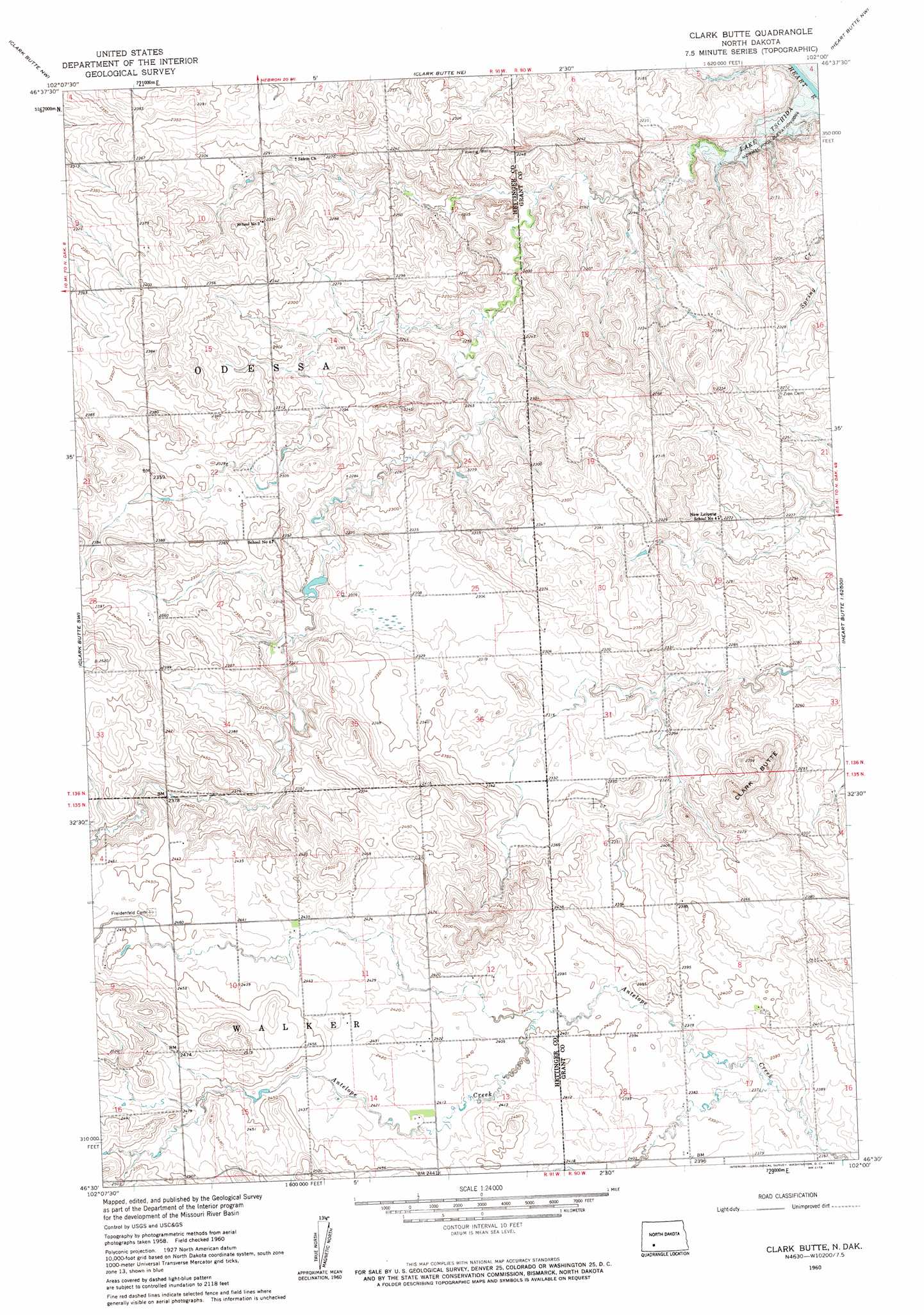
USGS Topo Quad 46102e1 - 1:24,000 scale
| Topo Map Name: | Clark Butte |
| USGS Topo Quad ID: | 46102e1 |
| Print Size: | ca. 21 1/4" wide x 27" high |
| Southeast Coordinates: | 46.5° N latitude / 102° W longitude |
| Map Center Coordinates: | 46.5625° N latitude / 102.0625° W longitude |
| U.S. State: | ND |
| Filename: | O46102E1.jpg |
| Download Map JPG Image: | Clark Butte topo map 1:24,000 scale |
| Map Type: | Topographic |
| Topo Series: | 7.5´ |
| Map Scale: | 1:24,000 |
| Source of Map Images: | United States Geological Survey (USGS) |
| Alternate Map Versions: |
Clark Butte ND 1960, updated 1962 Download PDF Buy paper map Clark Butte ND 2011 Download PDF Buy paper map Clark Butte ND 2014 Download PDF Buy paper map |
1:24,000 Topo Quads surrounding Clark Butte
Richardton Se |
Antelope |
Hebron Se |
Glen Ullin Sw |
Glen Ullin |
White Butte Ne |
Clark Butte Nw |
Clark Butte Ne |
Heart Butte Nw |
Heart Butte |
White Butte East |
Clark Butte Sw |
Clark Butte |
Lake Tschida West |
Lake Tschida East |
Mott North |
Burt Nw |
North Star Butte |
New Leipzig North |
Elgin |
Mott South |
Burt |
Bentley |
New Leipzig South |
Sheep Creek Dam |
> Back to 46102e1 at 1:100,000 scale
> Back to 46102a1 at 1:250,000 scale
> Back to U.S. Topo Maps home
Clark Butte topo map: Gazetteer
Clark Butte: Streams
Antelope Creek elevation 717m 2352′Clark Butte: Summits
Clark Butte elevation 725m 2378′Clark Butte digital topo map on disk
Buy this Clark Butte topo map showing relief, roads, GPS coordinates and other geographical features, as a high-resolution digital map file on DVD:
Eastern Montana & Western North Dakota
Buy digital topo maps: Eastern Montana & Western North Dakota