Lefor Sw Topo Map North Dakota
To zoom in, hover over the map of Lefor Sw
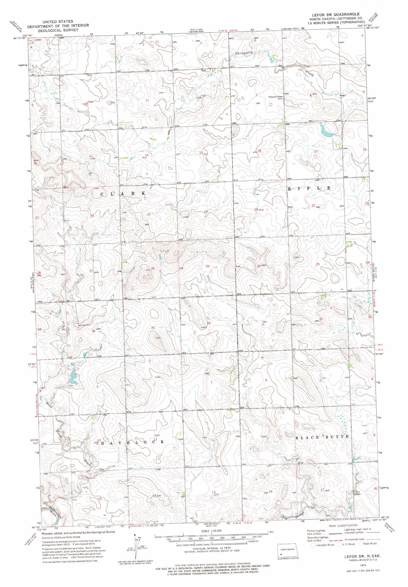
USGS Topo Quad 46102e6 - 1:24,000 scale
| Topo Map Name: | Lefor Sw |
| USGS Topo Quad ID: | 46102e6 |
| Print Size: | ca. 21 1/4" wide x 27" high |
| Southeast Coordinates: | 46.5° N latitude / 102.625° W longitude |
| Map Center Coordinates: | 46.5625° N latitude / 102.6875° W longitude |
| U.S. State: | ND |
| Filename: | O46102E6.jpg |
| Download Map JPG Image: | Lefor Sw topo map 1:24,000 scale |
| Map Type: | Topographic |
| Topo Series: | 7.5´ |
| Map Scale: | 1:24,000 |
| Source of Map Images: | United States Geological Survey (USGS) |
| Alternate Map Versions: |
Lefor SW ND 1973, updated 1977 Download PDF Buy paper map Lefor SW ND 2011 Download PDF Buy paper map Lefor SW ND 2014 Download PDF Buy paper map |
1:24,000 Topo Quads surrounding Lefor Sw
South Heart |
Dickinson South |
Lehigh |
Gladstone |
Bratburg Butte |
New England Nw |
Schefield |
Lefor Nw |
Lefor |
White Butte Nw |
New England Sw |
New England |
Lefor Sw |
Stony Butte |
White Butte West |
East Rainy Butte |
Jung Lake |
Havelock |
Regent |
Mott Nw |
Cedar Lake |
Enterprise School |
Liens Dams |
Abbey Hill |
Mott Sw |
> Back to 46102e1 at 1:100,000 scale
> Back to 46102a1 at 1:250,000 scale
> Back to U.S. Topo Maps home
Lefor Sw digital topo map on disk
Buy this Lefor Sw topo map showing relief, roads, GPS coordinates and other geographical features, as a high-resolution digital map file on DVD:
Eastern Montana & Western North Dakota
Buy digital topo maps: Eastern Montana & Western North Dakota