Griffin Topo Map North Dakota
To zoom in, hover over the map of Griffin
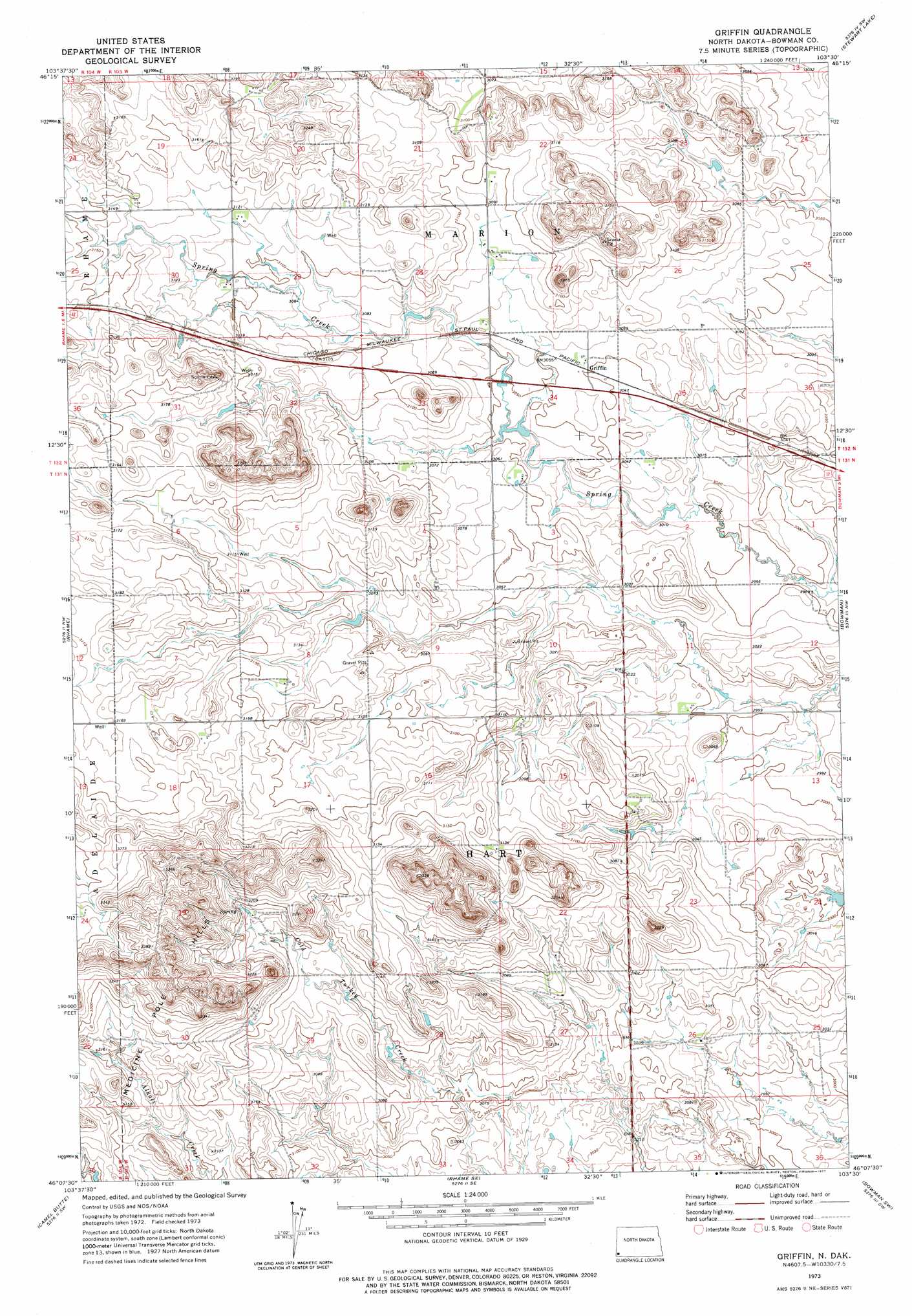
USGS Topo Quad 46103b5 - 1:24,000 scale
| Topo Map Name: | Griffin |
| USGS Topo Quad ID: | 46103b5 |
| Print Size: | ca. 21 1/4" wide x 27" high |
| Southeast Coordinates: | 46.125° N latitude / 103.5° W longitude |
| Map Center Coordinates: | 46.1875° N latitude / 103.5625° W longitude |
| U.S. State: | ND |
| Filename: | O46103B5.jpg |
| Download Map JPG Image: | Griffin topo map 1:24,000 scale |
| Map Type: | Topographic |
| Topo Series: | 7.5´ |
| Map Scale: | 1:24,000 |
| Source of Map Images: | United States Geological Survey (USGS) |
| Alternate Map Versions: |
Griffin ND 1973, updated 1977 Download PDF Buy paper map Griffin ND 2011 Download PDF Buy paper map Griffin ND 2014 Download PDF Buy paper map |
1:24,000 Topo Quads surrounding Griffin
Boyce Creek West |
Boyce Creek East |
Deep Creek South |
Black Butte |
Amidon |
Marmarth Se |
Ives |
West Fork Deep Creek |
Stewart Lake |
Amidon Se |
Cedar Hills |
Rhame |
Griffin |
Bowman |
Talbot Butte |
Mud Buttes |
Camel Butte |
Rhame Se |
Bowman Sw |
Bowman Se |
Dogie Butte |
Table Mountain |
Ladner Ne |
Eagles Nest Butte |
Tepee Buttes |
> Back to 46103a1 at 1:100,000 scale
> Back to 46102a1 at 1:250,000 scale
> Back to U.S. Topo Maps home
Griffin topo map: Gazetteer
Griffin: Populated Places
Griffin elevation 931m 3054′Griffin: Ranges
Medicine Pole Hills elevation 969m 3179′Griffin digital topo map on disk
Buy this Griffin topo map showing relief, roads, GPS coordinates and other geographical features, as a high-resolution digital map file on DVD:
Eastern Montana & Western North Dakota
Buy digital topo maps: Eastern Montana & Western North Dakota