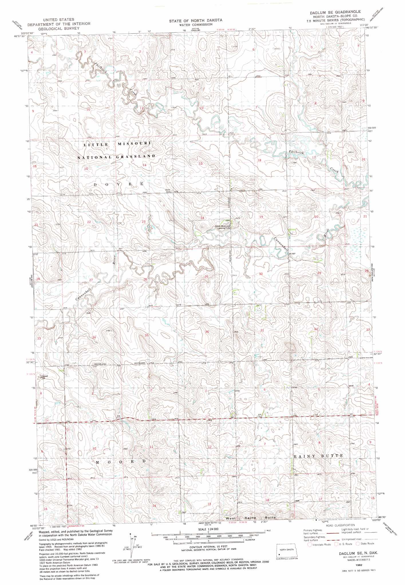
Daglum Se Topo Map North Dakota
To zoom in, hover over the map of Daglum Se
USGS Topo Quad 46103e1 - 1:24,000 scale
| Topo Map Name: | Daglum Se |
| USGS Topo Quad ID: | 46103e1 |
| Print Size: | ca. 21 1/4" wide x 27" high |
| Southeast Coordinates: | 46.5° N latitude / 103° W longitude |
| Map Center Coordinates: | 46.5625° N latitude / 103.0625° W longitude |
| U.S. State: | ND |
| Filename: | O46103E1.jpg |
| Download Map JPG Image: | Daglum Se topo map 1:24,000 scale |
| Map Type: | Topographic |
| Topo Series: | 7.5´ |
| Map Scale: | 1:24,000 |
| Source of Map Images: | United States Geological Survey (USGS) |
| Alternate Map Versions: |
Daglum SE ND 1982, updated 1983 Download PDF Buy paper map Daglum SE ND 1997, updated 2001 Download PDF Buy paper map Daglum SE ND 2011 Download PDF Buy paper map Daglum SE ND 2014 Download PDF Buy paper map |
| FStopo: | US Forest Service topo Daglum SE is available: Download FStopo PDF Download FStopo TIF |
1:24,000 Topo Quads surrounding Daglum Se
Fryburg |
Belfield Sw |
Belfield Se |
South Heart |
Dickinson South |
Rocky Ridge North |
Daglum Nw |
Daglum |
New England Nw |
Schefield |
Rocky Ridge South |
Daglum Sw |
Daglum Se |
New England Sw |
New England |
Amidon |
White Lake |
West Rainy Butte |
East Rainy Butte |
Jung Lake |
Amidon Se |
Mineral Springs |
Warnke Hill |
Cedar Lake |
Enterprise School |
> Back to 46103e1 at 1:100,000 scale
> Back to 46102a1 at 1:250,000 scale
> Back to U.S. Topo Maps home
Daglum Se topo map: Gazetteer
Daglum Se: Airports
Dovre Municipal Landing Field elevation 813m 2667′Daglum Se: Streams
Philbrick Creek elevation 796m 2611′Daglum Se digital topo map on disk
Buy this Daglum Se topo map showing relief, roads, GPS coordinates and other geographical features, as a high-resolution digital map file on DVD:
Eastern Montana & Western North Dakota
Buy digital topo maps: Eastern Montana & Western North Dakota