Spring Creek Topo Map North Dakota
To zoom in, hover over the map of Spring Creek
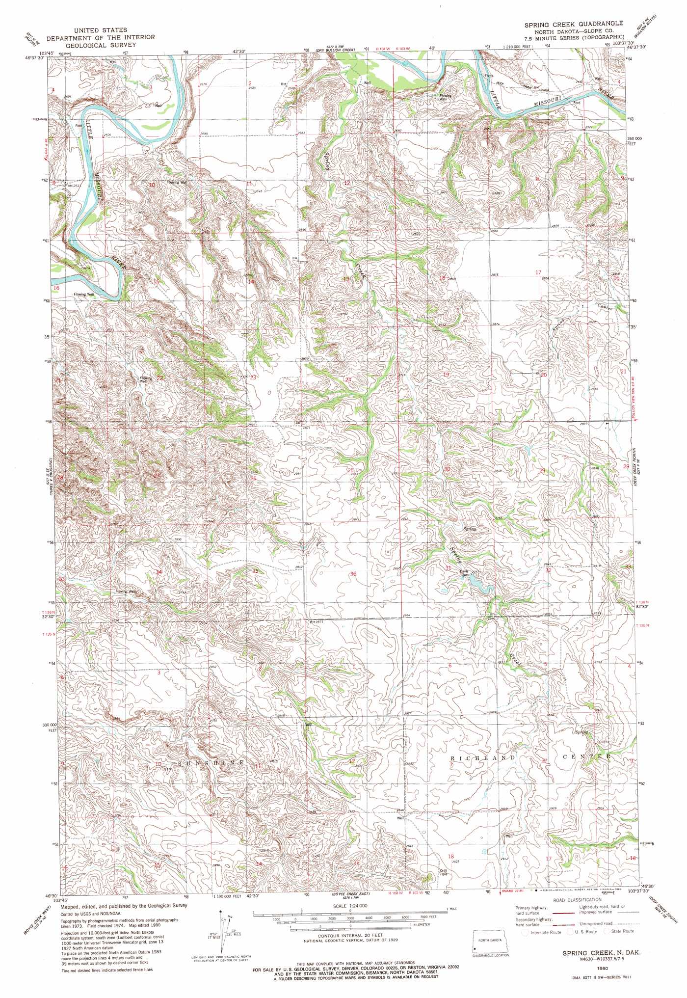
USGS Topo Quad 46103e6 - 1:24,000 scale
| Topo Map Name: | Spring Creek |
| USGS Topo Quad ID: | 46103e6 |
| Print Size: | ca. 21 1/4" wide x 27" high |
| Southeast Coordinates: | 46.5° N latitude / 103.625° W longitude |
| Map Center Coordinates: | 46.5625° N latitude / 103.6875° W longitude |
| U.S. State: | ND |
| Filename: | O46103E6.jpg |
| Download Map JPG Image: | Spring Creek topo map 1:24,000 scale |
| Map Type: | Topographic |
| Topo Series: | 7.5´ |
| Map Scale: | 1:24,000 |
| Source of Map Images: | United States Geological Survey (USGS) |
| Alternate Map Versions: |
Spring Creek ND 1980, updated 1980 Download PDF Buy paper map Spring Creek ND 1997, updated 2001 Download PDF Buy paper map Spring Creek ND 2011 Download PDF Buy paper map Spring Creek ND 2014 Download PDF Buy paper map |
| FStopo: | US Forest Service topo Spring Creek is available: Download FStopo PDF Download FStopo TIF |
1:24,000 Topo Quads surrounding Spring Creek
Thelan |
Sentinel Butte Se |
Square Butte |
Chimney Butte |
Tracy Mountain |
Golva |
Alpha |
Dry Bullion Creek |
Bullion Butte |
Cliffs Plateau |
Williams Lake |
Three V Crossing |
Spring Creek |
Deep Creek North |
Juniper Spur |
Pretty Butte |
Boyce Creek West |
Boyce Creek East |
Deep Creek South |
Black Butte |
Marmarth |
Marmarth Se |
Ives |
West Fork Deep Creek |
Stewart Lake |
> Back to 46103e1 at 1:100,000 scale
> Back to 46102a1 at 1:250,000 scale
> Back to U.S. Topo Maps home
Spring Creek topo map: Gazetteer
Spring Creek: Dams
Davis Dam elevation 840m 2755′Spring Creek: Streams
Spring Creek elevation 757m 2483′Spring Creek digital topo map on disk
Buy this Spring Creek topo map showing relief, roads, GPS coordinates and other geographical features, as a high-resolution digital map file on DVD:
Eastern Montana & Western North Dakota
Buy digital topo maps: Eastern Montana & Western North Dakota