Three V Crossing Topo Map North Dakota
To zoom in, hover over the map of Three V Crossing
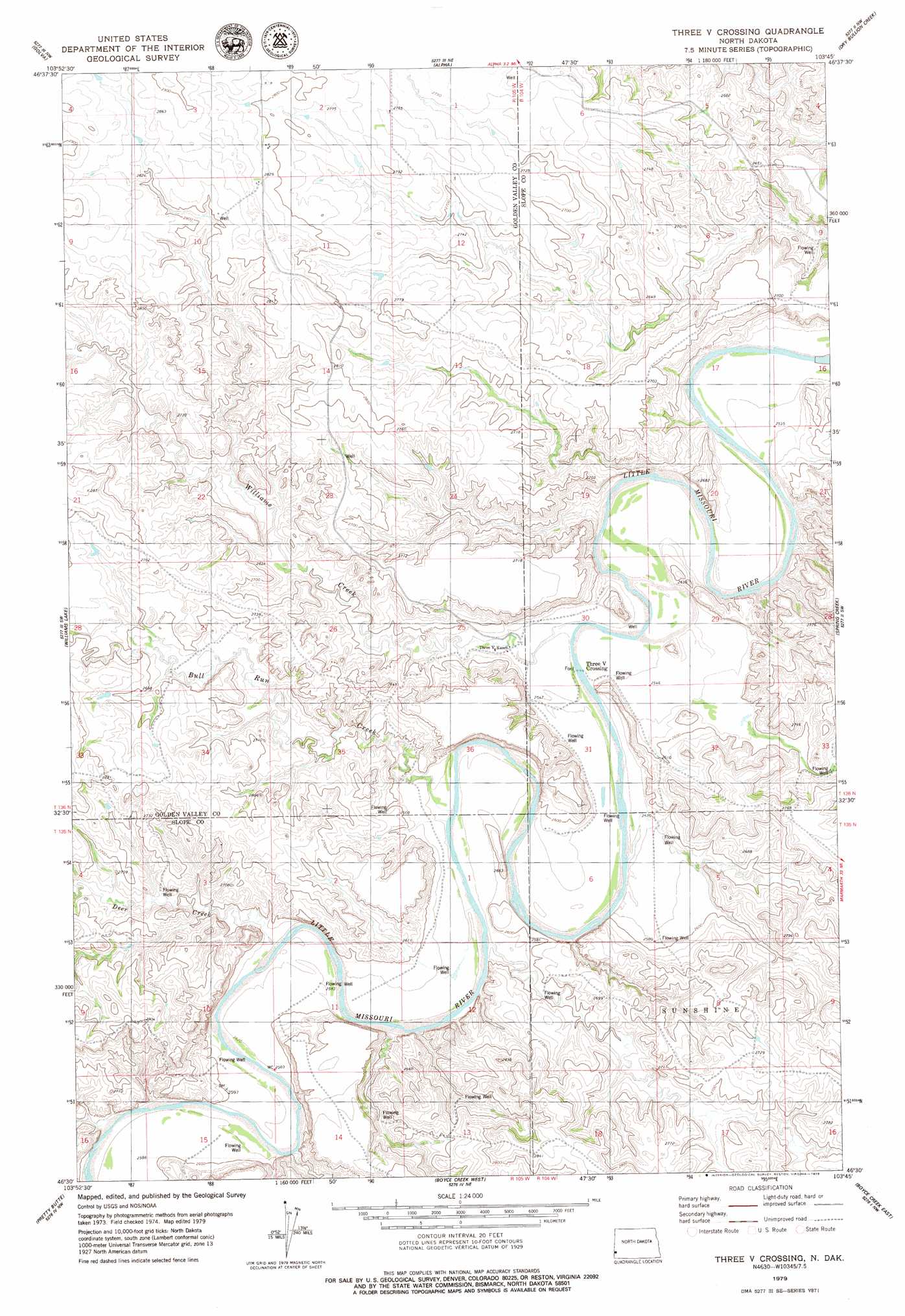
USGS Topo Quad 46103e7 - 1:24,000 scale
| Topo Map Name: | Three V Crossing |
| USGS Topo Quad ID: | 46103e7 |
| Print Size: | ca. 21 1/4" wide x 27" high |
| Southeast Coordinates: | 46.5° N latitude / 103.75° W longitude |
| Map Center Coordinates: | 46.5625° N latitude / 103.8125° W longitude |
| U.S. State: | ND |
| Filename: | O46103E7.jpg |
| Download Map JPG Image: | Three V Crossing topo map 1:24,000 scale |
| Map Type: | Topographic |
| Topo Series: | 7.5´ |
| Map Scale: | 1:24,000 |
| Source of Map Images: | United States Geological Survey (USGS) |
| Alternate Map Versions: |
Three V Crossing ND 1979, updated 1979 Download PDF Buy paper map Three V Crossing ND 1997, updated 2001 Download PDF Buy paper map Three V Crossing ND 2011 Download PDF Buy paper map Three V Crossing ND 2014 Download PDF Buy paper map |
| FStopo: | US Forest Service topo Three V Crossing is available: Download FStopo PDF Download FStopo TIF |
1:24,000 Topo Quads surrounding Three V Crossing
Duck Creek |
Thelan |
Sentinel Butte Se |
Square Butte |
Chimney Butte |
Carlyle |
Golva |
Alpha |
Dry Bullion Creek |
Bullion Butte |
Ollie |
Williams Lake |
Three V Crossing |
Spring Creek |
Deep Creek North |
Badland Draw |
Pretty Butte |
Boyce Creek West |
Boyce Creek East |
Deep Creek South |
Waterhole Creek |
Marmarth |
Marmarth Se |
Ives |
West Fork Deep Creek |
> Back to 46103e1 at 1:100,000 scale
> Back to 46102a1 at 1:250,000 scale
> Back to U.S. Topo Maps home
Three V Crossing topo map: Gazetteer
Three V Crossing: Populated Places
Three V Crossing elevation 770m 2526′Three V Crossing: Streams
Bull Run Creek elevation 776m 2545′Bull Run Creek elevation 776m 2545′
Deer Creek elevation 781m 2562′
Williams Creek elevation 770m 2526′
Three V Crossing digital topo map on disk
Buy this Three V Crossing topo map showing relief, roads, GPS coordinates and other geographical features, as a high-resolution digital map file on DVD:
Eastern Montana & Western North Dakota
Buy digital topo maps: Eastern Montana & Western North Dakota