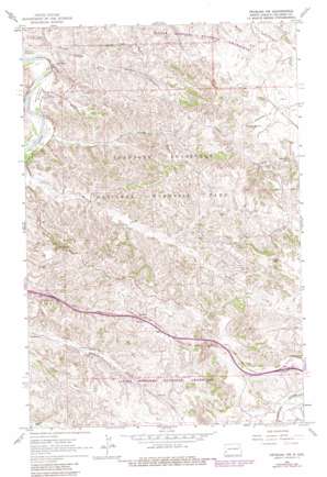
Fryburg Nw Topo Map North Dakota
To zoom in, hover over the map of Fryburg Nw
USGS Topo Quad 46103h4 - 1:24,000 scale
| Topo Map Name: | Fryburg Nw |
| USGS Topo Quad ID: | 46103h4 |
| Print Size: | ca. 21 1/4" wide x 27" high |
| Southeast Coordinates: | 46.875° N latitude / 103.375° W longitude |
| Map Center Coordinates: | 46.9375° N latitude / 103.4375° W longitude |
| U.S. State: | ND |
| Filename: | O46103H4.jpg |
| Download Map JPG Image: | Fryburg Nw topo map 1:24,000 scale |
| Map Type: | Topographic |
| Topo Series: | 7.5´ |
| Map Scale: | 1:24,000 |
| Source of Map Images: | United States Geological Survey (USGS) |
| Alternate Map Versions: |
Fryburg NW ND 1962, updated 1964 Download PDF Buy paper map Fryburg NW ND 1962, updated 1981 Download PDF Buy paper map Fryburg NW ND 1997, updated 2001 Download PDF Buy paper map Fryburg NW ND 2011 Download PDF Buy paper map Fryburg NW ND 2014 Download PDF Buy paper map |
| FStopo: | US Forest Service topo Fryburg NW is available: Download FStopo PDF Download FStopo TIF |
1:24,000 Topo Quads surrounding Fryburg Nw
> Back to 46103e1 at 1:100,000 scale
> Back to 46102a1 at 1:250,000 scale
> Back to U.S. Topo Maps home
Fryburg Nw topo map: Gazetteer
Fryburg Nw: Bends
Beef Corral Bottom elevation 686m 2250′Fryburg Nw: Parks
Theodore Roosevelt National Memorial Park elevation 771m 2529′Fryburg Nw: Populated Places
Scoria Point elevation 781m 2562′Fryburg Nw: Springs
Boicourt Spring elevation 801m 2627′Sheep Butte Spring elevation 806m 2644′
Fryburg Nw: Streams
Beef Corral Wash elevation 683m 2240′Jones Creek elevation 683m 2240′
Jules Creek elevation 680m 2230′
Paddock Creek elevation 683m 2240′
Fryburg Nw: Summits
Buck Hill elevation 869m 2851′Fryburg Nw: Valleys
Painted Canyon elevation 751m 2463′Peaceful Valley elevation 683m 2240′
Fryburg Nw: Wells
Halliday Flowing Well elevation 689m 2260′Mike Auney Flowing Well elevation 685m 2247′
Fryburg Nw digital topo map on disk
Buy this Fryburg Nw topo map showing relief, roads, GPS coordinates and other geographical features, as a high-resolution digital map file on DVD:
Eastern Montana & Western North Dakota
Buy digital topo maps: Eastern Montana & Western North Dakota


