Piney Butte Sw Topo Map Montana
To zoom in, hover over the map of Piney Butte Sw
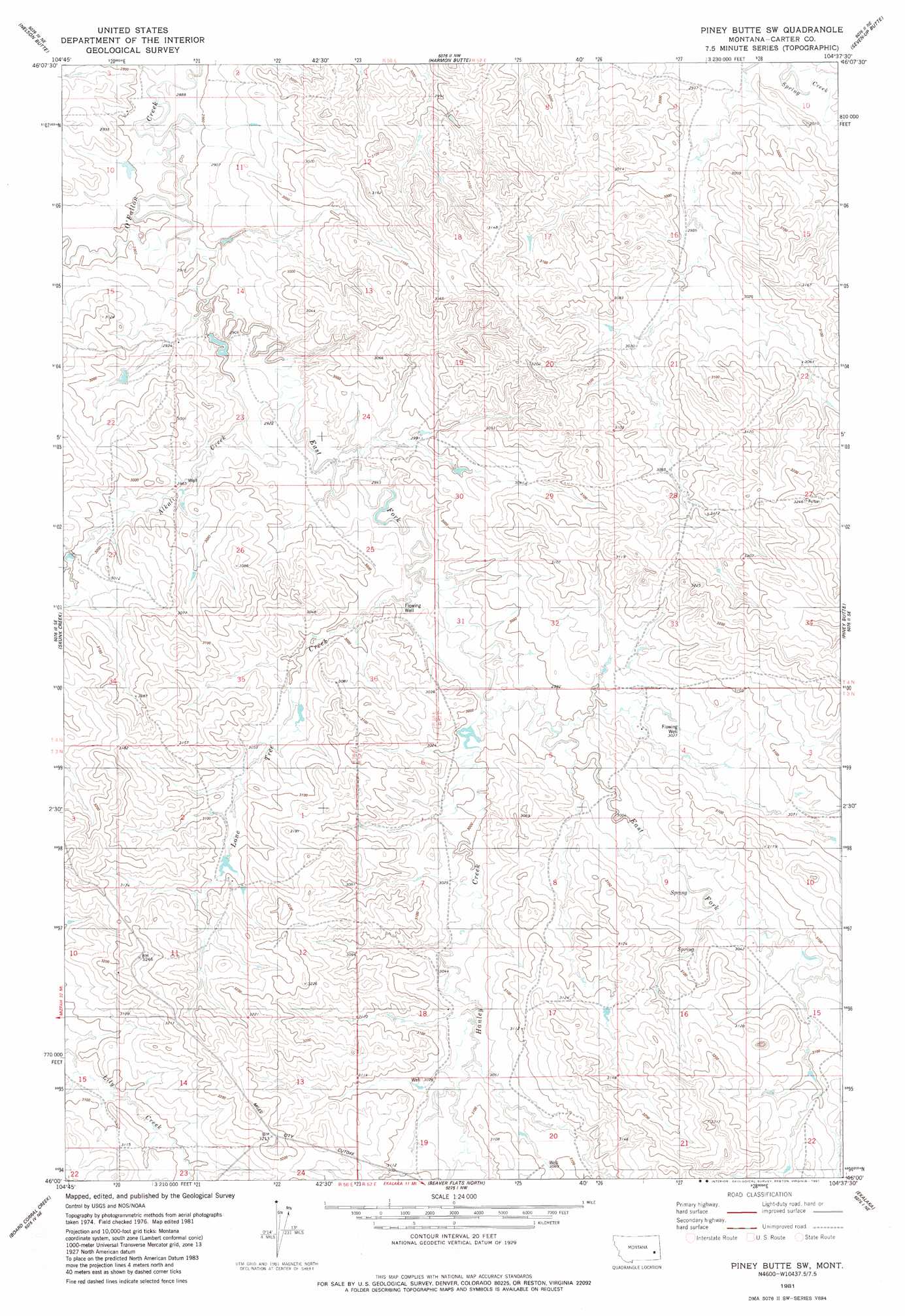
USGS Topo Quad 46104a6 - 1:24,000 scale
| Topo Map Name: | Piney Butte Sw |
| USGS Topo Quad ID: | 46104a6 |
| Print Size: | ca. 21 1/4" wide x 27" high |
| Southeast Coordinates: | 46° N latitude / 104.625° W longitude |
| Map Center Coordinates: | 46.0625° N latitude / 104.6875° W longitude |
| U.S. State: | MT |
| Filename: | o46104a6.jpg |
| Download Map JPG Image: | Piney Butte Sw topo map 1:24,000 scale |
| Map Type: | Topographic |
| Topo Series: | 7.5´ |
| Map Scale: | 1:24,000 |
| Source of Map Images: | United States Geological Survey (USGS) |
| Alternate Map Versions: |
Piney Butte SW MT 1981, updated 1981 Download PDF Buy paper map Piney Butte SW MT 2011 Download PDF Buy paper map Piney Butte SW MT 2014 Download PDF Buy paper map |
1:24,000 Topo Quads surrounding Piney Butte Sw
Foundation Spring |
Bracket Butte Se |
T G Creek |
Little Pine Creek |
South Sandstone Reservoir |
Hooky Dam |
Nelson Butte |
Harmon Butte |
Seven-Up Butte |
Sportsman Pond |
North Fork Alkali Creek |
Skunk Creek |
Piney Butte Sw |
Piney Butte |
Medicine Rocks State Park |
Blacktail Creek Nw |
Board Corral Creek |
Beaver Flats North |
Ekalaka |
Terrell Creek |
Blacktail Creek Sw |
Blacktail Creek Se |
Beaver Flats South |
Stagville Draw |
Camp Needmore |
> Back to 46104a1 at 1:100,000 scale
> Back to 46104a1 at 1:250,000 scale
> Back to U.S. Topo Maps home
Piney Butte Sw topo map: Gazetteer
Piney Butte Sw: Populated Places
Chausse (historical) elevation 930m 3051′Piney Butte Sw: Post Offices
Chausse Post Office (historical) elevation 930m 3051′Piney Butte Sw: Streams
Alkali Creek elevation 882m 2893′East Fork O'Fallon Creek elevation 885m 2903′
Hanley Creek elevation 912m 2992′
Lone Tree Creek elevation 896m 2939′
Piney Butte Sw: Wells
03N56E02DDCA01 Well elevation 938m 3077′03N56E10BDCA01 Well elevation 947m 3106′
03N57E06DCCD01 Well elevation 933m 3061′
04N56E08ABB_01 Well elevation 887m 2910′
04N56E09DBDB01 Well elevation 919m 3015′
04N56E10ACC_01 Well elevation 950m 3116′
04N56E14CCCB01 Well elevation 895m 2936′
04N56E16CAD_01 Well elevation 915m 3001′
04N56E23CC__01 Well elevation 925m 3034′
04N56E25DDCC01 Well elevation 977m 3205′
04N56E32BCDC01 Well elevation 951m 3120′
04N57E22BDDD01 Well elevation 929m 3047′
Piney Butte Sw digital topo map on disk
Buy this Piney Butte Sw topo map showing relief, roads, GPS coordinates and other geographical features, as a high-resolution digital map file on DVD:
Eastern Montana & Western North Dakota
Buy digital topo maps: Eastern Montana & Western North Dakota