Bracket Butte Topo Map Montana
To zoom in, hover over the map of Bracket Butte
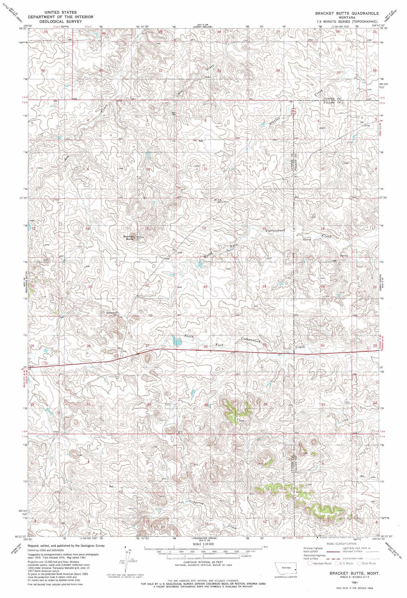
USGS Topo Quad 46104d8 - 1:24,000 scale
| Topo Map Name: | Bracket Butte |
| USGS Topo Quad ID: | 46104d8 |
| Print Size: | ca. 21 1/4" wide x 27" high |
| Southeast Coordinates: | 46.375° N latitude / 104.875° W longitude |
| Map Center Coordinates: | 46.4375° N latitude / 104.9375° W longitude |
| U.S. State: | MT |
| Filename: | o46104d8.jpg |
| Download Map JPG Image: | Bracket Butte topo map 1:24,000 scale |
| Map Type: | Topographic |
| Topo Series: | 7.5´ |
| Map Scale: | 1:24,000 |
| Source of Map Images: | United States Geological Survey (USGS) |
| Alternate Map Versions: |
Bracket Butte MT 1981, updated 1981 Download PDF Buy paper map Bracket Butte MT 2011 Download PDF Buy paper map Bracket Butte MT 2014 Download PDF Buy paper map |
1:24,000 Topo Quads surrounding Bracket Butte
Flat Top Butte |
Flat Top Butte Ne |
Mildred |
Mildred Ne |
Dorothy Draw |
Flat Top Butte Sw |
Little Whitney Creek |
Loony Hollow |
Ismay North |
Ayer Spring |
Hogan Creek |
Montague Butte |
Bracket Butte |
Ismay South |
Westmore |
Red Knob |
Knowlton |
Foundation Spring |
Bracket Butte Se |
T G Creek |
Pennock Creek |
Tepee Butte Ne |
Hooky Dam |
Nelson Butte |
Harmon Butte |
> Back to 46104a1 at 1:100,000 scale
> Back to 46104a1 at 1:250,000 scale
> Back to U.S. Topo Maps home
Bracket Butte topo map: Gazetteer
Bracket Butte: Dams
Gray Number 3 Dam elevation 881m 2890′Bracket Butte: Summits
Bracket Butte elevation 978m 3208′Bracket Butte: Wells
06N54E12BC__01 Well elevation 874m 2867′07N54E04CCAC01 Well elevation 947m 3106′
07N54E28A___01 Well elevation 982m 3221′
07N55E05CA__01 Well elevation 901m 2956′
08N54E11BA__01 Well elevation 904m 2965′
08N54E15DD__01 Well elevation 918m 3011′
08N54E17A___01 Well elevation 940m 3083′
08N54E20DD__01 Well elevation 946m 3103′
08N54E21BAA_01 Well elevation 935m 3067′
08N54E21CCCC01 Well elevation 943m 3093′
08N54E21CCCC02 Well elevation 946m 3103′
08N54E22ABAA01 Well elevation 919m 3015′
08N54E29AD__01 Well elevation 924m 3031′
08N54E34ADAC01 Well elevation 930m 3051′
08N54E34CD__01 Well elevation 952m 3123′
08N54E36CDBA01 Well elevation 948m 3110′
08N55E06DA__01 Well elevation 859m 2818′
08N55E06DA__02 Well elevation 859m 2818′
08N55E07AA__01 Well elevation 845m 2772′
08N55E32DAAA01 Well elevation 941m 3087′
McKee Well elevation 915m 3001′
Bracket Butte digital topo map on disk
Buy this Bracket Butte topo map showing relief, roads, GPS coordinates and other geographical features, as a high-resolution digital map file on DVD:
Eastern Montana & Western North Dakota
Buy digital topo maps: Eastern Montana & Western North Dakota