Ollie Topo Map Montana
To zoom in, hover over the map of Ollie
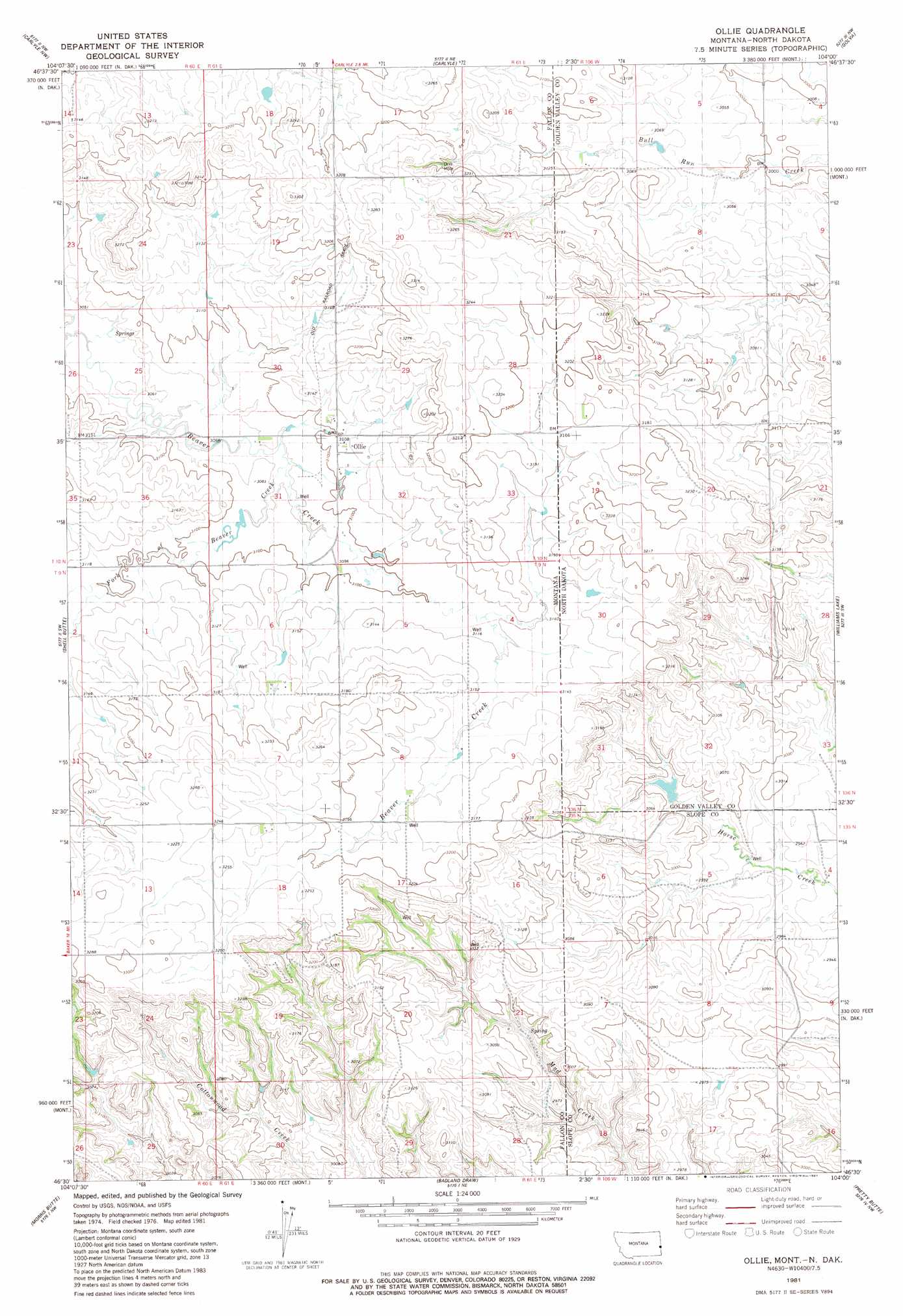
USGS Topo Quad 46104e1 - 1:24,000 scale
| Topo Map Name: | Ollie |
| USGS Topo Quad ID: | 46104e1 |
| Print Size: | ca. 21 1/4" wide x 27" high |
| Southeast Coordinates: | 46.5° N latitude / 104° W longitude |
| Map Center Coordinates: | 46.5625° N latitude / 104.0625° W longitude |
| U.S. States: | MT, ND |
| Filename: | o46104e1.jpg |
| Download Map JPG Image: | Ollie topo map 1:24,000 scale |
| Map Type: | Topographic |
| Topo Series: | 7.5´ |
| Map Scale: | 1:24,000 |
| Source of Map Images: | United States Geological Survey (USGS) |
| Alternate Map Versions: |
Ollie MT 1981, updated 1981 Download PDF Buy paper map Ollie MT 1997, updated 2001 Download PDF Buy paper map Ollie MT 2011 Download PDF Buy paper map Ollie MT 2014 Download PDF Buy paper map |
| FStopo: | US Forest Service topo Ollie is available: Download FStopo PDF Download FStopo TIF |
1:24,000 Topo Quads surrounding Ollie
Hodges Se |
Red Top Butte |
Duck Creek |
Thelan |
Sentinel Butte Se |
Cap Rock |
Carlyle Nw |
Carlyle |
Golva |
Alpha |
Rush Hall Reservoir |
Shell Butte |
Ollie |
Williams Lake |
Three V Crossing |
Baker Ne |
Morris Butte |
Badland Draw |
Pretty Butte |
Boyce Creek West |
Baker |
Buffalo Reservoir |
Waterhole Creek |
Marmarth |
Marmarth Se |
> Back to 46104e1 at 1:100,000 scale
> Back to 46104a1 at 1:250,000 scale
> Back to U.S. Topo Maps home
Ollie topo map: Gazetteer
Ollie: Areas
Hat Creek Breaks elevation 976m 3202′Ollie: Populated Places
Ollie elevation 945m 3100′Ollie: Post Offices
Ollie Post Office (historical) elevation 945m 3100′Ollie: Streams
Fork of Beaver Creek elevation 939m 3080′Ollie: Wells
10N61E31DA__01 Well elevation 940m 3083′Ollie digital topo map on disk
Buy this Ollie topo map showing relief, roads, GPS coordinates and other geographical features, as a high-resolution digital map file on DVD:
Eastern Montana & Western North Dakota
Buy digital topo maps: Eastern Montana & Western North Dakota