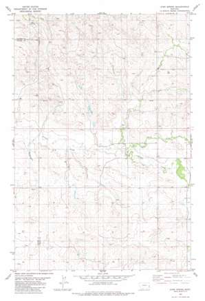
Ayer Spring Topo Map Montana
To zoom in, hover over the map of Ayer Spring
USGS Topo Quad 46104e6 - 1:24,000 scale
| Topo Map Name: | Ayer Spring |
| USGS Topo Quad ID: | 46104e6 |
| Print Size: | ca. 21 1/4" wide x 27" high |
| Southeast Coordinates: | 46.5° N latitude / 104.625° W longitude |
| Map Center Coordinates: | 46.5625° N latitude / 104.6875° W longitude |
| U.S. State: | MT |
| Filename: | o46104e6.jpg |
| Download Map JPG Image: | Ayer Spring topo map 1:24,000 scale |
| Map Type: | Topographic |
| Topo Series: | 7.5´ |
| Map Scale: | 1:24,000 |
| Source of Map Images: | United States Geological Survey (USGS) |
| Alternate Map Versions: |
Ayer Spring MT 1981, updated 1981 Download PDF Buy paper map Ayer Spring MT 2011 Download PDF Buy paper map Ayer Spring MT 2014 Download PDF Buy paper map |
1:24,000 Topo Quads surrounding Ayer Spring
> Back to 46104e1 at 1:100,000 scale
> Back to 46104a1 at 1:250,000 scale
> Back to U.S. Topo Maps home
Ayer Spring topo map: Gazetteer
Ayer Spring: Streams
Dry Fork Creek elevation 789m 2588′Ayer Spring: Wells
09N56E01CBAB01 Well elevation 815m 2673′09N56E03CBAC01 Well elevation 823m 2700′
09N56E05AABA01 Well elevation 804m 2637′
09N56E07AAAD01 Well elevation 784m 2572′
09N56E11BBCD01 Well elevation 798m 2618′
09N56E14AACB01 Well elevation 811m 2660′
10N56E18BC__01 Well elevation 850m 2788′
10N56E20DA__01 Well elevation 848m 2782′
10N56E26BA__01 Well elevation 843m 2765′
Ayer Spring digital topo map on disk
Buy this Ayer Spring topo map showing relief, roads, GPS coordinates and other geographical features, as a high-resolution digital map file on DVD:
Eastern Montana & Western North Dakota
Buy digital topo maps: Eastern Montana & Western North Dakota


