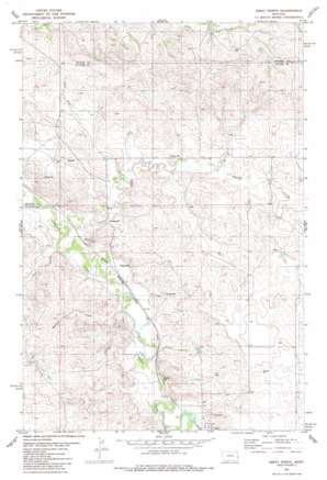
Ismay North Topo Map Montana
To zoom in, hover over the map of Ismay North
USGS Topo Quad 46104e7 - 1:24,000 scale
| Topo Map Name: | Ismay North |
| USGS Topo Quad ID: | 46104e7 |
| Print Size: | ca. 21 1/4" wide x 27" high |
| Southeast Coordinates: | 46.5° N latitude / 104.75° W longitude |
| Map Center Coordinates: | 46.5625° N latitude / 104.8125° W longitude |
| U.S. State: | MT |
| Filename: | o46104e7.jpg |
| Download Map JPG Image: | Ismay North topo map 1:24,000 scale |
| Map Type: | Topographic |
| Topo Series: | 7.5´ |
| Map Scale: | 1:24,000 |
| Source of Map Images: | United States Geological Survey (USGS) |
| Alternate Map Versions: |
Ismay North MT 1981, updated 1981 Download PDF Buy paper map Ismay North MT 2011 Download PDF Buy paper map Ismay North MT 2014 Download PDF Buy paper map |
1:24,000 Topo Quads surrounding Ismay North
> Back to 46104e1 at 1:100,000 scale
> Back to 46104a1 at 1:250,000 scale
> Back to U.S. Topo Maps home
Ismay North topo map: Gazetteer
Ismay North: Post Offices
Ismay Post Office elevation 773m 2536′Ismay North: Streams
Ash Creek elevation 755m 2477′Lone Tree Creek elevation 763m 2503′
Malone Creek elevation 762m 2500′
Pennel Creek elevation 750m 2460′
Ismay North: Wells
09N54E24BD__01 Well elevation 832m 2729′09N55E02DDCD01 Well elevation 799m 2621′
09N55E03AADC01 Well elevation 788m 2585′
09N55E05BC__01 Well elevation 766m 2513′
09N55E09BD__01 Well elevation 803m 2634′
09N55E17C___01 Well elevation 792m 2598′
09N55E17DB__01 Well elevation 761m 2496′
09N55E21CBDB01 Well elevation 764m 2506′
09N55E22DDCD01 Well elevation 792m 2598′
09N55E27BB__01 Well elevation 784m 2572′
09N55E27CA__01 Well elevation 787m 2582′
09N55E27CA__02 Well elevation 787m 2582′
09N55E27CCAA01 Well elevation 776m 2545′
09N55E28BB__01 Well elevation 764m 2506′
10N55E23AA__01 Well elevation 835m 2739′
10N55E28DCCC01 Well elevation 775m 2542′
10N55E32BDCD01 Well elevation 767m 2516′
10N55E33A___01 Well elevation 768m 2519′
10N55E33AD__01 Well elevation 786m 2578′
10N55E33BDDA01 Well elevation 770m 2526′
10N55E34DBBA01 Well elevation 774m 2539′
10N55E35BDBD01 Well elevation 789m 2588′
Ismay North digital topo map on disk
Buy this Ismay North topo map showing relief, roads, GPS coordinates and other geographical features, as a high-resolution digital map file on DVD:
Eastern Montana & Western North Dakota
Buy digital topo maps: Eastern Montana & Western North Dakota


