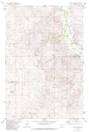
Loony Hollow Topo Map Montana
To zoom in, hover over the map of Loony Hollow
USGS Topo Quad 46104e8 - 1:24,000 scale
| Topo Map Name: | Loony Hollow |
| USGS Topo Quad ID: | 46104e8 |
| Print Size: | ca. 21 1/4" wide x 27" high |
| Southeast Coordinates: | 46.5° N latitude / 104.875° W longitude |
| Map Center Coordinates: | 46.5625° N latitude / 104.9375° W longitude |
| U.S. State: | MT |
| Filename: | o46104e8.jpg |
| Download Map JPG Image: | Loony Hollow topo map 1:24,000 scale |
| Map Type: | Topographic |
| Topo Series: | 7.5´ |
| Map Scale: | 1:24,000 |
| Source of Map Images: | United States Geological Survey (USGS) |
| Alternate Map Versions: |
Loony Hollow MT 1981, updated 1981 Download PDF Buy paper map Loony Hollow MT 2011 Download PDF Buy paper map Loony Hollow MT 2014 Download PDF Buy paper map |
1:24,000 Topo Quads surrounding Loony Hollow
> Back to 46104e1 at 1:100,000 scale
> Back to 46104a1 at 1:250,000 scale
> Back to U.S. Topo Maps home
Loony Hollow topo map: Gazetteer
Loony Hollow: Dams
Gray Number 1 Dam elevation 836m 2742′Marshall Dam elevation 785m 2575′
Loony Hollow: Reservoirs
Archdale Reservoir elevation 788m 2585′Horse Reservoir elevation 839m 2752′
Loony Hollow: Streams
Dry Creek elevation 820m 2690′Loony Hollow: Valleys
Loony Hollow elevation 746m 2447′Loony Hollow: Wells
09N54E29DA__01 Well elevation 853m 2798′10N54E19AC__01 Well elevation 806m 2644′
10N54E22DDCB01 Well elevation 749m 2457′
10N54E29DACB01 Well elevation 829m 2719′
10N54E30ADDB01 Well elevation 803m 2634′
Loony Hollow digital topo map on disk
Buy this Loony Hollow topo map showing relief, roads, GPS coordinates and other geographical features, as a high-resolution digital map file on DVD:
Eastern Montana & Western North Dakota
Buy digital topo maps: Eastern Montana & Western North Dakota


