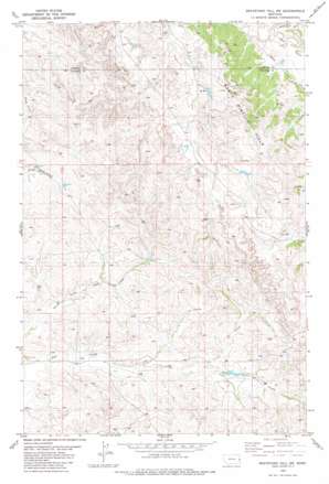
Graveyard Hill Sw Topo Map Montana
To zoom in, hover over the map of Graveyard Hill Sw
USGS Topo Quad 46104g6 - 1:24,000 scale
| Topo Map Name: | Graveyard Hill Sw |
| USGS Topo Quad ID: | 46104g6 |
| Print Size: | ca. 21 1/4" wide x 27" high |
| Southeast Coordinates: | 46.75° N latitude / 104.625° W longitude |
| Map Center Coordinates: | 46.8125° N latitude / 104.6875° W longitude |
| U.S. State: | MT |
| Filename: | o46104g6.jpg |
| Download Map JPG Image: | Graveyard Hill Sw topo map 1:24,000 scale |
| Map Type: | Topographic |
| Topo Series: | 7.5´ |
| Map Scale: | 1:24,000 |
| Source of Map Images: | United States Geological Survey (USGS) |
| Alternate Map Versions: |
Graveyard Hill SW MT 1982, updated 1982 Download PDF Buy paper map Graveyard Hill SW MT 2011 Download PDF Buy paper map Graveyard Hill SW MT 2014 Download PDF Buy paper map |
1:24,000 Topo Quads surrounding Graveyard Hill Sw
> Back to 46104e1 at 1:100,000 scale
> Back to 46104a1 at 1:250,000 scale
> Back to U.S. Topo Maps home
Graveyard Hill Sw topo map: Gazetteer
Graveyard Hill Sw: Streams
Judith Branch Ash Creek elevation 793m 2601′Labelle Ditch elevation 696m 2283′
Little Fork Ash Creek elevation 735m 2411′
Graveyard Hill Sw: Wells
10N55E25CDCD01 Well elevation 748m 2454′12N55E12DB__01 Well elevation 769m 2522′
12N55E13DC__01 Well elevation 751m 2463′
12N55E19CDCD01 Well elevation 745m 2444′
12N55E24CDDD01 Well elevation 737m 2417′
12N55E25CDCC01 Well elevation 752m 2467′
12N55E25DD__01 Well elevation 774m 2539′
12N56E02CC__01 Well elevation 781m 2562′
12N56E10ACDA01 Well elevation 806m 2644′
12N56E18CD__01 Well elevation 778m 2552′
12N56E19CD__01 Well elevation 750m 2460′
12N56E23CCDA01 Well elevation 808m 2650′
12N56E23DCCA01 Well elevation 832m 2729′
12N56E26AB__01 Well elevation 813m 2667′
12N56E26DB__01 Well elevation 806m 2644′
12N56E29AC__01 Well elevation 761m 2496′
12N56E30CD__01 Well elevation 780m 2559′
13N55E22BD__01 Well elevation 746m 2447′
13N55E23ADC_01 Well elevation 768m 2519′
13N55E25DA__01 Well elevation 742m 2434′
Graveyard Hill Sw digital topo map on disk
Buy this Graveyard Hill Sw topo map showing relief, roads, GPS coordinates and other geographical features, as a high-resolution digital map file on DVD:
Eastern Montana & Western North Dakota
Buy digital topo maps: Eastern Montana & Western North Dakota


