Jack Creek Topo Map Montana
To zoom in, hover over the map of Jack Creek
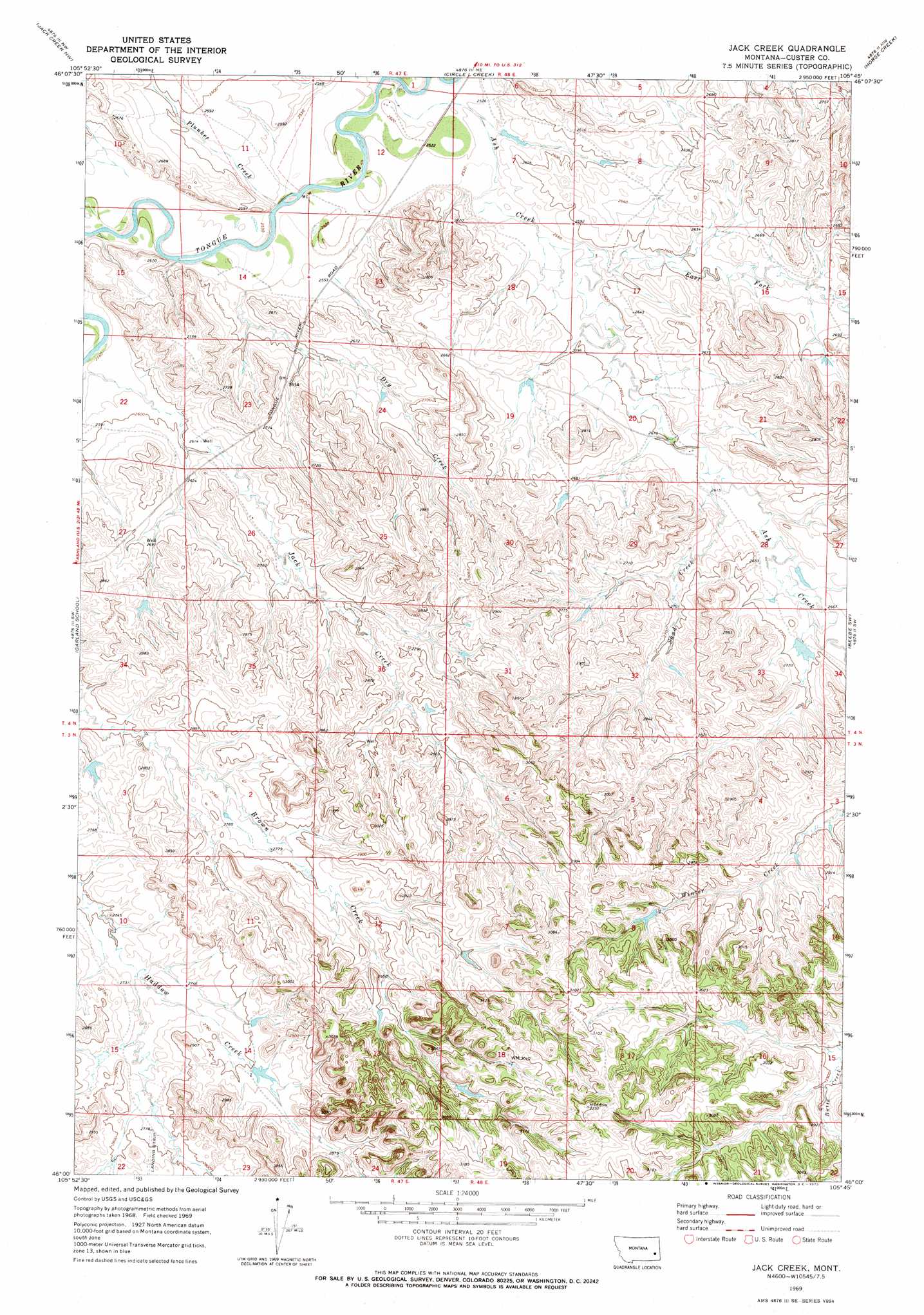
USGS Topo Quad 46105a7 - 1:24,000 scale
| Topo Map Name: | Jack Creek |
| USGS Topo Quad ID: | 46105a7 |
| Print Size: | ca. 21 1/4" wide x 27" high |
| Southeast Coordinates: | 46° N latitude / 105.75° W longitude |
| Map Center Coordinates: | 46.0625° N latitude / 105.8125° W longitude |
| U.S. State: | MT |
| Filename: | o46105a7.jpg |
| Download Map JPG Image: | Jack Creek topo map 1:24,000 scale |
| Map Type: | Topographic |
| Topo Series: | 7.5´ |
| Map Scale: | 1:24,000 |
| Source of Map Images: | United States Geological Survey (USGS) |
| Alternate Map Versions: |
Jack Creek MT 1969, updated 1973 Download PDF Buy paper map Jack Creek MT 2011 Download PDF Buy paper map Jack Creek MT 2014 Download PDF Buy paper map |
1:24,000 Topo Quads surrounding Jack Creek
Horton |
Lignite Creek |
Paddy Fay Creek |
Whitney Creek |
Government Hill Se |
Moon Creek School |
Jack Creek Nw |
Circle L Creek |
Horse Creek |
First Creek |
Miller Creek |
Garland School |
Jack Creek |
Beebe Sw |
Beebe |
H S School |
Fourmile Creek |
Carey-Malone School |
Kirkpatrick Hill |
Harris Buttes |
Hayes Point |
North Stacey School |
Foster Creek School |
Volborg |
Divide School |
> Back to 46105a1 at 1:100,000 scale
> Back to 46104a1 at 1:250,000 scale
> Back to U.S. Topo Maps home
Jack Creek topo map: Gazetteer
Jack Creek: Dams
Christensen Number 8 Dam elevation 887m 2910′Failings Number 5 Dam elevation 819m 2687′
Fortune Number 3 Dam elevation 857m 2811′
Fortune Number 5 Dam elevation 839m 2752′
Powell Number 2 Dam elevation 824m 2703′
Jack Creek: Streams
Ash Creek elevation 763m 2503′Dry Creek elevation 771m 2529′
East Fork Ash Creek elevation 777m 2549′
Plunket Creek elevation 766m 2513′
Sand Creek elevation 792m 2598′
Jack Creek: Wells
03N48E18DBBB01 Well elevation 934m 3064′04N47E23CCAB01 Well elevation 794m 2604′
04N48E20DBBC01 Well elevation 791m 2595′
Jack Creek digital topo map on disk
Buy this Jack Creek topo map showing relief, roads, GPS coordinates and other geographical features, as a high-resolution digital map file on DVD:
Eastern Montana & Western North Dakota
Buy digital topo maps: Eastern Montana & Western North Dakota