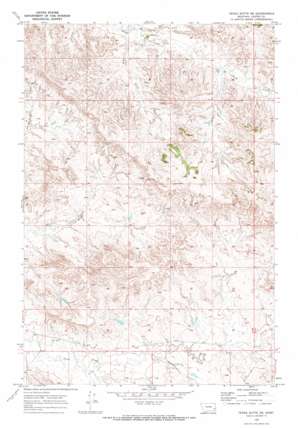
Tepee Butte Ne Topo Map Montana
To zoom in, hover over the map of Tepee Butte Ne
USGS Topo Quad 46105b1 - 1:24,000 scale
| Topo Map Name: | Tepee Butte Ne |
| USGS Topo Quad ID: | 46105b1 |
| Print Size: | ca. 21 1/4" wide x 27" high |
| Southeast Coordinates: | 46.125° N latitude / 105° W longitude |
| Map Center Coordinates: | 46.1875° N latitude / 105.0625° W longitude |
| U.S. State: | MT |
| Filename: | o46105b1.jpg |
| Download Map JPG Image: | Tepee Butte Ne topo map 1:24,000 scale |
| Map Type: | Topographic |
| Topo Series: | 7.5´ |
| Map Scale: | 1:24,000 |
| Source of Map Images: | United States Geological Survey (USGS) |
| Alternate Map Versions: |
Tepee Butte NE MT 1969, updated 1973 Download PDF Buy paper map Tepee Butte NE MT 2011 Download PDF Buy paper map Tepee Butte NE MT 2014 Download PDF Buy paper map |
1:24,000 Topo Quads surrounding Tepee Butte Ne
> Back to 46105a1 at 1:100,000 scale
> Back to 46104a1 at 1:250,000 scale
> Back to U.S. Topo Maps home
Tepee Butte Ne topo map: Gazetteer
Tepee Butte Ne: Dams
Balsam Number 3 Dam elevation 856m 2808′Tepee Butte Ne: Streams
Lone Tree Creek elevation 836m 2742′North Fork Sheep Creek elevation 842m 2762′
South Fork Sheep Creek elevation 841m 2759′
Straight Creek elevation 818m 2683′
Tepee Butte Ne: Valleys
Foundation Draw elevation 864m 2834′Tepee Butte Ne: Wells
04N53E01BB__01 Well elevation 826m 2709′04N53E01BCAD01 Well elevation 817m 2680′
04N53E02BBB_01 Well elevation 804m 2637′
04N53E02BBDC01 Well elevation 806m 2644′
05N53E17DAAA01 Well elevation 830m 2723′
05N53E19AACB01 Well elevation 816m 2677′
05N53E19BACA01 Well elevation 809m 2654′
05N53E25BACC01 Well elevation 849m 2785′
05N53E33ADAA01 Well elevation 843m 2765′
05N53E35CCBD01 Well elevation 830m 2723′
05N54E32CCC_01 Well elevation 842m 2762′
06N53E33AAAA01 Well elevation 858m 2814′
06N53E35AAAA01 Well elevation 859m 2818′
Tepee Butte Ne digital topo map on disk
Buy this Tepee Butte Ne topo map showing relief, roads, GPS coordinates and other geographical features, as a high-resolution digital map file on DVD:
Eastern Montana & Western North Dakota
Buy digital topo maps: Eastern Montana & Western North Dakota


