Knowlton Topo Map Montana
To zoom in, hover over the map of Knowlton
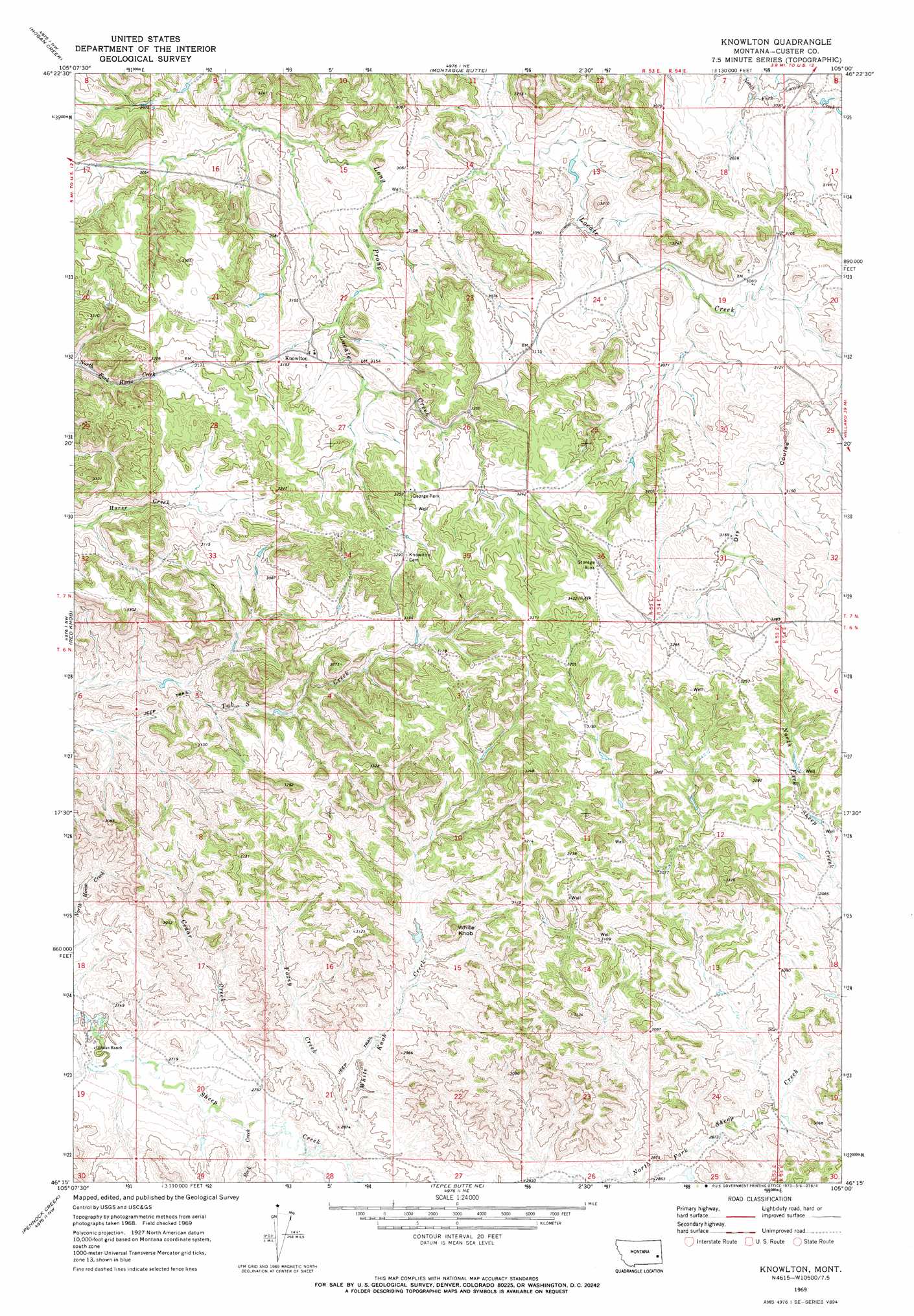
USGS Topo Quad 46105c1 - 1:24,000 scale
| Topo Map Name: | Knowlton |
| USGS Topo Quad ID: | 46105c1 |
| Print Size: | ca. 21 1/4" wide x 27" high |
| Southeast Coordinates: | 46.25° N latitude / 105° W longitude |
| Map Center Coordinates: | 46.3125° N latitude / 105.0625° W longitude |
| U.S. State: | MT |
| Filename: | o46105c1.jpg |
| Download Map JPG Image: | Knowlton topo map 1:24,000 scale |
| Map Type: | Topographic |
| Topo Series: | 7.5´ |
| Map Scale: | 1:24,000 |
| Source of Map Images: | United States Geological Survey (USGS) |
| Alternate Map Versions: |
Knowlton MT 1969, updated 1973 Download PDF Buy paper map Knowlton MT 2011 Download PDF Buy paper map Knowlton MT 2014 Download PDF Buy paper map |
1:24,000 Topo Quads surrounding Knowlton
Spring Draw |
Flat Top Butte Sw |
Little Whitney Creek |
Loony Hollow |
Ismay North |
Locate |
Hogan Creek |
Montague Butte |
Bracket Butte |
Ismay South |
Locate Se |
Red Knob |
Knowlton |
Foundation Spring |
Bracket Butte Se |
Mizpah |
Pennock Creek |
Tepee Butte Ne |
Hooky Dam |
Nelson Butte |
Forty Creek |
Bear Jaw Creek |
Tepee Butte |
North Fork Alkali Creek |
Skunk Creek |
> Back to 46105a1 at 1:100,000 scale
> Back to 46104a1 at 1:250,000 scale
> Back to U.S. Topo Maps home
Knowlton topo map: Gazetteer
Knowlton: Parks
George Park elevation 996m 3267′Knowlton: Populated Places
Knowlton elevation 952m 3123′Knowlton: Post Offices
Knowlton Post Office (historical) elevation 950m 3116′Knowlton: Streams
Cedar Creek elevation 826m 2709′Foxey Creek elevation 847m 2778′
Rock Creek elevation 831m 2726′
White Knob Creek elevation 845m 2772′
Knowlton: Summits
White Knob elevation 943m 3093′Knowlton: Valleys
Dry Coulee elevation 936m 3070′Knowlton: Wells
06N53E19AA__01 Well elevation 826m 2709′07N53E16DBAD01 Well elevation 914m 2998′
07N53E16DBDA01 Well elevation 920m 3018′
07N53E16DBDA02 Well elevation 920m 3018′
07N53E23DDCA01 Well elevation 946m 3103′
07N53E23DDCD01 Well elevation 951m 3120′
07N53E26CC__01 Well elevation 986m 3234′
07N53E35BBCA01 Well elevation 1004m 3293′
07N54E17ACCB01 Well elevation 958m 3143′
07N54E17CBCD01 Well elevation 952m 3123′
07N54E18BDC_01 Well elevation 979m 3211′
07N54E20ABDC01 Well elevation 950m 3116′
07N54E28A___02 Well elevation 944m 3097′
07N56E26ABDA01 Well elevation 970m 3182′
Knowlton digital topo map on disk
Buy this Knowlton topo map showing relief, roads, GPS coordinates and other geographical features, as a high-resolution digital map file on DVD:
Eastern Montana & Western North Dakota
Buy digital topo maps: Eastern Montana & Western North Dakota