Government Hill Se Topo Map Montana
To zoom in, hover over the map of Government Hill Se
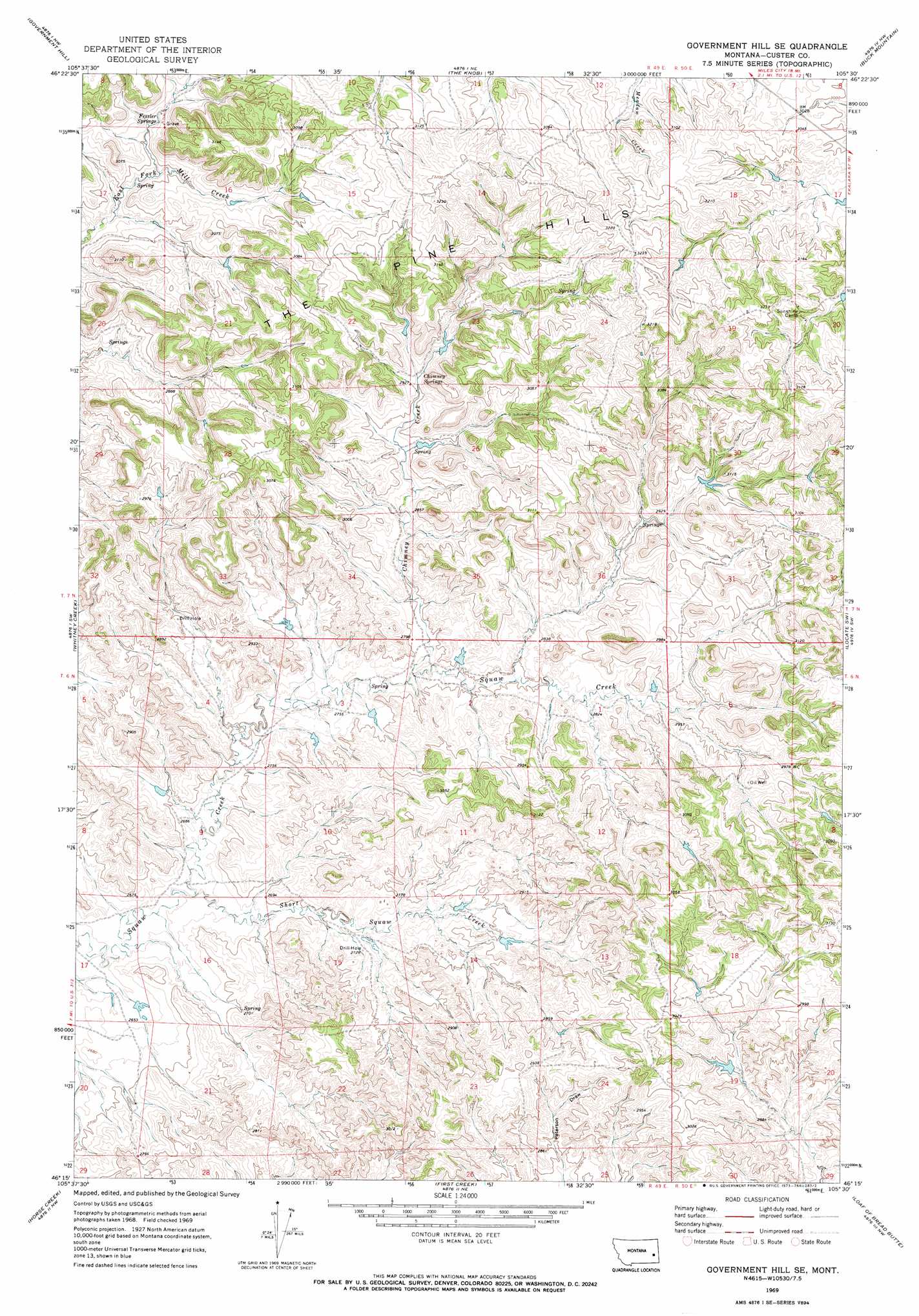
USGS Topo Quad 46105c5 - 1:24,000 scale
| Topo Map Name: | Government Hill Se |
| USGS Topo Quad ID: | 46105c5 |
| Print Size: | ca. 21 1/4" wide x 27" high |
| Southeast Coordinates: | 46.25° N latitude / 105.5° W longitude |
| Map Center Coordinates: | 46.3125° N latitude / 105.5625° W longitude |
| U.S. State: | MT |
| Filename: | o46105c5.jpg |
| Download Map JPG Image: | Government Hill Se topo map 1:24,000 scale |
| Map Type: | Topographic |
| Topo Series: | 7.5´ |
| Map Scale: | 1:24,000 |
| Source of Map Images: | United States Geological Survey (USGS) |
| Alternate Map Versions: |
Government Hill SE MT 1969, updated 1973 Download PDF Buy paper map Government Hill SE MT 2011 Download PDF Buy paper map Government Hill SE MT 2014 Download PDF Buy paper map |
1:24,000 Topo Quads surrounding Government Hill Se
Noble Reservoir |
Kinsey |
Shirley |
Corral Butte |
Spring Draw |
Miles City |
Government Hill |
The Knob |
Buck Mountain |
Locate |
Paddy Fay Creek |
Whitney Creek |
Government Hill Se |
Locate Sw |
Locate Se |
Circle L Creek |
Horse Creek |
First Creek |
Loaf Of Bread Butte |
Mizpah |
Jack Creek |
Beebe Sw |
Beebe |
Miles City Creek |
Forty Creek |
> Back to 46105a1 at 1:100,000 scale
> Back to 46104a1 at 1:250,000 scale
> Back to U.S. Topo Maps home
Government Hill Se topo map: Gazetteer
Government Hill Se: Dams
Jones Number 4 Dam elevation 912m 2992′Severson Number 3 Dam elevation 872m 2860′
Government Hill Se: Springs
Chimney Springs elevation 888m 2913′Fessler Springs elevation 891m 2923′
Government Hill Se: Streams
Chimney Creek elevation 838m 2749′Iron Teeth Woman Creek elevation 803m 2634′
Government Hill Se: Wells
07N48E28DBCD01 Well elevation 909m 2982′Government Hill Se digital topo map on disk
Buy this Government Hill Se topo map showing relief, roads, GPS coordinates and other geographical features, as a high-resolution digital map file on DVD:
Eastern Montana & Western North Dakota
Buy digital topo maps: Eastern Montana & Western North Dakota